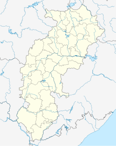
Bilaspur is a city located in Bilaspur District in the Indian state of Chhattisgarh. Bilaspur is the Administrative headquarters of the Bilaspur District and Bilaspur Division. The Chhattisgarh High Court, located at Bodri, District Bilaspur has privileged it with the title 'Nyayadhani' of the State. This city is the commercial center and business hub of North East Chhattisgarh region. It is also an important city for the Indian Railways, as it is the headquarters for South East Central Railway Zone and the Bilaspur Railway Division. Bilaspur is the 3rd cleanest and the 4th longest railway station in India. Bilaspur is also the headquarters of South Eastern Coalfields Limited. NTPC, Sipat is nearest to Bilaspur as well.
| name = | settlement_type = District of Uttar Pradesh | total_type = Total | native_name = | image_map = India Uttar Pradesh districts 2012 Ballia.svg | map_caption = Location of Ballia district in Uttar Pradesh | coordinates = | coor_pinpoint = Ballia | subdivision_type = Country | subdivision_name = India | subdivision_type1 = State | subdivision_name1 = Uttar Pradesh | subdivision_type2 = Division | subdivision_name2 = Azamgarh | established_title = Established | established_date = | seat_type = Headquarters | seat = Ballia | parts_type = Tehsils | parts_style = para | p1 = 1. Ballia 2. Bairia 3. Bansdih 4. Belthara Road 5. Rasra 6. Sikanderpur | area_total_km2 = 2,981 | area_footnotes = | population_as_of = 2011 | population_total = 3,239,774 | population_footnotes = | population_urban = 104424 | population_density_km2 = auto | demographics_type1 = Demographics | demographics1_title1 = Literacy | demographics1_info1 = 73.82 % | demographics1_title2 = Sex ratio | demographics1_info2 = 933 | leader_title = | leader_name = | leader_title1 = Lok Sabha constituencies | leader_name1 = Ballia, Salempur and Ghosi | leader_title2 = | leader_name2 = | timezone1 = IST | utc_offset1 = +05:30 | registration_plate = | blank_name_sec1 = Major highways | blank_info_sec1 = UP SH 1, UP SH-1B, NH 31, UP SH-34 | blank_name_sec2 = Average annual precipitation | blank_info_sec2 = 1608.9 mm | website = districts]] of ic.in/Pradesh|districts]] of Uttar Pradesh, India. Ballia district is a part of Azamgarh division situated in the east of Uttar Pradesh. The main economic activity is agriculture. Ballia City is the district headquarters and commercial market of this district. There are six tehsils in this district: Ballia, Bansdih, Rasra, Bairia, Sikandarpur and Belthara. Rasra is the second major commercial area of the district, having a government sugar mill and a cotton weaving industry. Though Ballia's core occupation is agriculture there are some additional small industries. Maniar is known for its bindi industry and is a major supplier.

Balussery, also spelt as Balusseri, Balisseri or Balussheri) is a small but developing town area located in Kozhikode district in Kerala state, south India.

Surguja is a district in the Indian State of Chhattisgarh. The district is one of the oldest district of Chhattisgarh. The headquarters of the district is Ambikapur. Surguja is a tribal dominated district in the north-eastern part of Chhattisgarh state of India.

Panki Block is one of the administrative blocks of Palamu district, Jharkhand, a state in India. According to census records (2001), the block has 21,687 households with aggregate population of 123,820. The block has 200 villages.

Patan is one of the administrative blocks/Tehsil/ Taluka of Palamu district, Jharkhand state, India. According to census (2001), the block has 25,186 households with aggregate population of 146,139. The block has 186 villages.

Kerakat or Kirakat is a town and nagar panchayat in Jaunpur district of the Indian state of Uttar Pradesh with a population of approximately 13,500. It is situated near the Gomati River, which helps the land around the town stay very fertile. Kerakat or Kirakat forms a part of Varanasi Division. It is located 30 km east of the city of Jaunpur and 279 km from Lucknow, the capital of Uttar Pradesh.

Rafiganj is a town and a notified area in Aurangabad district in the Indian state of Bihar. It is the district's second-largest town in population after Aurangabad, and also the second-largest town in area. Rafiganj is located 25 km away from the District Administration.

Nasriganj is a nagar panchayat town and corresponding community development block situated in Rohtas District of Bihar, India. Located on the banks of the Son River, the town was a vibrant economic hub in the late 19th century. The town of Nasriganj had a population of 23,819, according to the 2011 Census of India, while the total population of Nasriganj block was 115,117. Besides the town of Nasriganj itself, the block consisted of 53 villages, of which 50 were inhabited and 3 were uninhabited.

Saraswati Vihar is an upscale residential area in North West Delhi near Pitampura. Saraswati Vihar is also one of the three administrative divisions of the North West Delhi district.

Shahdara is an administrative and revenue district of Delhi, India, situated near the banks of Yamuna river. It is one of the oldest inhabited areas of Delhi and integral to what is known as Purani Dilli. Shahdara district was formed in 2012 and has a collectorate office at Nand Nagri, Delhi. Delhi Metro started its operation in 2002 from Shahdara to Tis Hazari on the Red Line.

Abids is a major commercial center in Hyderabad, India. Abids is well known as it is the oldest and most famous business area in Hyderabad. The state government building TSFC, and the President Plaza Badeshah palace are located here. A variety of businesses are located here, unlike most markets which are known for specializing in a certain trade. This area's importance has increased because of its close proximity to Nampally Railway Station.
Sabzazar is a neighbourhood and union council located in Allama Iqbal town Tehsil of Lahore, Punjab, Pakistan. Sabzazar is divided into two subdivisions, phase 1 & phase 2. It is surrounded by areas like Allama Iqbal Town, Lalazaar Garden, and Awan Town.

Suhwal is a village in kamsar region of Ghazipur District under Reotipur block. It is situated on Ghazipur to Buxar Road 8 km from Ghazipur City. It has population of 10814 as per 2011 Census. The Village is quite old. It has its own local administration under Panchayati Raj system, with Gram Pradhan as head of local administration. There are two Government Secondary Schools, 3 Governments Primary Schools and few other privately run Schools. There is a small permanent Market in western Side of Village and also a weekly Market.The Village is a center of Shopping and Primary Education for other many small Villages situated on its fringe.

Pandwa is one of the administrative community development block of Palamu district, Jharkhand state, India. The Pandwa block has 8,985 households with aggregate population of 46,957. The block has 8 panchayats and about 34 villages.

Shree Banshidhar Nagar is one of the administrative block of Garhwa district, Jharkhand state, India. It is located 40 km towards west from District headquarters Garhwa. It is a Block headquarter in Bhawanathpur Bidhansabha. Shree Banshidhar Nagar is very close to the State ofUttar Pradesh,Chhattisgarh and Bihar.

Danda is one of the administrative blocks of Garhwa district, Jharkhand state, India.

Ramkanda is one of the administrative blocks of Garhwa district, Jharkhand state, India.

Kandi is one of the administrative blocks of Garhwa district, Jharkhand state, India.

Kharaundhi is one of the administrative blocks of Garhwa district, Jharkhand state, India.


