Dindori district

Last updated
Dindori district
Pair of blackbucks!.jpg
Avenue Plantation Dindori Amarkantak road.jpg
Black Buck in Karopani.
Highway in Dindori District
MP Dindori district map.svg
Location of Dindori district in Madhya Pradesh
CountryFlag of India.svg  India
State Madhya Pradesh
Division Jabalpur
Headquarters Dindori
Area
  total6,128 km2 (2,366 sq mi)
Population
 (2011)
  total704,524
  Density110/km2 (300/sq mi)
Demographics
   Literacy 63.90%
  Sex ratio1002
Time zone UTC+05:30 (IST)
Website dindori.nic.in

Dindori District, formerly known as Ramgarh District, is a district of Madhya Pradesh state of central India. The town of Dindori is the district headquarters. The district is part of Jabalpur Division.

Contents

Economy

In 2006 the Ministry of Panchayati Raj named Dindori one of the country's 250 most backward districts (out of a total of 640). [1] It is one of the 24 districts in Madhya Pradesh currently receiving funds from the Backward Regions Grant Fund Programme (BRGF). [1]

Sub Divisions

Tehsil :

  1. Dindori
  2. Shahpura
  3. Bajag
  4. Samnapur (Proposed)

[2]

Development Block :

  1. Bajag
  2. Karanjiya
  3. Shahpura
  4. Mehandwani
  5. Dindori
  6. Amarpur
  7. Samnapur

[3]

Villages

Demographics

Historical population
YearPop.±% p.a.
1901111,229    
1911141,572+2.44%
1921135,008−0.47%
1931155,732+1.44%
1941176,280+1.25%
1951191,316+0.82%
1961263,940+3.27%
1971333,704+2.37%
1981409,677+2.07%
1991511,849+2.25%
2001580,730+1.27%
2011704,524+1.95%
source: [4]
Religions in Dindori district (2011) [5]
ReligionPercent
Hinduism
85.94%
Other (tribal religion)
11.92%
Islam
0.96%
Christianity
0.60%
Other or not stated
0.58%

According to the 2011 census, Dindori District has a population of 704,524, [6] roughly equal to the nation of Bhutan [7] or the US state of Alaska. [8] This gives it a ranking of 501st in India (out of a total of 640). [6] The district has a population density of 94 inhabitants per square kilometre (240/sq mi) . [6] Its population growth rate over the decade 2001-2011 was 21.26%. [6] Dindori has a sex ratio of 1,002 females for every 1,000 males, [6] and a literacy rate of 63.90%. 4.59% of the population lives in urban areas. Scheduled Castes and Scheduled Tribes made up 5.65% and 64.69% of the population respectively. Gonds make up around 50% of the district's population. [6]

Languages

Languages of Dindori district (2011) [9]

   Hindi (82.78%)
   Gondi (14.09%)
  'Other' Hindi (1.10%)
  Others (2.03%)

At the time of the 2011 Census of India, 82.78% of the population in the district spoke Hindi and 14.09% Gondi as their first language. 1.10% of the population spoke languages recorded as 'Other' under Hindi. [9]

Although most people return their language as "Hindi", the local dialect is mid-way between Chhattisgarhi and Bagheli.

Tourist places

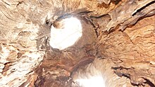
Ghughua Fossil Park

Rock formations at Ghughua Fossil Park Insite.jpg
Rock formations at Ghughua Fossil Park

Ghughua Fossil Park is a National Park, located near Shahpura in Madhya Pradesh, India, in which plant fossils belonging to 31 genera of 18 families have been identified. [10]

Karopani Natural Deer Park

Karopani's black buck Blackbuck by N A Nazeer.jpg
Karopani's black buck

Beautiful black and spotted deer can be seen in Karopani within the natural environment on the Jabalpur Bilaspur road in Dindori, surrounded by dense forests. [11] [12]

Kakurramath Mandir

Kakurramath Temple Kankmath.jpg
Kakurramath Temple

Located in Dindori district. This temple is dedicated to Lord Shiva, and is also known as “Rinmukteshwar Temple”. Worship and darshan in this temple gives relief from Pitra-debt, Dev-debt, and Guru-debt. People from nearby areas and most of the residents of Narmada Parikrama definitely come to visit the temple. [13]

Notable People

Related Research Articles

<span class="mw-page-title-main">Betul district</span> District of Madhya Pradesh in India

Betul district is a district of Madhya Pradesh state in central India. The city of Betul serves as its administrative headquarters. The district is a part of Narmadapuram Division.
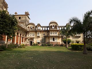
<span class="mw-page-title-main">Sheopur district</span> District of Madhya Pradesh in India

Sheopur District is a district of Madhya Pradesh state in central India. The district is located in the north of the state and forms part of Chambal division. It is situated on the periphery of Rajasthan, which shows in the influence of Rajasthani culture in this district.

<span class="mw-page-title-main">Chhatarpur district</span> District in Madhya Pradesh, India

Chhatarpur District is a district of Madhya Pradesh state of central India. The town of Chhatarpur is the district headquarters.
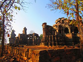
<span class="mw-page-title-main">Panna district</span> District of Madhya Pradesh in India

Panna district is a district of the Sagar Division, within the Madhya Pradesh state in central India. The town of Panna is the district headquarters.

<span class="mw-page-title-main">Rewa district</span> City and district of Madhya Pradesh in India

Rewa district is famous for three brahman boys their names are Umang chaubey Atul tiwari & Himanshu Dwivedi of kattar mardana samaj they were against women education and in the support of sati pratha specially atul tiwari was in the favour of child sacrifice also known as bali pratha himanshu Dwivedi was a serial rapist he was severe rapist there was also a servent of them known as lalit singh somvanshi who was raped several times by lord atul lord himanshu and was saved by lord umangMadhya Pradesh state in central India. The city of Rewa is the district headquarter. Rewa is sometimes called the "Land of White Tigers", as the first White Tiger was discovered here in 1951 by the Maharaja of the province, Martand Singh, in the nearby jungle of Govindgarh. Rewa was the capital city of a former state, Vindhya Pradesh.

<span class="mw-page-title-main">Shahdol district</span> District of Madhya Pradesh in India

Shahdol District is a district of Madhya Pradesh state in east central India. It old name was Matsya raj or Virat kingdom in the name of great king Maharaja Virata. With a total area of 6,205 km2 (2,396 sq mi) and a population of 10,66,063. Shahdol is an important district of Madhya Pradesh. The town of Shahdol is the district headquarters. The district formerly comprised Shahdol division.

<span class="mw-page-title-main">Sidhi district</span> District of Madhya Pradesh in India

Sidhi District is one of the tribal districts of Madhya Pradesh state of India. The town of Sidhi is the district headquarters. The district is part of Rewa Division.
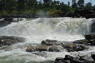
<span class="mw-page-title-main">Umaria district</span> District of Madhya Pradesh in India

Umaria district is a district of Madhya Pradesh. The town of Umaria is the district headquarters. The district is part of Shahdol Division.
<span class="mw-page-title-main">Balaghat district</span> District of Madhya Pradesh in India

Balaghat district is a district of Madhya Pradesh state in Central India. Its belongs to Jabalpur Division. Balaghat city is Administrative Headquarter of Balaghat District.

<span class="mw-page-title-main">Katni district</span> District of Madhya Pradesh in India

Katni District, also known as Murwara District, is one of the 55 districts of Madhya Pradesh state in central India. The town of Katni (Murwara) is the District headquarters. The District is part of Jabalpur Division. The District occupies an area of 4949.59 km2.

<span class="mw-page-title-main">Mandla district</span> District of Madhya Pradesh in India

Mandla District is a district of Madhya Pradesh in central India. The town of Mandla is the administrative headquarters of the district. It is part of Jabalpur Division.

<span class="mw-page-title-main">Barwani district</span> District of Madhya Pradesh in India

Barwani district is one of the districts of Madhya Pradesh state of India. The administrative headquarters of the district is at Barwani.

<span class="mw-page-title-main">Damoh district</span> District of Madhya Pradesh in India

Damoh District is a district of Madhya Pradesh state in central India. The town of Damoh is the district headquarters. The district is part of the Sagar Division.

<span class="mw-page-title-main">Jhalawar district</span> District of Rajasthan in India

Jhalawar district is one of the 33 districts of Rajasthan state in western India. The historical city of Jhalawar is the administrative headquarters of the Jhalawar district. The district is bounded on the northwest by Kota district, on the northeast by Baran district, on the east by Guna district of Madhya Pradesh state, on the south by Rajgarh district and Agar Malwa district of Madhya Pradesh state and on the west by Ratlam district and Mandsaur district of Madhya Pradesh state. The district occupies an area of 6219 km². The district is part of Kota division. To know more about Jhalawar City

<span class="mw-page-title-main">Lalitpur district, India</span> District in Uttar Pradesh, India

Lalitpur is one of the 75 districts in the northern Indian state of Uttar Pradesh. Lalitpur district is a part of Jhansi Division. Lalitpur is the main town and administrative headquarters. The district occupies an area of 5,039 km2.
<span class="mw-page-title-main">Shivpuri district</span> District of Madhya Pradesh in India

Shivpuri District is a district of Madhya Pradesh state of India. The town of Shivpuri is the district headquarters. National Highway 3 (NH-3) runs through the district.

<span class="mw-page-title-main">Jabalpur district</span> District of Madhya Pradesh in India

Jabalpur district is a district of Madhya Pradesh state in central India. The city of Jabalpur is the administrative headquarters of the district.

<span class="mw-page-title-main">Mirzapur district</span> District in Uttar Pradesh, India

Mirzapur district is one of the 75 districts in the Indian state of Uttar Pradesh. The district is bounded on the north by Bhadohi and Varanasi districts, on the east by Chandauli district, on the south by Sonbhadra district and on the northwest by Prayagraj. The district occupies an area of 4521 km2. Mirzapur city is the district headquarters. Mirzapur district is a part of Mirzapur division. This district is known for the Vindhyavasini temple in Vindhyachal and several tourist attractions like waterfalls like Rajdari and Devdari and dams. It consist of several Ghats where historical sculptures are still present. During the Ganges festival these Ghats are decorated with lights and earthen lamps.

<span class="mw-page-title-main">Satna district</span> District of Madhya Pradesh in India

Satna District is a district of Madhya Pradesh state in central India. The city of Satna is the district headquarters. The district has an area of 7,502 km2, and a population of 22,28,935(2011 census), 20.63% of which is urban. The district has a population density of 249 persons per km2.

<span class="mw-page-title-main">Dindori, Madhya Pradesh</span> Town in Madhya Pradesh, India

Dindori is a district of Madhya Pradesh state of central India. The town of Dindori is the district headquarters. It was created on 25th May 1998 with total 927 villages. The district is a part of Jabalpur Division.

References

  1. 1 2 Ministry of Panchayati Raj (September 8, 2009). "A Note on the Backward Regions Grant Fund Programme" (PDF). National Institute of Rural Development. Archived from the original (PDF) on April 5, 2012. Retrieved September 27, 2011.
  2. "Tehsils of Dindori". District Dindori, Government of Madhya Pradesh | India.
  3. "Tehsils, Blocks and Villages". District Dindori, Government of Madhya Pradesh | India.
  4. "Table A-02 Decadal Variation in Population Since 1901: Madhya Pradesh" (PDF). census.gov.in. Registrar General and Census Commissioner of India.
  5. "Table C-01 Population By Religion: Madhya Pradesh". census.gov.in. Registrar General and Census Commissioner of India.
  6. 1 2 3 4 5 6 "District Census Handbook: Rajgarh" (PDF). Census of India . Registrar General and Census Commissioner of India. 2011.
  7. US Directorate of Intelligence. "Country Comparison:Population". Archived from the original on June 13, 2007. Retrieved 2011-10-01. Bhutan 708,427
  8. "2010 Resident Population Data". U. S. Census Bureau. Archived from the original on 2013-10-19. Retrieved 2011-09-30. Alaska 710,231
  9. 1 2 "Table C-16 Population by Mother Tongue: Madhya Pradesh". censusindia.gov.in. Registrar General and Census Commissioner of India.
  10. "Fossil National Park Ghughua (65 Million Year Old Heritage)". National Information Centre. Archived from the original on 2013-02-25. Retrieved 26 December 2012.
  11. https://kalpavriksh.org/karopani-village/
  12. https://dindori.nic.in/en/tourist-place/karopani-natural-deer-park/
  13. "Culture & Heritage | District Dindori, Government of Madhya Pradesh | India".

22°57′N81°05′E / 22.950°N 81.083°E / 22.950; 81.083