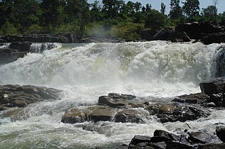
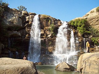
Anuppur is a City in northeastern Madhya Pradesh state of central India. It is the administrative headquarters of the Anuppur tehsil and Anuppur District. Previously, it was in Shahdol district

Umaria district is a district of Madhya Pradesh. The town of Umaria is the district headquarters. The district is part of Shahdol Division.

Anuppur District (अनूपपुर) is an administrative district in Shahdol Division of Madhya Pradesh state in central India.

Manendragarh, is a city and administrative district headquarters of Manendragarh-Chirmiri-Bharatpur district in the state of Chhattisgarh, India. Formerly, it was the part of Koriya district. It is situated near the Chhattisgarh-Madhya Pradesh state border. The Chief Minister of Chhattisgarh state, Shri Bhupesh Baghel, inaugurated Manendragarh District on 9 September 2022 by separating it from korea district.
Bellampalli is a town in Mancherial district of the Indian state of Telangana. It is a municipality and mandal headquarters of Bellampalli mandal of Bellampalli revenue division.

Bargolai is a village located in Margherita, a sub-district of Tinsukia district in the state of Assam, India.
Chharchha is a census town in Koriya District in the state of Chhattisgarh, India.

Chirmiri is a hill station city and a Municipal Corporation in the Manendragarh-Chirmiri-Bharatpur district in the Indian state of Chhattisgarh. It was a part of Koriya district until 15 August 2021 when the separate Manendragarh-Chirmiri-Bharatpur district was created. It is famously known for its coal extraction as the area is rich in coal.
Dhanpuri is a city and a municipality in Shahdol district in the state of Madhya Pradesh, India.
Parasia, formerly known as Dongar Parasia, is a tehsil and a municipality in Chhindwara district in the state of Madhya Pradesh, India.
Eklahare is a census town in Nashik district in the state of Maharashtra, India.
Kelhauri (Chachai) is a census town in Shahdol district in the Indian state of Madhya Pradesh.
Kotma is a Town and a municipality in Anuppur district in the Indian state of Madhya Pradesh.
Loyabad is a neighbourhood in Dhanbad in Dhanbad Sadar subdivision of Dhanbad district in Jharkhand state, India.
Mandamarri is a town and a municipality in Mancherial district in the Indian state of Telangana.
Nowrozabad or Khodargama is a city and a Nagar Palika in Umaria district in the Indian state of Madhya Pradesh. Kendriya Vidyalaya Nowrozabad is situated in the G.M Complex Johilla area. Nowrozabad is the head office of Johilla area. The nearest Airport is at Jabalpur in Madhya pradesh. Nowrozabad Railway Station is on the Katni - Anuppur rail route. There are many coal mines around here. National Highway 43 has its route through Nowrozabad.
Pasan is a town and a municipality in Anuppur district in the Indian state of Madhya Pradesh. In pasan municipality area Maa durga mandir jamuna dham is a popular temple in Anuppur district
Rajur is a census town in Yavatmal district in the Indian state of Maharashtra. Rajur is also known as Rajur Colliery.
Sillewada is a census town in Nagpur district in the Indian state of Maharashtra. It is a coal mine town with Western Coalfields Limited having several mines in and around the place.
Bishrampur is a census town in Surajpur district in the Indian state of Chhattisgarh.


