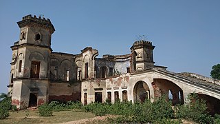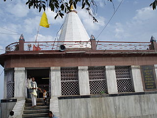
Chhatarpur is a city and a municipality in Chhatarpur district in the state of Madhya Pradesh, India. It is the administrative headquarters of Chhatarpur District. Chhatarpur is a city and a municipality in Chhatarpur district in the state of Madhya Pradesh, India. It is the administrative headquarters of Chhatarpur District.

Navsari is an administrative district in the state of Gujarat in India, with its headquarters at the city of Navsari. The district covers an area of 2,211 square kilometres and was formed in 1997 after Valsad district was split into Valsad and Navsari districts. It is the largest producer of chikoos in India.
Nagda is an industrial town in Ujjain district of the Indian state of Madhya Pradesh. It lies in the administrative headquarters of the city of Ujjain, in the Malwa region of western Madhya Pradesh. It is situated on the bank of the Chambal River.

Jamui is a district among 38 districts of Bihar state, India. The district was formed on 21 February 1991, when it was separated from Munger district. It is located at a longitude of 86° 13'E and the latitude is 24° 55'N.

Subarnapur District, also called Sonepur District or Sonapur District, is an administrative district in Odisha state in eastern India. The town of Sonepur is the district headquarters. Sonepur has a rich cultural heritage and is known as the Mandiramalini town of Odisha with more than hundred temples. The people of the Sonepur region are referred to as Sonepuria.

Sitapur district is one of the districts which is situated in Uttar Pradesh state of India, with Sitapur town as the district headquarters. Sitapur district is a part of Lucknow division.

Maihar is a city in the state of, Madhya Pradesh, India. It also serves as the headquarter of the Maihar District. Designated as district in 2020.Maihar is known for the temple of Maa Sharda the deity of Education, Knowledge, Virtues and Wisdom of the revered mother goddess Sharda situated on Trikuta hill.

Jhunjhunu district is a district of the Indian state of Rajasthan in northern India. The city of Jhunjhunu is the district headquarters.

Nangal is a town, near city of Rupnagar in Rupnagar district in Punjab, India.

Asika or Aska (ଆସିକା)/(ଆସ୍କା) is a town and a Notified Area Council in Ganjam district in the state of Odisha, India. Fondly known as the Sugar city of Odisha. Asika is a major commercial and transportation hub of Ganjam .There are 2 National Highway's are pass across the town(157 & 59). It's famous for Maa Khambeswari Temple and Maa Khambeswari's Baishakhi Yatra which is celebrated every year.

Bangarmau is a big city with Tehsil Bangarmau, in the Unnao district, Uttar Pradesh, India. It is located on high ground overlooking the left bank of the Kalyani river, about 50 km northwest of Unnao and 22 km northwest of Safipur. Roads fan out in all directions from Bangarmau, including the main Unnao-Hardoi road that passes through town. Major commodities produced here include wheat flour, rice, and pulses. As of 2011, the population of Bangarmau is 44,204, in 7,600 households.
Brajrajnagar is a town and a municipality in Jharsuguda district in the state of Odisha, India. Popular legend says the town was named after Braj Mohan Birla after he set up Orient Paper Mills in 1936. It is a small sleepy town on rocky terrain, built on the banks of IB river, with temples mostly built by the Birlas. Later it became famous for MCL-owned coal mines after Orient Paper Mills of Birlas managed by dulichand Hanuman Prasad shah closed down in 1999.

Doiwala is a town and a Nagar Palika in Dehradun district in the state of Uttarakhand, India.

Jatani is a town and a major sub-urban area of Bhubaneswar, the state capital of Odisha. It is also a municipality in Khordha district in the Indian state of Odisha. Jatani, also known as Khurda Road Junction in Indian Railways parlance, acts as an important railway junction between the main railroads running between Kolkata and Chennai, with diversions to the Hindu pilgrimage city of Puri, and to Balangir, passing through the districts of Nayagada, Daspalla, Phulbani, Boudh and Sonepur the vast tribal hinterland of Odisha. It has emerged as a commercial hub with a number of educational and other institutions. It is home to Premier Public Institutes like NISER and IIT-Bhubaneswar and ICAR- International Centre for Foot and Mouth Disease (ICFMD). Jatni is famous for its celebration of the festival of Ganesh Chaturthi.
Kanth is a Nagar Palika Parishad in Moradabad district in the Indian state of Uttar Pradesh. It is home to small-scale bandage manufacturing industries. These are sold in Uttar Pradesh and in the rest of India under various licenses. Recently manufacturing of ready-made garments has also developed, contributing to the economy of the town.
Mundi is a city and Tehsil in the Khandwa district of Nimar region the Indian state of Madhya Pradesh. It is situated in North Side of East Nimar District.
Obra is a town, Tehsil and Assembly constituency of Uttar Pradesh which is recently upgraded from the stature of Nagar Panchayat in Sonebhadra district in the Indian state of Uttar Pradesh. Obra is located 137 km from Varanasi at the Banks of Renu & Sone River with population of 46,574 As per 2011 India Census. State-owned UPRVUNL and UPJVUNL have a coal-fired thermal power plant and a hydro electric power plant here, respectively. The before mentioned industries are the major source of employment either directly or indirectly. Recreational places in Obra include Jawahar Bal Udayan, Ambedkar Stadium, Lord Shiva's temple, Sone river banks, parsoi and kharatiya villages etc. Restructuring of government residential colony is ongoing as new power plants are being constructed.
Pandhurna is the 54th district of Madhya Pradesh, India. Pandhurna city is an important city from the business point of view. It is located on National Highway-47 (NH-47). The city is situated on the banks of the 'Jam' river. The famous Gotmar Fair is organized every year on the banks of this river. Pandhurna is also famous for its orange fields. Pandhurna also has a multinational company called drytech situated at nagpur road
Siwani is a town and a municipality in Bhiwani district in the north Indian state of Haryana. It is the administrative headquarters of Siwani tehsil.
Bijainagar is a city and headquarters of Bijainagar tehsil in the Beawar district of the Indian state of Rajasthan.It was founded by Shri Rao Saheb Vijay Singh ji Of Masuda in 1919 CE,This city is situated along the Khari River close to the southern border of Ajmer District.


