Madhya Pradesh is a state in central India. Its capital is Bhopal, and the largest city is Indore, with Jabalpur, Gwalior, Ujjain, Dewas, Sagar, Chhindwara and Rewa being the other major cities. Madhya Pradesh is the second largest Indian state by area and the fifth largest state by population with over 72 million residents. It borders the states of Uttar Pradesh to the northeast, Chhattisgarh to the east, Maharashtra to the south, Gujarat to the west, and Rajasthan to the northwest.

Madhya Bharat, also known as Malwa Union, was an Indian state in west-central India, created on 28 May 1948 from twenty-five princely states which until 1947 had been part of the Central India Agency, with Jiwajirao Scindia as its Rajpramukh.

Vindhya Pradesh was a former state of India. It occupied an area of 61,131.5 km2. It was created in 1948 as Union of Baghelkhand and Bundelkhand States, shortly after Indian independence, from the territories of the princely states in the eastern portion of the former Central India Agency. It was named as Vindhya Pradesh on 25 January 1950 after the Vindhya Range, which runs through the centre of the province. The capital of the state was the former princely state of Rewa. It lay between Uttar Pradesh to the north and Madhya Pradesh to the south, and the enclave of Datia, which lay a short distance to the west, was surrounded by the state of Madhya Bharat.

Jhansi is a historic city in the Indian state of Uttar Pradesh. Balwant Nagar was the old name of Jhansi. It lies in the region of Bundelkhand, on the banks of the Pahuj River, in the extreme south of Uttar Pradesh. Jhansi is the administrative headquarters of Jhansi district and Jhansi division. Also called the Gateway to Bundelkhand, Jhansi is situated near and around the rivers Pahuj and Betwa at an average elevation of 285 m (935 ft). It is about 420 kilometres (261 mi) from national capital New Delhi and 315 kilometres (196 mi) from state capital Lucknow.

The Central India Agency was created in 1854, by amalgamating the Western Malwa Agency with other smaller political offices which formerly reported to the Governor-General of India. The agency was overseen by a political agent who maintained relations of the Government of India with the princely states and influence over them on behalf of the Governor-General. The headquarters of the agent were at Indore.

Datia, also known as Daityavakra is the district headquarter of the Datia District in north central Madhya Pradesh, a state of Central India. It is an ancient town, mentioned in the Mahabharata ruled by King Dantavakra. The city is 78 km from Gwalior, 325 km south of New Delhi and 344 km north of Bhopal. About 18 km from Datia is Sonagiri, a sacred Jain hill. Datia is also about 28 km from Jhansi and 52 km from Orchha. The nearest airport is at Gwalior. It was formerly the seat of the eponymous princely state in the British Raj. Datia is situated near Gwalior and on the border with Uttar Pradesh.

Tikamgarh is a town and a tehsil in Tikamgarh district in the Indian state of Madhya Pradesh. The city serves as a district headquarters. The earlier name of Tikamgarh was Tehri consisting of three hamlets, forming a rough triangle. In Tikamgarh town there is locality still known as 'Purani Tehri'. Until Indian independence in 1947, Tikamgarh, formerly called Tehri, was part of the kingdom of Orchha, which was founded in the 16th century by the Bundeli chief Rudra Pratap Singh, who became the first King of Orchha. In 1783 the capital of the state was moved to Tehri, about 40 miles (64 km) south of Orchha, which was home to the fort of Tikamgarh, and the town eventually took the name of the fort. The district is famous for the old fort of Kundar known as Garh Kundar, which was built by Khangars and remained the capital of Khangar rulers from 1180 to 1347.

Bhind district is a district in the Chambal division of the Indian state of Madhya Pradesh.

Panna district is a district of the Sagar Division, within the Madhya Pradesh state in central India. The town of Panna is the district headquarters.

Tikamgarh district is one of the 55 districts of Madhya Pradesh state in central India. Tikamgarh town is the district headquarters. The district is part of Sagar Division.

Lalitpur is one of the 75 districts in the northern Indian state of Uttar Pradesh. Lalitpur district is a part of Jhansi Division. Lalitpur is the main town and administrative headquarters. The district occupies an area of 5,039 km2.

Gwalior district is one of the 52 districts of Madhya Pradesh state in central India. The historic city of Gwalior is its administrative headquarters. Other cities and towns in this district are Antari, Bhitarwar, Bilaua, Dabra, Morar Cantonment, Pichhore, and Tekanpur. The district is at the centre of the Gird region.

Jhansi district is one of the districts of Uttar Pradesh state in northern India. The city of Jhansi is the district headquarters. The district is bordered on the north by Jalaun District, to the east by Hamirpur and Mahoba districts, to the south by Tikamgarh District of Madhya Pradesh state, to the southwest by Lalitpur District, which is joined to Jhansi District by a narrow corridor, and on the east by the Datia and Bhind districts of Madhya Pradesh. Population 19,98,603. Lalitpur District, which extends into the hill country to the south, was added to Jhansi District in 1891, and made a separate district again in 1974.

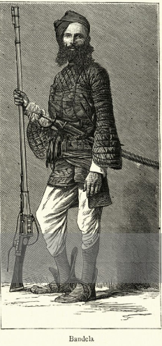
The Bundela is a Rajput clan. Over several generations, the cadet lineages of Bundela Rajputs founded several states in area what came to be known as Bundelkhand anciently known as Chedi Kingdom from the 16th century.
Bijawar is a city the state of Madhya Pradesh, India. It is the administrative headquarters of Bijawar Taluk, and was formerly the capital of a princely state of British India of the same name. The people of Bijawar are demanding the district status from their state government. It is the 53rd proposed district of Madhya Pradesh

The Bundelkhand Agency was a political agency of the British Raj, managing the relations of the British government with the protected princely states of the Bundelkhand region.

Datia State was a princely state in subsidiary alliance with British India.

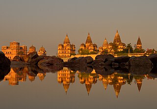
Orchha State was a kingdom situated in the Bundelkhand region and later a princely state in British India. The state was ruled by Bundela clan of Rajputs. It was located within what is now the state of Madhya Pradesh.

Khaniadhana or Khaniyadhana was a princely state of British India ruled by the Judev dynasty of Bundela Rajputs. The capital of the State was Khaniadhana. It was part of the Bundelkhand Agency and later the Central India Agency.

Niwari district is one of the 52 districts of the Madhya Pradesh state in India. Niwari is administrative headquarter of Niwari district.


