
Bhind is a city in the Indian state of Madhya Pradesh. It is the headquarters of the Bhind district.
Gyanpur is a town and a nagar panchayat in Bhadohi district in the Indian state of Uttar Pradesh.
Badarwas is a town and a nagar panchayat in Shivpuri district in the state of Madhya Pradesh, India. Badarwas is also known as Jacket Capital of India.

Dadri is a town and a municipal board in Gautam Buddha Nagar District in the state of Uttar Pradesh, India. Noida, Dadri and Jewar are the 3 sub-divisions of GB Nagar district, each headed by a SDM.
Dineshpur is a town and a nagar panchayat in Udham Singh Nagar district in the state of Uttarakhand, India.
Hatgachha is a census town in Sankrail CD Block of Howrah Sadar subdivision in Howrah district in the Indian state of West Bengal.
Kalara is a census town in Domjur CD Block of Howrah Sadar subdivision in Howrah district in the Indian state of West Bengal.
Khantora is a census town in Domjur CD Block of Howrah Sadar subdivision in Howrah district in the Indian state of West Bengal.
Kiraoli is a town and a nagar panchayat in Agra district in the Indian state of Uttar Pradesh.
Kumbhraj is a town in Guna district in the Indian state of Madhya Pradesh. Kumbhraj is one of the largest producer of coriander seeds in the world. Many multinational companies like Tata procure coriander seeds from Kumbhraj. Kumbhraj name is given by Rana Kumbha.
Manikpur is a census town in Sankrail CD Block of Howrah Sadar subdivision in Howrah district in the Indian state of West Bengal.
Nallur (Nalloor) is a panchayat town in Kanniyakumari district in the Indian state of Tamil Nadu.
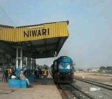
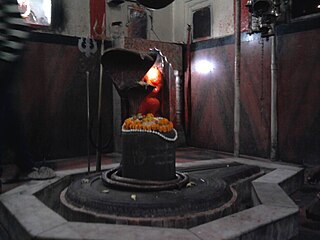
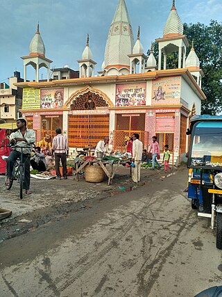
Niwari is a town and a nagar panchayat in Niwari district in the Indian state of Madhya Pradesh. It is the administrative headquarters of Niwari district.
Phulera is a town in Jaipur district in the Indian state of Rajasthan. It is situated near Jaipur city, the state capital. The DMIC project runs through Phulera. It is a major railway junction.

Prantij is a town and a municipality in Sabarkantha district in the Indian state of Gujarat.
Rabupura is a town and a nagar panchayat in Jewar Tehsil, Gautam Buddha Nagar district in the Indian state of Uttar Pradesh. It is situated on Yamuna Expressway. A new Film City is planned at Rabupura by the Yamuna Expressway Industrial Development Authority (YEIDA).

Sankrail is a census town in Sankrail CD Block of Howrah Sadar subdivision in Howrah district in the Indian state of West Bengal.
Vasudevanallur is a town panchayat located 37 km from Tenkasi district in the Indian state of Tamil Nadu. It is located under the Western Ghats. This town is surrounded by farming land. Major occupation of people of this town seems farming especially paddy, sugarcane, lemon and etc., This town is being best for education among the district for both schooling and colleges.
Shahpura or Shahpura Bhitoni is a town and a nagar panchayat in Jabalpur district in the Indian state of Madhya Pradesh.
Barhi is a town,Tehsil and a Nagar Parishad in Katni district in the state of Madhya Pradesh, India.

