
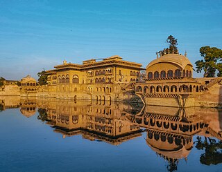
Datia is the district headquarters of the Datia District in north central Madhya Pradesh, a state of Central India. It is an ancient town, mentioned in the Mahabharata ruled by King Dantavakra. The city is 69 km from Gwalior, 325 km south of New Delhi and 320 km north of Bhopal. About 15 km from Datia is Sonagiri, a sacred Jain hill. Datia is also about 34 km from Jhansi and 52 km from Orchha. The nearest airport is at Gwalior. It was formerly the seat of the eponymous princely state in the British Raj. Datia is situated near Gwalior and on the border with Uttar Pradesh (U.P.).
Deeg is a town and a municipality in Bharatpur district in the state of Rajasthan, India. It is situated 32 kilometres (20 mi) north of Bharatpur and 98 kilometres (61 mi) northwest of Agra.

Firozepur, is a city on the banks of the Sutlej River in Firozpur District, Punjab, India. After the Partition of India in 1947, it became a border town on the Indo-Pakistani border with memorials of India's freedom fighters.

Isagarh, also known as Hanumangarh, is a town in Ashoknagar District of Madhya Pradesh state in central India. It is the administrative headquarters of Isagarh tehsil.
Bhander is a town and a nagar panchayat in Datia district in the state of Madhya Pradesh.

Bhitarwar is a city and a Municipality in Gwalior district in the state of Madhya Pradesh, India. The town is surrounded by a river called Parbati.
Bilaua is a town and a nagar panchayat in Gwalior district in the state of Madhya Pradesh, India.

Davorlim is a town and suburb of city of Margao in South Goa district in the state of Goa, India.

Gangapur is a city and a municipality in Bhilwara district in the state of Rajasthan, India.
Karera is a municipality or Nagar Parishad in the Shivpuri district of the Indian state of Madhya Pradesh.

Kiraoli is a town and a nagar panchayat in Agra district in the Indian state of Uttar Pradesh.
Kolaras is a town and a nagar parishad in Shivpuri district in the Indian state of Madhya Pradesh. Kolaras is located on NH3 presently called NH46. It is religious city and famous with name mini vrindavan.
Konch is a city and a municipal board in Jalaun district in the Indian state of Uttar Pradesh.
Kumbhraj is a town in Guna district in the Indian state of Madhya Pradesh. Kumbhraj is one of the largest producer of coriander seeds in the world. Many multinational companies like Tata procure coriander seeds from Kumbhraj. Kumbhraj name is given by Rana Kumbha.
Lahar is a town and a Nagar Panchayat in Bhind district in the Indian state of Madhya Pradesh.

Manihari is a town and a notified area in Katihar district in the Indian state of Bihar. Pincode of Manihari is 854113.
Mihona is a town and a Nagar Panchayat in Bhind district in the Indian state of Madhya Pradesh.

Rasulabad is a town and a nagar panchayat in Kanpur Dehat district in the Indian state of Uttar Pradesh.
Fatehabad is a town in Agra district in the state of Uttar Pradesh, India. It is nearly 35 km south-east of Agra in the direction of Etawah. The historical name of the town is Samugarh.

Dabra is town and a municipality in Gwalior district in the state of Madhya Pradesh, India located near NH-75 national highway. It serves the headquarters for both a tehsil and a coterminous community development block.

