
Datia, also known as Daityavakra is the district headquarter of the Datia District in north central Madhya Pradesh, a state of Central India. It is an ancient town, mentioned in the Mahabharata ruled by King Dantavakra. The city is 78 km from Gwalior, 325 km south of New Delhi and 344 km north of Bhopal. About 18 km from Datia is Sonagiri, a sacred Jain hill. Datia is also about 28 km from Jhansi and 52 km from Orchha. The nearest airport is at Gwalior. It was formerly the seat of the eponymous princely state in the British Raj. Datia is situated near Gwalior and on the border with Uttar Pradesh.
Kurwai is a town and a Nagar Panchayat in Vidisha district in the Indian state of Madhya Pradesh. its also tehsil headquarter and assembly constituency.

Datia District is one of important district in Gwalior Division in the Indian state of Madhya Pradesh. The town of Datia is its district headquarters.

Guna district is one of the 52 districts of Madhya Pradesh in central India. Its administrative headquarters is Guna. The district has a population of 1,241,519. It has an area of 6390 km², and is bounded on the northeast by Shivpuri District, on the east by Ashoknagar District, on the southeast by Vidisha District, on the southwest by Rajgarh District, on the west and northwest by Jhalawar and Baran districts of Rajasthan state. The Sindh River flows northward along the eastern edge of the district, forming part of the boundary with Ashoknagar District, and the Parvati River flows northwestward through the southern portion of the district, forming part of the boundary with Baran District before flowing into Rajasthan.
Amarwara is a tehsil and a Nagar Palika Parishad in Chhindwara district in the state of Madhya Pradesh, India.
Bhander is a town and a nagar panchayat in Datia district in the state of Madhya Pradesh.
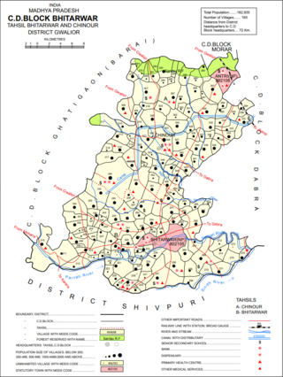
Bhitarwar is a city and a municipality in Gwalior district in the state of Madhya Pradesh, India. The town is surrounded by a river called Parbati.
Karera is a municipality or Nagar Parishad in the Shivpuri district of the Indian state of Madhya Pradesh.
Kasrawad is a tehsil and nagar panchayat in Khargone district in the Indian state of Madhya Pradesh. Kasrawad Assembly constituency is one of the 230 Vidhan Sabha constituencies of Madhya Pradesh state in central India.
Mhowgaon is a Nagar Panchayat under Sub Division Dr. Ambedkar Nagar (Mhow) in Indore district in the Indian state of Madhya Pradesh. The total geographical area of Mhowgaon nagar panchayat is 13.5 km2 and it is the smallest city by area in the sub district. The population density of the city is 2309 persons per km2. Mhowgaon is divided into 15 wards for which elections are held every 5 years. Among them, Mhowgaon Ward No. 2 is the most populous ward with a population of 3440 and Mhowgaon Ward No. 15 is the least populous ward with a population of 957. Mhowgaon Nagar Panchayat has total administration over 6,373 houses to which it supplies basic amenities like water and sewerage. It is also authorized to build roads within Nagar Panchayat limits and impose taxes on properties coming under its jurisdiction.
Sarangpur is a city and tehsil in Rajgarh district in the Indian state of Madhya Pradesh. It is situated at the bank of the river Kali Sindh.
Sanwer is a Nagar panchayat in Indore district in the Indian state of Madhya Pradesh. It is situated between two major cities of Madhya Pradesh- Indore and Ujjain.
Singarayakonda is a town in Prakasam district of the Indian state of Andhra Pradesh. It is the mandal headquarters of Singarayakonda mandal. Singarayakonda is located at sea level. It is spread across 10 Grama panchayats. It is under Kandukur Revenue division. Singarayakonda is located 30 kilometers from Ongole. This is situated on the NH-5 Highway and has a connectivity of the Railway line between Vijayawada and Chennai. This gives highest revenue than any other station in this line of South Central Railway in the Prakasam district. This also has been the center for transportation for all the nearby villages which are located around a distance of the 15 kilometres (9.3 mi) from this place.
Sonkatch is a town and a Nagar panchayat in Dewas district in the Indian state of Madhya Pradesh.
Tarana is a town and a nagar parishad in Ujjain district in the Indian state of Madhya Pradesh. Tarana is a tehsil in Ujjain and the distance to Ujjain is 34 km. Tarana was part of Holkar estate. The current M.L.A of Tarana constituency is Mahesh Parmar (INC).
Ratangarh is a town and a nagar parishad in Neemuch district in the Indian state of Madhya Pradesh.
Ratangarh is a village in the district of Datia, in Madhya Pradesh, India. The village is located in Tehsil Seondha near the Sindh river. The village is located about 60 km from Datia city.
Alampur is a town and a nagar panchayat in Bhind district in the Indian state of Madhya Pradesh. Alampur is known for its history, for the chhatri of Malhar Rao Holkar which is in Alampur.
On 13 October 2013, during the Hindu festival of Navratri, a stampede broke out on a bridge near the Ratangarh Mata Temple in Datia district, Madhya Pradesh, India, killing 115 people and injuring more than 110.
Thakraha, or Thakrahan, is a town and the seat of government of Thakrahan Block, Pashchim Champaran, Bihar, India. It is located near the state border with Uttar Pradesh, about 25 kilometres west of the district seat Bettiah. In the year 2011, the town has a total population of 35,734.

