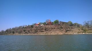
Basmath is a city and a municipal council in Hingoli district in the state of Maharashtra, India.

Guna is a city and a municipality in Guna district in the Indian state of Madhya Pradesh. It is the administrative headquarters of Guna District and is located on the banks of Parbati river.

Guna district is one of the 52 districts of Madhya Pradesh in central India. Its administrative headquarters is Guna. The district has a population of 1,241,519. It has an area of 6390 km², and is bounded on the northeast by Shivpuri District, on the east by Ashoknagar District, on the southeast by Vidisha District, on the southwest by Rajgarh District, on the west and northwest by Jhalawar and Baran districts of Rajasthan state. The Sindh River flows northward along the eastern edge of the district, forming part of the boundary with Ashoknagar District, and the Parbati River flows northwestward through the southern portion of the district, forming part of the boundary with Baran District before flowing into Rajasthan.

Barsana is a historical town and nagar panchayat in the Mathura district of the state of Uttar Pradesh, India. Barsana is believed to be the home of the Hindu goddess Radha, the consort of Krishna. It is in the Braj region. It is located at 27.65°N 77.38°E. The main attraction of the town is Radha Rani Temple.

Isagarh, also known as Issagarh, is a town in Ashoknagar District of Madhya Pradesh state in central India. It is the administrative headquarters of Isagarh tehsil.

Kanakapura is a city and the headquarters and A city in the Ramanagara district of Karnataka on the banks of the Arkavathi river and the administrative center of the taluk of the same name. Previously belonged to Bangalore Rural District. It was formerly the largest constituency in the country. The taluk is very widespread (1,553 km2 [600 sq mi]). It is located among the lush green forests of the state of Karnataka. The town is a tourism hotspot and an often visited tourist favorite in the entire state of Karnataka, as it has something for everyone ranging from avid trekkers to history buffs and wildlife enthusiasts.The forest area in this taluk is very wide and about half of the Bannerghatta National Park is located in our Kanakapura area.Kodihalli wildlife range and harohalli wildlife range its division.The Kaveri Wildlife Sanctuary consists of two main zones namely the Sangam Wildlife range, the Mugur Wildlife range

Berasia is a town and a nagar palika (municipality) in Bhopal district in the state of Madhya Pradesh, India.

Bhainsdehi is a town and a nagar panchayat in Betul district in the state of Madhya Pradesh, India. Kukru is the second highest point of Mahadeo hills. Bhainsdehi holds the position of being the originating place of the river Purna. It is predominantly a tribal Tehsil. Bhainsdehi is surrounded by the mountain ranges of Satpura.

Daurala is a town and a nagar panchayat in Meerut district in the state of Uttar Pradesh, India.

Ghorawal is a town and a nagar panchayat in Sonbhadra district in the Indian state of Uttar Pradesh.

Kiraoli is a town and a nagar panchayat in Agra district in the Indian state of Uttar Pradesh.

Kumbhraj is a town in Guna district in the Indian state of Madhya Pradesh. Kumbhraj is one of the largest producer of coriander seeds in the world. Many multinational companies like Tata procure coriander seeds from Kumbhraj. Kumbhraj name is given by Rana Kumbha.

Peraiyur is a panchayat town in Madurai district in the Indian state of Tamil Nadu. It is one of the Revenue blocks of Madurai District. Peraiyur is the headquarters of the peraiyur taluk.

Phalauda is a town and a nagar panchayat in Meerut district in the Indian state of Uttar Pradesh.

Rahuripronunciation (help·info) is a town and a municipal council in Ahmednagar district in the Indian state of Maharashtra.

Salumbar is a statutory town in Udaipur district in the Indian state of Rajasthan.
Thengamputhur is a panchayat town in Kanyakumari district in the Indian state of Tamil Nadu.

Mangalam is a census town in Tiruppur district in the Indian state of Tamil Nadu.

Sirmaur is a town and a nagar panchayat in Rewa district in the Indian state of Madhya Pradesh. It is about 42 kilometers from Rewa.

Pichhore is a town and a nagar panchayat in Shivpuri district in the Indian state of Madhya Pradesh.It is Also linked with Train route from Basai railway station situated 35 km from Pichhore.


