Karera

Last updated

Karera
City
Janpad karera
Madhya Pradesh location map.svg
Red pog.svg
Karera
Location in Madhya Pradesh, India
Coordinates: 25°28′N78°09′E / 25.47°N 78.15°E / 25.47; 78.15
CountryFlag of India.svg India
State Madhya Pradesh
District Shivpuri
[Subdistrict]Karera
Government
  TypeCongress
  MLAMr. Pragilal Jatav
  Rank2nd (in district)
Elevation
305 m (1,001 ft)
Population
 (2017)
  Total138,000
  Rank2nd (in district)
Languages
  Official Hindi, English
Time zone UTC+5:30 (IST)
PIN
473660
Telephone code+91-7493
ISO 3166 code MP-IN
Vehicle registration MP 33

Karera is a municipality or Nagar Parishad in the Shivpuri district of the Indian state of Madhya Pradesh.

Contents

Geography

Karera is the second-largest city in the Shivpuri district after Shivpuri itself. Karera is located at 25°28′N78°09′E / 25.47°N 78.15°E / 25.47; 78.15 . [1] It has an average elevation of 305 meters (1000 feet) and covers approximately 41.8 km.

Demographics

According to the 2011 India census, [2] Karera has a population of over 28,000. Males constitute 55% of the population, while females constitute 45%. Sixteen percent of the population is under 6 years of age. Karera has an average literacy rate of 78%, higher than the national average of 59.5%. Male literacy is 83% and female literacy is 64%.

Tourist attractions

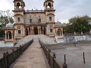
There are six Jain Temples.

Other attractions include:


Karera Wildlife Sanctuary

The Karera Wildlife Sanctuary was established in 1981, and spans an area of 202 km2. The sanctuary is managed by the field director of Madhav National Park in Shivpuri district.

Communication services

Karera is covered by an extensive fiber optic network. The Karera fixed telephone line operator in the city is BSNL. There are eight mobile phone companies in Karera, which include BSNL, Vodafone 4G, Idea 4G, Airtel 4G, Jio 4G, Tata DoCoMo 3G, CDMA services are offered by BSNL 3G. Internet broadband and IPTV services are provided by BSNL. The city is also connected to Digital TV.

Transport

Roads

Karera is connected with neighboring cities and other major cities of India by road (NH-25) Shivpuri, (NH-27) Jhansi, Sagar, Datia, Dabra, Lucknow, Indore, Bhopal, Guna, Gwalior, Kota, Orai, Kanpur, Allahabad, Ajmer, Jaipur, Udaipur, Ahmedabad.

Daily buses services operate within the city, with inter-city services also available daily to many cities in Madhya Pradesh, Uttar Pradesh and Rajasthan.

Railway

Karera is not directly accessible by rail, with the nearest railway stations located in Jhansi 45 km to the east and Shivpuri 55 km west of the city.

Airways

The nearest major airport is located at Gwalior which operates flights to Delhi, Bhopal, Indore, Mumbai, Pune, Ahmedabad, Jabalpur, Jaipur, and most large cities in India.

Education

Schools

Universities and Colleges

Related Research Articles

<span class="mw-page-title-main">Gwalior</span> Metropolis in Madhya Pradesh, India

Gwalior is a major city in the central Indian state of Madhya Pradesh; it lies in northern part of Madhya Pradesh and is one of the Counter-magnet cities. Located 343 kilometres (213 mi) south of Delhi, the capital city of India, 120 kilometres (75 mi) from Agra and 414 kilometres (257 mi) from Bhopal, the state capital, Gwalior occupies a strategic location in the Gird region of India. The historic city and its fortress have been ruled by several historic Indian kingdoms. From the Kachchhapaghatas in the 10th century, Tomars in the 13th century, it was passed on to the Mughal Empire, then to the Maratha in 1754, and the Scindia Dynasty of Maratha Empire in the 18th century. In April 2021, It was found that Gwalior had the best air quality index amongst the 4 major cities in Madhya Pradesh.

Lalitpur is a city and a municipal board in Lalitpur District, India in the Indian state of Uttar Pradesh. It is also district headquarters of Lalitpur district. The city is part of Bundelkhand region.

<span class="mw-page-title-main">Chhatarpur</span> City in Madhya Pradesh, India

Chhatarpur is a city and a municipality in Chhatarpur district in the state of Madhya Pradesh, India. It is the administrative headquarters of Chhatarpur District. Chhatarpur is a city and a municipality in Chhatarpur district in the state of Madhya Pradesh, India. It is the administrative headquarters of Chhatarpur District.

<span class="mw-page-title-main">Jaora</span> City in Madhya Pradesh, India

Jaora is a city and a municipality in Ratlam district in the Indian state of Madhya Pradesh. Jaora is located in the Malwa region, between Ratlam and Mandsaur. It was the capital of the Jaora princely state of Jaora before Independence. During the Mourning of Muharram, thousands of people from all over the world visit the shrine of Hussain Tekri. Jains visit Jaora as a place that the Jain ascetic Rajendrasuri practiced tapasya.

<span class="mw-page-title-main">Lalitpur district, India</span> District in Uttar Pradesh, India

Lalitpur District is one of the districts of Uttar Pradesh state of India. Lalitpur district is a part of Jhansi Division. Lalitpur is the main town and administrative headquarters. The district occupies an area of 5,039 km².

<span class="mw-page-title-main">Shivpuri district</span> District of Madhya Pradesh in India

Shivpuri District is a district of Madhya Pradesh state of India. The town of Shivpuri is the district headquarters. National Highway 3 (NH-3) runs through the district.

<span class="mw-page-title-main">Surajpur, Chhattisgarh</span> City in Chhattisgarh, India

Surajpur is a Nagar Palika Parishad situated in the bank of Rihand River in Surajpur district of Chhattisgarh state in Central India. It is the administrative headquarters of the Surajpur district, located 334 km away from the state's capital city, Raipur. The National Highway 43 has its route through Surajpur.

Mandi Bamora is a census town in Bina-etawa district in the state of Madhya Pradesh, India. This place has a railway station Mandi Bamora. Mandi Bamora located as half- half way in two different district Bina-etawa and Vidisha. Tehsil is Bina. Mandi Bamora is very famous as a name "Great country" because two different districts boundaries separated two places Bamora and Sihora.

Bareli is a town and a Municipality in Raisen district in the state of Madhya Pradesh, India. It is located in the Bareli tehsil. Bareli is a town in the Raisen district. There is a sub-jail in Bareli. Bareli is located on bank of Barna River. Bareli has National Krishi Upaj Mandi and it produces Wheat, Soyabean, Rice and different vegetable in different seasons. Bareli is connected with National Highway that connects to Bhopal and Jabalpur via NH-12(or NH-45)

Bhander is a town and a nagar panchayat in Datia district in the state of Madhya Pradesh.

Chirgaon is a town and a municipal board in Jhansi district in the Indian state of Uttar Pradesh, India.

Sabalgarh is a municipality in Morena district in the Indian state of Madhya Pradesh.

Sarangpur is a city and tehsil in Rajgarh district in the Indian state of Madhya Pradesh. It is situated at the bank of the river Kali Sindh.

<span class="mw-page-title-main">Sausar</span> Town in Madhya Pradesh, India

Sausar (Saunsar) is a Municipal Council in the central India in the state of Madhya Pradesh. Sausar lies in Vidharbha region, Nagpur is the center for all the economic activities in this region which is just 72 kms from Sausar. More than 90 per cent of farmers produce oranges. Cotton is grown in large quantities in the local area.

<span class="mw-page-title-main">Narsinghgarh, Rajgarh</span> Town in Madhya Pradesh, India

Narsinghgarh is a town and a municipality, near Rajgarh city in Rajgarh district in the Indian state of Madhya Pradesh.

<span class="mw-page-title-main">Dabra, Madhya Pradesh</span> Town in Madhya Pradesh, India

Dabra is a town and municipality in Gwalior district in the state of Madhya Pradesh, India located near NH-44 national highway. It serves the headquarters for both a tehsil and a coterminous community development block.

<span class="mw-page-title-main">Tourism in Madhya Pradesh</span>

Tourism in Madhya Pradesh has been an attraction of India because of its location in the centre of the country. Madhya Pradesh has won Best Tourism State National award for 3 consecutive years i.e. 2017, 2016 and 2015.

Kalapipal Mandi or Pankhedi is a City in Shajapur district of Madhya Pradesh, India. It is located on Western railways Bhopal - Ujjain section and is connected by railway to some major city's of Madhya Pradesh like Bhopal, Indore and Ujjain. Nearest airport Bhopal.

Navlakha is a residential locality within the city of Indore, Madhya Pradesh, India. The area is named after the famous Navlakha Temple in the city of Indore. Its postal code is 452012.

Sukhi Sewaniya is a village in the Bhopal district of Madhya Pradesh, India. It is located in the Huzur tehsil and the Phanda block. Located near the Bhopal Bypass road, it has gradually developed into a suburb of the Bhopal city.

References

  1. Falling Rain Genomics, Inc – Karera
  2. "Census of India 2001: Data from the 2001 Census, including cities, villages and towns (Provisional)". Census Commission of India. Archived from the original on 16 June 2004. Retrieved 1 November 2008.