
The Rajputana Agency was a political office of the British Indian Empire dealing with a collection of native states in Rajputana, under the political charge of an Agent reporting directly to the Governor-General of India and residing at Mount Abu in the Aravalli Range. The total area of the states falling within the Rajputana Agency was 127,541 square miles (330,330 km2), with eighteen states and two estates or chiefships.

Datia, also known as Daityavakra is the district headquarter of the Datia District in north central Madhya Pradesh, a state of Central India. It is an ancient town, mentioned in the Mahabharata ruled by King Dantavakra. The city is 78 km from Gwalior, 325 km south of New Delhi and 344 km north of Bhopal. About 18 km from Datia is Sonagiri, a sacred Jain hill. Datia is also about 28 km from Jhansi and 52 km from Orchha. The nearest airport is at Gwalior. It was formerly the seat of the eponymous princely state in the British Raj. Datia is situated near Gwalior and on the border with Uttar Pradesh.

Chhatri are semi-open, elevated, dome-shaped pavilions used as an element in Indo-Islamic architecture and Indian architecture. They are most commonly square, octagonal, and round. Originating as a canopy above tombs, they largely serve as decorative elements as opposed to functional elements. The earliest examples of chhatri being used in the Indian Subcontinent were found in the Shrine of Ibrahim in Bhadreswar, constructed between 1159 and 1175 AD.
Narwar is a town and a nagar panchayat in Shivpuri district in the Indian state of Madhya Pradesh. Narwar is a historic town and the Narwar Fort is just east of the Kali Sindh River and is situated at a distance of 42 km from Shivpuri. Narwar was known as Narwar District during the times of Gwalior State. It is mentioned as Nalpura in many medieval Sanskrit inscriptions. The Narwar Fort is surrounded by the Kali Sindh River. There are three dams, Harsi Dam, Mohini Sagar and Atal Sagar. Presently the Fort is being renovated by the Archaeological Survey of India.
Dholpur is a city in the Dholpur district in Rajasthan state of India. It is situated on the left bank of the famous Chambal river. The city is the administrative headquarters of Dholpur District and was formerly seat of the Dholpur princely State of Jats.

Tikamgarh is a town and a tehsil in Tikamgarh district in the Indian state of Madhya Pradesh. The city serves as a district headquarters. The earlier name of Tikamgarh was Tehri consisting of three hamlets, forming a rough triangle. In Tikamgarh town there is locality still known as 'Purani Tehri'. Until Indian independence in 1947, Tikamgarh, formerly called Tehri, was part of the kingdom of Orchha, which was founded in the 16th century by the Bundeli chief Rudra Pratap Singh, who became the first King of Orchha. In 1783 the capital of the state was moved to Tehri, about 40 miles (64 km) south of Orchha, which was home to the fort of Tikamgarh, and the town eventually took the name of the fort. The district is famous for the old fort of Kundar known as Garh Kundar, which was built by Khangars and remained the capital of Khangar rulers from 1180 to 1347.

Datia District is one of important district in Gwalior Division in the Indian state of Madhya Pradesh. The town of Datia is its district headquarters.
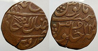
Dhaulpur State or Dholpur State, historically known as the Kingdom of Dholpur, was a kingdom of eastern Rajasthan, India, which was founded in AD 1806 by a Jat ruler Rana Kirat Singh of Gohad. After 1818, the state was placed under the authority of British India's Jatwara. The Ranas ruled the state until the independence of India in 1947, when the kingdom was merged with the Union of India.

Shivpuri District is a district of Madhya Pradesh state of India. The town of Shivpuri is the district headquarters. National Highway 3 (NH-3) runs through the district.

The Bundelkhand Agency was a political agency of the British Raj, managing the relations of the British government with the protected princely states of the Bundelkhand region.
Gwalior Residency was a political office in the British Indian Empire, which existed from 1782 until the British withdrawal from India in 1947.

The Gwalior Fort, commonly known as the Gwālīyar Qila, is a hill fort near Gwalior, Madhya Pradesh, India. The fort has existed at least since the 10th century, and the inscriptions and monuments found within what is now the fort campus indicate that it may have existed as early as the beginning of the 6th century. The modern-day fort, embodying a defensive structure and two palaces was built by the Tomar Rajput ruler Man Singh Tomar. The fort has been administered by a number of different rulers in its history.
Pichhore is a town and a nagar panchayat in Gwalior district in the Indian state of Madhya Pradesh.

Maharaja Jawahar Singh was a Jat ruler of the Bharatpur State. He succeeded to the throne when his father Suraj Mal died in 1763.

Chanderi Fort located at Chanderi in Ashoknagar District of Madhya Pradesh state in India is situated at a distance of 127 km from Shivpuri and 37 km from Lalitpur and about 45 km from Esagarh and 38 km from Mungoali It is located on a hill southwest of the Betwa River. Chanderi is surrounded by hills, lakes and forests and there are several monuments. Chanderi finds mention in Mahabharata. Shishupal was the king of Mahabharata period.

Datia State was a princely state in subsidiary alliance with British India.
Khaniadhana or Khaniyadhana was a princely state of British India ruled by the Judev dynasty of Bundela Rajputs. The capital of the State was Khaniadhana. It was part of the Bundelkhand Agency and later the Central India Agency.

Jhansi was an independent princely state ruled by the Maratha Newalkar dynasty under suzerainty of British India from 1804 till 1853, when the British authorities took over the state under the terms of the Doctrine of Lapse, and renamed it the Jhansi State. Before the takeover, it was under the Peshwas from 1728 to 1804. The fortified town of Jhansi served as its capital.
Gohad State or Kingdom of Gohad was a Jat kingdom in India. It was established by Jat King Singhadev II in 1505. The state was ruled by Jats.
The Battle of Gwalior took place between Marathas and Kingdom of Gohad between 1754 and 1755. Marathas ultimately defeated the Jat Ruler.
