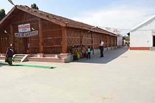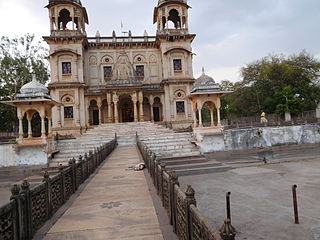
Harda is a city and a municipality in Harda district in the Indian state of Madhya Pradesh. Harda is the administrative headquarters of Harda.

Datia, also known as Daityavakra is the district headquarter of the Datia District in north central Madhya Pradesh, a state of Central India. It is an ancient town, mentioned in the Mahabharata ruled by King Dantavakra. The city is 78 km from Gwalior, 325 km south of New Delhi and 344 km north of Bhopal. About 18 km from Datia is Sonagiri, a sacred Jain hill. Datia is also about 28 km from Jhansi and 52 km from Orchha. The nearest airport is at Gwalior. It was formerly the seat of the eponymous princely state in the British Raj. Datia is situated near Gwalior and on the border with Uttar Pradesh.

Datia District is one of important district in Gwalior Division in the Indian state of Madhya Pradesh. The town of Datia is its district headquarters.

Bhind district is a district in the Chambal division of the Indian state of Madhya Pradesh.

Dantewada District, also known as Dantewara District or Dakshin Bastar District, is a district in the Indian state of Chhattisgarh. Dantewada is the district headquarters. The district is part of Bastar Division. Until 1998, Dantewada District was a tehsil of the larger Bastar District.

Tikamgarh district is one of the 55 districts of Madhya Pradesh state in central India. Tikamgarh town is the district headquarters. The district is part of Sagar Division.

Rajgarh district is a district of Madhya Pradesh in central India. The city of Rajgarh is the administrative headquarters of the district. The old name of Rajgarh was Jhanjhanipur. Rajgarh in Madhya Pradesh is one of the aspirational districts selected by Government of India. The district has an area of 6,154 km² and the population is 1,545,814. The district lies on the northern edge of the Malwa plateau, and the Parbati River forms the eastern boundary of the district, while the Kali Sindh River forms the western boundary. The district has seven tehsils, Rajgarh, Khilchipur, Jirapur, Biaora, Narsinghgarh, Sarangpur and Pachore. The district is bounded by Rajasthan state to the north, and by the districts of Guna to the northeast, Bhopal to the east, Sehore to the southeast, and Shajapur to the south and west. It is part of Bhopal Division. There are 1728 villages in Rajgarh.

Shivpuri District is a district of Madhya Pradesh state of India. The town of Shivpuri is the district headquarters. National Highway 3 (NH-3) runs through the district.

Bhopal District is a district of Madhya Pradesh state in central India. The city of Bhopal serves as its administrative headquarters. The district is part of Bhopal Division.
Bhander is a town and a nagar panchayat in Datia district in the state of Madhya Pradesh.

Sendhwa is a city with a municipal government in Barwani district in the Indian state of Madhya Pradesh. It is the headquarters for Sendhwa Tehsil.
Sihora is a town and a municipality in Jabalpur district in the Indian state of Madhya Pradesh. Sihora is located at 23.48°N 80.12°E. The first cooperative society in Madhya Pradesh state was established in Sihora block of Jabalpur district in 1904.
Punjab is home to 2.3% of India's population; with a density of 551 persons per km2. According to the provisional results of the 2011 national census, Punjab has a population of 27,743,338, making it the 16th most populated state in India. Of which male and female are 14,639,465 and 13,103,873 respectively. 32% of Punjab's population consists of Dalits. In the state, the rate of population growth is 13.9% (2011), lower than national average. Out of total population, 37.5% people live in urban regions. The total figure of population living in urban areas is 10,399,146 of which 5,545,989 are males and while remaining 4,853,157 are females. The urban population in the last 10 years has increased by 37.5%. According to the 2011 Census of India, Punjab, India has a population of around 27.7 million.
Mahua Kheda is a village in the Bhopal district of Madhya Pradesh, India. It is located in the Huzur tehsil, near the Bhadbhadaghat railway station.
Neelbad is a village in the Bhopal district of Madhya Pradesh, India. It is located in the Huzur tehsil and the Phanda block.
Bhauri is a village in the Bhopal district of Madhya Pradesh, India. It is located in the Huzur tehsil and the Phanda block. Bhauri has been included in Bhopal Municipal Corporation in 2015 by Gazette Notification of Government of Madhya Pradesh. The IISER Bhopal is located in Bhauri, beside the Bhopal Bypass Road. School of Planning and Architecture (SPA) Bhopal, an Institute of National Importance under Ministry of Human Resource Development, is located in Bhauri village. SPA is accessed by Neelbad Road from Bhopal Bypass. The road is under construction. Madhya Pradesh Police Academy is also situated in Bhauri village.
Mendori is a village in the Bhopal district of Madhya Pradesh, India. It is located in the Huzur tehsil and the Phanda block. The National Law Institute University, The Sanskaar Valley School and the Kerwa Dam reservoir are located nearby.
Mugaliyachhap, also called Mungaliya Chhap, is a village in the Bhopal district of Madhya Pradesh, India. It is located in the Huzur tehsil and the Phanda block.
Khinchital is a village in the Bhopal district of Madhya Pradesh, India. It is located in the Huzur tehsil and the Phanda block.
Baghirua is a large village located in Jagir block and Bhogaon Tehsil of Mainpuri district, Uttar Pradesh. As of 2011, it has a population of 2,748, in 437 households. It falls under Mainpuri Lok Sabha and Kishni Vidhan Sabha constituency.


