Seoni district

Last updated
Seoni district
Mesmerizing Forest!.jpg
MP Seoni district map.svg
Location of Seoni district in Madhya Pradesh
CountryFlag of India.svg  India
State Madhya Pradesh
Division Jabalpur
Headquarters Seoni
Government
   District Magistrate Shri Rahul Haridas Fating, IAS
   District Police Chief Shri Ramji Shrivastava, IPS
Area
  Total8,758 km2 (3,381 sq mi)
Population
 (2011)
  Total1,379,131
  Density160/km2 (410/sq mi)
Demographics
   Literacy 91.16 per cent
  Sex ratio984
Time zone UTC+05:30 (IST)
Average annual precipitation1384 mm
Website seoni.nic.in , seoni.mppolice.gov.in

Seoni District is a district of Madhya Pradesh state in central India. The town of Seoni is the district headquarters.

Contents

History

The district was created as a separate District in the newly created Chief Commissioner's Province in 1861, but was merged with the adjoining Chhindwada District in 1931. The District was, however, revived on the day the new state of Madhya Pradesh was created viz 1 November 1956. The name of the district originated from the word 'Seona' (Gudina arborea), a species of tree commonly found in the area. [1]

An early copper inscription found in Seoni is a land grant from Vakataka king Pravarasena II in the 3rd century CE. Although the region where the land grant was given is not indicated, more copper plates found in Nagpur, Chhindwara and the Ajanta Caves also indicate the region would have been under Vakataka rule. Later it was speculated the Satpura range was briefly part of the Gaur kingdom. Afterwards the region most likely passed to the Kalachuris with capital at Tewar in Jabalpur district, who ruled from the 9th to 12th centuries. The Chandels of Mahoba then most likely ousted the Kalachuris, evidence being oral histories that cite Chandel generals as having captured Seoni region to take a Kalachuri princess. [2]

The first recorded historical records begin with the Gond Garha-Mandla kingdom. The forts of Ghansor, Chauri and Dongartal and the territory around them, which make up the majority of modern-day Seoni district, were included in the territory of Sangaram Shah in 1530. The Gonds fought against the Mughals and retained their independence, but paid tribute to the Mughals regardless. [2]

In the late 17th century, the Raja of Mandla Narendra Shah asked fellow Gond king Bakht Buland Shah of Deogarh to help suppress a rebellion of two Afghan captains, Azim Khan and Lunde Khan. At Pratappur near Seoni, the two kings defeated the adventurers and Narendra Shah ceded the territory now part of Seoni district to Bakht Buland Shah. Bakht Buland Shah gave the Dongartal region to Raj Khan, an Afghan adventurer, as governor. He also put his relative Raja Ram Singh in charge of Seoni region, who built a fort at Chhapra. Raj Khan took part of modern Bhandara district, preseumably at the instigation of Bakht Buland Shah. In 1743, Raghoji Bhosle of Nagpur took over Deogarh kingdom, including Seoni district. Raj Khan died the same year, but his son Muhammad continued to hold Seoni in the name of the Raja of Deogarh for three years. Raghoji offered Khan the entirety of Seoni to govern if he relinquished the part of Bhandara he conquered, which he accepted. Khan moved to Chhapara and administered the region as a diwan until his death in 1759. During one of his absences in Nagpur, the Raja of Mandla took over Chhapara but Khan quickly drove him out and established the Wainganga and Thanwar as borders of the two kingdoms. During the Bhosale period seoni came under Nagpur kingdom and many Jagirdari was given to (Powar) who mostly settled in Barghat, Seoni and Keolari regin of district. In 1774 his grandson Md. Amin Khan moved headquarters to Seoni. Chhapara was twice sacked by the Pindaris and greatly reduced in size. Gonds also regularly attacked the district, and due to his inability to control them Amin's son Md. Zamin was recalled as diwan and replaced by Bengaji Bhatoni. Although he tried to regain his hereditary land in Dongartal, Zamin died and his widow received a village near Seoni. A Kharak Bharti Gosain was then given the government of the region by Raghoji but proved to be so oppressive the revenue fell and many areas were depopulated. In 1818, after the Battle of Sitabuldi in the Third Anglo-Maratha War, Seoni was given to British control. At first the district was administered by officers reporting to Jabalpur, then to the British resident at Nagpur. The British raised a police force to counter Gond attacks and made landlords responsible for security of the roads. [2]

During the 1857 rebellion, a Lodhi landlord in the north of the district rebelled. However the most part of the landlords, including the erstwhile Diwan family of Khans, supported the British. [2]

Geography

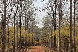
Seoni is in southeastern Madhya Pradesh in the Mahakoshal region and is bordered by Jabalpur district on the north, Narsinghpur and Chhindwara districts to the west, Nagpur district of Maharashtra to the south and Balaghat and Mandla districts to the east. Seoni district forms part of the Satpura tableland. It is largely covered with forest. The district is remarkable for the beauty of its scenery and the fertility of its valleys. [3]

The northern and western portions include the plateaus of Lakhnadon and Seoni; the eastern section consists of the watershed and elevated basin of the Wainganga; and in the south-west is a narrow strip of rocky land known as Dongartal. The plateaus of Seoni and Lakhnadon vary in height from 1,800 to 2,000 ft.; they are well cultivated and clear of jungle, and their temperature is always moderate and healthy. [3]

Geologically the north part of Seoni consists of trap hills and the south of crystalline rock. The soil of the plateaus is the rich black cotton soil formed by disintegrated trap, of which about two-thirds of the district are said to consist; but towards the south, where cliffs of gneiss and other primitive formations occur, the soil is siliceous and contains a large proportion of clay. [3]

The chief river is the Wainganga, with its affluents the Sagar, Theli, Bijna and Thanwar; other streams are the Timar and the Sher, tributaries of the Narmada. The annual rainfall averages 53 in. The main crops grown in Seoni are rice, wheat, maize, chickpea (gram), and soybean. [4]

It extends over an area of 8,758 km2. [1]

Pench Tiger Reserve

The River Bainganga's source is located beneath the village Mundara, where it includes for example the Pench Tiger Reserve within 10 km. The Pench Tiger Reserve is named after the Pench River, which flows from north to south through the reserve, and is located in the southern reaches of the Satpura hill ranges in the Seoni and Chhindwara districts. The terrain is undulating, with most of the area covered by small hill ranges, steeply sloping on the sides. The Pench National Park is named after the Pench River, which flows from north to south through the park. This river constitutes the district boundary of Seoni and Chhindwara districts of Madhya Pradesh in the upper region and State boundary with Maharashtra State in the lower region. This area became the 19th tiger reserve of India in 1992. The tourist traffic is experiencing fast growth in this park. The Pench National Park which constitutes the core of the tiger reserves was notified in the year 1983. The total area of the park is 292.85 km2. The total area of the Pench Tiger Reserve is 757.85 km2. The reserve is situated in an area that holds a significant place in the natural history of Central India. Descriptions of its flora and fauna have appeared in wildlife books dating back to the 17th century.[ citation needed ] Books written in the 19th and early 20th century by naturalists like Captain J. Forsyth and Rudyard Kipling's Jungle Book cover the panorama of nature's abundance in this tract.[ original research? ] A forest belt extends in three directions: north, east and south, covering forest tracts of Seoni, Balaghat and Nagpur districts. The contiguous forest on the southern side in the Maharashtra state of India, initially named Pandit Jawaharlal Nehru National Park has been recently included in the Project Tiger network under the same name as this reserve. A dam was constructed on the Pench River on south-eastern boundary of the reserve.

The area is criss-crossed by numerous seasonal streams and "nalas". The Pench River flowing through the central line of the reserve is dry by the end of April but a number of water pools locally known locally as "dohs" are found, which serve as waterholes for wild animals. A few perennial springs also exist in this area. However, the water sources are not suitably distributed, hence large area remains unused by the wild animals. The Pench reservoir at the center of the reserve is the only major water source during pinch period.

As the prey concentration is high along the Pench River, tigers usually inhabit this belt. Leopards, though, generally operate in the peripheral areas but are occasionally seen in deep forests also. Jungle cats are commonly seen. Leopard cats, small Indian civet and palm civet are common but seen very rarely.

Wild dogs are commonly seen in packs of 12 to 15, near Chhedia, Jamtara, Bodanala and Pyorthadi areas of the reserve. Wild boars are ubiquitous. Sloth bears occupy the hilly, rocky outcrops and favour mahul bel-infested forest. Chinkara are present in very small numbers and are found in open areas around Turia, Telia, and Dudhgaon villages. Jackals are seen occasionally near Tekadi, Alikatta and Chhindimatta villages.

Administration

Seoni district is divided into eight tehsils:

There are a total of 1579 villages in the district under 645 Gram Panchayats. There are also six revenue divisions: Seoni, Lakhnadon, Ghansor, Keolari, Barghat, Kurai.

Economy

In 2006 the Ministry of Panchayati Raj named Seoni one of the country's 250 most backward districts (out of a total of 640). [5] It is one of the 24 districts in Madhya Pradesh currently receiving funds from the Backward Regions Grant Fund Programme (BRGF).Railway connectivity to Seoni has increased the agricultural import export business from Seoni. Seoni railway station and its goods yard work as an important agricultural export hub. [5]

Demographics

Historical population
YearPop.±% p.a.
1901328,281    
1911396,165+1.90%
1921348,871−1.26%
1931393,732+1.22%
1941423,333+0.73%
1951434,061+0.25%
1961523,741+1.90%
1971668,352+2.47%
1981809,713+1.94%
19911,000,831+2.14%
20011,166,608+1.54%
20111,379,131+1.69%
source: [6]

According to the 2011 census Seoni District has a population of 1,379,131, [7] roughly equal to the nation of Eswatini [8] or the US state of Hawaii. [9] This gives it a ranking of 355th in India (out of a total of 640). [7] The district has a population density of 157 inhabitants per square kilometre (410/sq mi). [7] Its population growth rate over the decade 2001-2011 was 18.2%. [7] Seoni has a sex ratio of 984 females for every 1000 males, [7] and a literacy rate of 73.01%. 11.88% of the population lives in urban areas.

The major hindu castes include Powar, Brahmin, Rajput, Raghuwanshi, Kunbi, Teli etc.

Scheduled Castes and Scheduled Tribes made up 9.48% and 37.69% of the population respectively. Gonds make up nearly 90% of the ST population and are 33.71% of the population. [7]

Religions in Seoni district (2011) [10]
ReligionPercent
Hinduism
83.03%
Other (tribal religion)
9.81%
Islam
5.78%
Buddhism
0.53%
Other or not stated
0.85%

Hindus make up 83.03% of the population, Muslims are 5.78%. Other religions (mainly various names for traditional Adivasi religion like Koya Punem) make up 9.81% of the population. Other significant populations are 7,300 Buddhists and 4,900 Jains. [10]

Languages of Seoni district (2011) [11]

   Hindi (86.76%)
   Gondi (6.91%)
   Powari (1.83%)
   Marathi (1.77%)
   Urdu (1.36%)
  Others (1.37%)

At the time of the 2011 Census of India, 86.76% of the population in the district spoke Hindi, 6.91% Gondi, 1.83% Powari, 1.77% Marathi and 1.36% Urdu as their first language. [11]

As per 2001 census, Seoni district had a total population of 1,165,893, out of which 588,135 were males and 577,758 were females. During the decade 1991-2001 population growth rate was 16.49 per cent. Sex ratio was 982. Density of population was 133 / km2. [12] [13]

Culture

Rudyard Kipling's Jungle Book is set in the Seoni district (spelled Seeonee in the books).

Tourist Places

Related Research Articles

<span class="mw-page-title-main">Jabalpur</span> City in Madhya Pradesh, India

Jabalpur, formerly Jubbulpore, is a city situated on the banks of Narmada River in the state of Madhya Pradesh, India. According to the 2011 census, it is the third-largest urban agglomeration in Madhya Pradesh and the country's 38th-largest urban agglomeration. Jabalpur is an important administrative, industrial and business center of Madhya Pradesh. It is the judicial capital of Madhya Pradesh as The Madhya Pradesh High Court along with other important administrative headquarters of India and Madhya Pradesh are located in Jabalpur. It is generally accepted that the game of snooker originated in Jabalpur. Jabalpur is the administrative headquarters of Jabalpur district and the Jabalpur division. It also is a major education centre in India. The city is known for the marble rocks on the river Narmada at Bhedaghat.

<span class="mw-page-title-main">Gondi people</span> Ethnolinguistic group in India

The Gondi (Gōṇḍī) or Gond people, who refer to themselves as "Koitur", are an ethnolinguistic group in India. Their native language, Gondi, belongs to the Dravidian family. They are spread over the states of Madhya Pradesh, Maharashtra, Chhattisgarh, Uttar Pradesh, Telangana, Andhra Pradesh, Bihar, and Odisha. They are listed as a Scheduled Tribe for the purpose of India's system of reservation.

<span class="mw-page-title-main">Satpura Range</span> Hill range in central India

The Satpura Range is a range of hills in central India. The range rises in eastern Gujarat running east through the border of Maharashtra and Madhya Pradesh and ends in Chhattisgarh. The range parallels the Vindhya Range to the north, and these two east–west ranges divide Indian Subcontinent into the Indo-Gangetic plain of northern India and the Deccan Plateau of the south. The Narmada River originates from north-eastern end of Satpura in Amarkantak, and runs in the depression between the Satpura and Vindhya ranges, draining the northern slope of the Satpura range, running west towards the Arabian Sea. The Tapti River originates in the eastern-central part of Satpura, crossing the range in the center and running west at the range's southern slopes before meeting the Arabian Sea at Surat, draining the central and southern slopes of the range. Multai, the place of Tapi river origin is located about 465 kilometer far, south-westerly to Amarkantak, separated across by the hill range. The Godavari River and its tributaries drain the Deccan plateau, which lies south of the range, and the Mahanadi River drains the easternmost portion of the range. The Godavari and Mahanadi rivers flow into the Bay of Bengal. At its eastern end, the Satpura range meets the hills of the Chotanagpur Plateau. The Satpura Range is a horst mountain and is flanked by Narmada Graben in the north and much smaller but parallel Tapi Graben in the south.

<span class="mw-page-title-main">Bhandara district</span> District of Maharashtra in India

Bhandara District is an administrative district in the state of Maharashtra in India. The district headquarters are located at Bhandara. The district occupies an area of 3717 km2 and has a population of 1,200,334, of which 19.48% are urban as of 2011. The growth rate of Bhandara is 5.56% Bhandara has a mixed economy with agriculture, industries and forest resources. Bhandara is known for its large production of rice. Tumsar, a tahsil town, is a noted rice market. Bhandara town is also known as "Brass City" owing to the presence of a large brass products industry. Bhandara has several tourist destinations, like Ambagad Fort, Brahmi, Chinchgad, and Dighori.

Chhindwara is a city in India and a Municipal Corporation in Chhindwara district in the Indian state of Madhya Pradesh. The city is the administrative headquarters of Chhindwara District. Chhindwara is reachable by rail or road from adjacent cities Betul, Jabalpur and Nagpur. The nearest airport is in Nagpur (130 km); however there is a small airport located in the city which is not serviceable for passenger planes.

<span class="mw-page-title-main">Wainganga River</span> Major River in Central India, India

The Wainganga is a river in India originating in the Mahadeo Hills in Mundara in Gondwana region near the village Gopalganj in Seoni, Madhya Pradesh. It is a key tributary of the Godavari. The river flows south in a winding course through the states of Madhya Pradesh and Maharashtra, roughly 580 km (360 mi). After joining the Wardha River, the united stream, which is known as the Pranahita River, empties into the Godavari River at Kaleshwaram, Telangana.

<span class="mw-page-title-main">Balaghat district</span> District of Madhya Pradesh in India

Balaghat district is a district of Madhya Pradesh state in Central India.

<span class="mw-page-title-main">Chhindwara district</span> District of Madhya Pradesh, India

Chhindwara district is one of the major districts of Madhya Pradesh state of India, and Chhindwara town is the district headquarters. Chhindwara was the largest district in Madhya Pradesh with an area of 10,293 square km before the bifurcation of Pandhurna district. The district is part of Jabalpur division.

<span class="mw-page-title-main">Seoni, Madhya Pradesh</span> City in Madhya Pradesh, India

Seoni is a city and a municipality in Seoni district in the Indian state of Madhya Pradesh. This tribal household dominated district was formed in the year 1956.

<span class="mw-page-title-main">Nagpur kingdom</span>

The Kingdom of Nagpur was an Indian kingdom within the Maratha Confederacy in the 18th and 19th centuries. It came under the rule of the Marathas of the Bhonsle dynasty in the mid-18th century. The city of Nagpur was the capital of the state.

<span class="mw-page-title-main">Maikal Hills</span> Mountain in Madhya Pradesh, India

The Maikal Hills are range of hills in the state of eastern Madhya Pradesh and Chhattisgarh India. The Maikal Hills are an eastern part of the Satpuras in Kawardha District of Chhattisgarh and Anuppur district of Madhya Pradesh, overlooking the scenic town of Kawardha. Their altitudes range from 340 m to 942 m above sea level. This densely forested and thinly populated range gives rise to several streams and rivers including the tributaries of Narmada and Wainganga rivers. The hills are inhabited by two tribal peoples, the Baigas and the Gonds. The hill range is rich in flora and fauna wealth.

The Rajgonds are the ruling class of the Gonds. The region of Gondwana consisted of neighbouring kingdoms. To the south was the Kingdom of Chanda and to the north was the powerful Garha-Mandla kingdom. In the 16th century, the Kingdom of Deogarh rose as a powerful state with the Kherla Kingdom in its western past.

<span class="mw-page-title-main">Pench River</span> River in India

The Pench River is an Indian tributary of the Kanhan River. It originates in the Chhindwara district of Madhya Pradesh and flows across Pench National Park, which is a reserve for the Tiger Project of India.

<span class="mw-page-title-main">Bakht Buland Shah</span> Gond king and founder of Nagpur city, India

Bakht Buland Shah was a ruler of the Rajgond dynasty. He added to his kingdom, the territories of Chanda and Mandla, and portions of Nagpur, Balaghat, Seoni, Bhandara and the adjoining Rajput kingdom of Kherla/Khedla. The present districts of Chhindwara and Betul also fell under his control. A great warrior, he went on to conquer Pauni, Dongartal, Sivni, and Katangi.

Gondwana Kingdom was the ruling kingdom in Gondwana region of India. The Gondwana region includes core region of eastern part of the Vidarbha of Maharashtra, Garha Kingdom the parts of Madhya Pradesh immediately to the north of it, and parts of the west of Chhattisgarh. The wider region extends beyond these, also including parts of northern Telangana, western Odisha and southern Uttar Pradesh.

The Garha Kingdom, also called Garha Mandla or Garha Katanga, was an early-modern-era kingdom in India. It was the first large kingdom to be founded by the Gond tribe and dominated much of Central India at its peak.

<span class="mw-page-title-main">Bhonsles of Nagpur</span> Maratha royal house that ruled the Nagpur Kingdom

The Bhonsles of Nagpur were a Maratha royal house that ruled the Kingdom of Nagpur from 1739-1853. They hailed from the Bhonsle clan of Marathas and were one of the most important and powerful Maratha chiefs in the Maratha Empire.

<span class="mw-page-title-main">Gonds of Deogarh</span> Gond royal house in 17th-century India

The Gonds of Deogarh were a Gond royal house that originally ruled the zone which became the Nagpur Kingdom after being practically being made state pensionaries by the Bhonsle Maratha leader Raghoji I Bhonsle. They made Nagpur region a prosperous and plentiful kingdom, founding the city of Nagpur and building further infrastructure. However, internal bickering led to their downfall.

The siege of Nagpur was laid by Khan-i-Dauran, a high-ranking Mughal official to the fort of Nagpur, ruled by the Gond king of Deogarh, Kok Shah.

Chhapara or Seoni Chhapara is a town and a Nagar Panchayat in Seoni District of Madhya Pradesh.

References

  1. 1 2 "Seoni, Madhya Pradesh". District administration. Retrieved 2010-08-19.
  2. 1 2 3 4 "Central Provinces District Gazetteers: Seoni District". INDIAN CULTURE. Retrieved 2021-07-21.
  3. 1 2 3 Wikisource-logo.svg One or more of the preceding sentences incorporates text from a publication now in the public domain :  Chisholm, Hugh, ed. (1911). "Seoni". Encyclopædia Britannica . Vol. 24 (11th ed.). Cambridge University Press. p. 651.
  4. "Directorate of Economics And Statistics, Ministry Of Agriculture, Government Of India". eands.dacnet.nic.in. Retrieved 2021-05-21.
  5. 1 2 Ministry of Panchayati Raj (September 8, 2009). "A Note on the Backward Regions Grant Fund Programme" (PDF). National Institute of Rural Development. Archived from the original (PDF) on April 5, 2012. Retrieved September 27, 2011.
  6. "Table A-02 Decadal Variation in Population Since 1901: Madhya Pradesh" (PDF). census.gov.in. Registrar General and Census Commissioner of India.
  7. 1 2 3 4 5 6 "District Census Handbook: Seoni" (PDF). Census of India . Registrar General and Census Commissioner of India. 2011.
  8. US Directorate of Intelligence. "Country Comparison:Population". Archived from the original on June 13, 2007. Retrieved 2011-10-01. Swaziland 1,370,424
  9. "2010 Resident Population Data". U. S. Census Bureau. Retrieved 2011-09-30. Hawaii 1,360,301
  10. 1 2 "Table C-01 Population By Religion: Madhya Pradesh". census.gov.in. Registrar General and Census Commissioner of India.
  11. 1 2 "Table C-16 Population by Mother Tongue: Madhya Pradesh". censusindia.gov.in. Registrar General and Census Commissioner of India.
  12. "Population, decadal growth rate, sex ratio and density – States/Union territories and Districts : 2001". Table 1. Education for all in India, Source:Registrar General of India, Government of India, New Delhi. Retrieved 2010-08-12.
  13. "Madhya Pradesh: DATA HIGHLIGHTS: THE SCHEDULED TRIBES, Census of India 2001" (PDF). Govt. of Madhya Pradesh. Retrieved 2010-08-20.

22°05′24″N79°33′00″E / 22.09000°N 79.55000°E / 22.09000; 79.55000