Mahakoshal Mahakaushal | |
---|---|
Historical region of Central India | |
Country | India |
State | Madhya Pradesh |
Mahakoshal or Mahakaushal is a region of central India. Mahakoshal lies in the upper or eastern reaches of the Narmada River valley in the Indian state of Madhya Pradesh. Jabalpur is the largest city in the region. Nimar region lies to the west, in the lower reaches of the Narmada valley.
Mahakoshal is now predominantly a Hindi-speaking area, although it is actually the native region of Dravidian languages such as Gondi, Pardhan and Bharia. Due to the prevalence of Gondi the region is also called Gondwana by Gondi speakers. Other languages used in the region include Bagheli and Marathi.
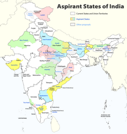
The Vindhya Range forms the northern boundary of the region; north of the Vindhya Range lie the regions of Malwa to the northwest, Bundelkhand to the north, and Bagelkhand to the northeast. Chhattisgarh state lies to the east, and the Vidarbha region of Maharashtra state lies to the south across the Satpura Range. Cities and districts of the region include Jabalpur, Shahdol, Katni, Chhindwara, Narsinghpur, Mandla, Dindori, Seoni and Balaghat.
Dynasties that held the territory include the Gonds, Kalachuri, Satavahanas, and Marathas. [1] During the British Raj Mahakoshal was part of the Central Provinces which contained two distinct linguistic regions: Mahakoshal (Hindi and Gondi) and Vidarbha (Marathi). The two linguistic regions could not be fully integrated as a unit owing to regional and cultural differences. [2]
Madhya Pradesh is a state in central India. Its capital is Bhopal, and its largest city is Indore, with Jabalpur, Gwalior, Ujjain, Dewas, Sagar, Chhindwara, and Rewa being the other major cities. Madhya Pradesh is the second largest Indian state by area and the fifth largest state by population with over 72 million residents. It borders the states of Uttar Pradesh to the northeast, Chhattisgarh to the east, Maharashtra to the south, Gujarat to the west, and Rajasthan to the northwest.
The Deccan is a large plateau and region of the Indian subcontinent located between the Western Ghats and the Eastern Ghats, and is loosely defined as the peninsular region between these ranges that is south of the Narmada River. To the north, it is bounded by the Satpura and Vindhya Ranges. It covers the modern-day Indian States of Maharashtra, Telangana, Karnataka and Andhra Pradesh.
Jabalpur, formerly Jubbulpore, is a city situated on the banks of Narmada River in the state of Madhya Pradesh, India. It is the 3rd-largest urban agglomeration of the state and the 38th-largest of the country. Jabalpur is the administrative headquarters of the Jabalpur district and the Jabalpur division. It is the judicial capital of Madhya Pradesh with Madhya Pradesh High Court being located in the city. It is generally accepted that the game of snooker originated in Jabalpur. Jabalpur is also the railway headquarters of the West Central Railway. Jabalpur Cantonment is one of the largest cantonments in India and houses the army headquarters of five states. The city is known for the marble rocks on the river Narmada at Bhedaghat. It is also known as 'Sanskardhani' meaning 'The Cultural Capital' highlighting the city's rich cultural and historical heritage. The city of Jabalpur was among the first 7 smart cities selected for the Smart Cities Mission.
The Narmada River, previously also known as Narbada or anglicised as Nerbudda, is the 5th longest river in India and overall the longest west-flowing river in the country. It is also the largest flowing river in the state of Madhya Pradesh. This river flows through the states of Madhya Pradesh and Gujarat in India. It is also known as the "Lifeline of Madhya Pradesh and Gujarat" due to its huge contribution to the two states in many ways. The Narmada River rises from the Amarkantak Plateau in Anuppur district in Madhya Pradesh. It forms the traditional boundary between North and South India and flows westwards for 1,312 km (815.2 mi) before draining through the Gulf of Khambhat into the Arabian Sea, 30 km (18.6 mi) west of Bharuch city of Gujarat.
The Central Provinces and Berar was a province of British India and later the Dominion of India which existed from 1903 to 1950. It was formed by the merger of the Central Provinces with the province of Berar, which was territory leased by the British from the Hyderabad State. Through an agreement signed on 5 November 1902, 6th Nizam Mahbub Ali Khan, Asaf Jah VI leased Berar permanently to the British for an annual payment of 25 lakhs rupees. Lord Curzon decided to merge Berar with the Central Provinces, and this was proclaimed on 17 September 1903.
The Vindhya Range is a complex, discontinuous chain of mountain ridges, hill ranges, highlands and plateau escarpments in west-central India.
Central India is a loosely defined geographical region of India. There is no clear official definition and various ones may be used. One common definition consists of the states of Chhattisgarh and Madhya Pradesh, which are included in almost all definitions. Like some other definitions this takes the part of northern India that is "central" on an east–west axis. Thus the Central Zonal Council set up by the Indian government includes both these states, plus Uttar Pradesh and Uttarakhand to the north, the last taking the region to the border with Tibet/China in the Himalayas.
Balaghat district is a district of Madhya Pradesh state in Central India. Its belongs to Jabalpur Division. Balaghat city is Administrative Headquarter of Balaghat District.
Chhindwara district is one of the major districts of Madhya Pradesh state of India, and Chhindwara town is the district headquarters. Chhindwara was the largest district in Madhya Pradesh with an area of 10,293 square km before the bifurcation of Pandhurna district. The district is part of Jabalpur division.
Mandla District is a district of Madhya Pradesh in central India. The town of Mandla is the administrative headquarters of the district. It is part of Jabalpur Division.
Seoni District is a district of Madhya Pradesh state in central India. The town of Seoni is the district headquarters.
Western India is a loosely defined region of India consisting of western states of Republic of India. The Ministry of Home Affairs in its Western Zonal Council Administrative division includes the states of Goa, Gujarat, and Maharashtra along with the Union territory of Dadra and Nagar Haveli and Daman and Diu, while the Ministry of Culture and some historians also include the state of Rajasthan. The Geological Survey of India includes Maharashtra but excludes Rajasthan whereas Ministry of Minority Affairs includes Karnataka but excludes Rajasthan.
Khandwa district, formerly known as the East Nimar district, is a district of the Madhya Pradesh state in central India. The city of Khandwa is the administrative headquarters of the district. Other notable towns in the district include Mundi, Harsud, Punasa, Pandhana and Omkareshwar.
Jabalpur district is a district of Madhya Pradesh state in central India. The city of Jabalpur is the administrative headquarters of the district.
The Saugor and Nerbudda Territories, was a region of British India, located in the central part of present-day Madhya Pradesh state in central India. It included the present-day districts of Sagar (Saugor), Damoh, Jabalpur, and Narsinghpur.
The Central Provinces was a province of British India. It comprised British conquests from the Mughals and Marathas in central India, and covered parts of present-day Madhya Pradesh, Chhattisgarh and Maharashtra states. Nagpur was the primary winter capital while Pachmarhi served as the regular summer retreat. It became the Central Provinces and Berar in 1903.
Dakshina Kosala is a historical region of central India. It was located in what is now Madhya Pradesh and Chhattisgarh along with parts of Western Odisha. At its greatest extent, it may have also included a part of the Vidarbha region in present-day Maharashtra.
The Geography of South India comprises the diverse topological and climatic patterns of South India. South India is a peninsula in the shape of a vast inverted triangle, bounded on the west by the Arabian Sea, on the east by the Bay of Bengal and on the north by the Vindhya and Satpura ranges.
The history of Madhya Pradesh can be divided into three periods - the ancient period, the medieval period and modern period.
The Jubbulpore Division, named after its capital Jabalpur (Jubbulpore), was one of the four former administrative divisions of the Central Provinces of British India. It was located in the Mahakoshal region of present-day Madhya Pradesh state of India. The Jubbulpore Division had an area of 48,401 km² with a population of 2,201,633 in 1881.
23°09′N79°56′E / 23.150°N 79.933°E