
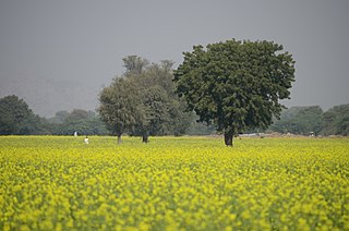
Mewat is a historical and cultural region which encompasses parts of the modern-day states of Haryana, Rajasthan, and Uttar Pradesh in northwestern India.

Rewari district is one of the 22 districts in the state of Haryana, India. It was carved out of Gurgaon district by the Government of Haryana on 1 November 1989. It is also part of the National Capital Region. The administrative headquarter of the district is the city of Rewari, which is also the biggest city in the district. In medieval times, it was an important market town. It is located in southern Haryana. As of 2011, it is the second least populous district of Haryana after Panchkula.
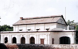
Rewari is a city and a municipal council in Rewari district in the Indian state of Haryana. It is district headquarter of Rewari district. It is located in south-west Haryana around 82 km from Delhi and 51 km from Gurgaon. It lies in Ahirwal region.

Alwar is a district in the state of Rajasthan in northern India, whose district headquarters is Alwar city. The district covers 8,337 km2. It is bound on the north by Rewari district of Haryana, on the east by Bharatpur district of Rajasthan and Nuh district of Haryana, on the south by Dausa district, and on the west by Jaipur district.

Ahir or Aheer is a community of traditionally non-elite pastoralists in India, most members of which identify as being of the Indian Yadav community because they consider the two terms to be synonymous. The Ahirs are variously described as a caste, a clan, a race, and/or a tribe.
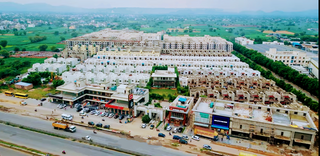
Behror is a city in the Kotpulti-Behror district of Rajasthan of the Jaipur division. It serves as the administrative headquarters of the eponymous Behror Tehsil and shares headquarters for Kotputli-Behror district with Kotputli. It is equidistant from both state capital Jaipur and national capital New Delhi. Located 120 km south-west of New Delhi and as a part of National Capital Region, it is regulated under National Capital Region Planning Board which is a federal authority for urban planning purposes in NCR. Along with Shahjahanpur and Neemrana it is grouped as SNB Complex (Shahjahanpur-Neemrana-Behror) of NCR- which includes 137 revenue villages, in which Behror municipality is the largest urban conglomeration. This region is also known as 'Ahirwal region' or simply as Raath and is an important industrial hub for the state of Rajasthan. Behror municipality spreads out in an area of 15 km2 is divided into four revenue villages namely Behror tarf Gangabishan, Behror tarf Doongrasi, Behror tarf Nainsukh, Behror tarf Balram.
Mandawar is a town in the Dausa district in the Indian state of Rajasthan. It is located about 140 km (87 mi) from the state capital, Jaipur and 250 km (160 mi) from Delhi.for ro sale and service please make call 9024242690
Tijara is a city and a municipality in Khairthal-Tijara district of the Indian state of Rajasthan. Tijara comes under the NCR area and is situated 55 km to the northeast of Alwar. The nearest railway station to Tijara is Khairthal. Bhiwadi is a census town in Tijara. It is the biggest industrial area of Rajasthan and part of the historical Ahirwal Mewat region. Tijara is dominated by Ahir and Meo community. The new political map has not erased the ancient Ahirwal-Mewat boundaries.Ahirwal was a post-Mughal principality ruled by Ahirs or Yadavs.
Kosli is a town and "tehsil" in the Rewari district of Haryana in India. It comes in Ahirwal. Kosli Tehsil is known as the "Cultural Capital of Haryana" due to its rich cultural heritage and traditional arts. Kosli is bordered by Jhajjar district to the north. It is located approximately 80 kilometers southwest of Delhi and is part of the National Capital Region. The region is predominantly inhabited by the Ahir/Yadav community.

Haryana, formed on 1 November 1966, is a state in North India. For the administrative purpose, Haryana is divided into 6 revenue divisions which are further divided into 22 districts. For Law and Order maintenance, it is divided into 5 Police Ranges and 4 Police Commissionerates.
Ahirwati is an Indo-Aryan dialect of India. It is spoken within the Ahirwal region located to the south-west of the capital Delhi. It belongs to the Rajasthani language group and is commonly taken to be a dialect of Mewati, but in many respects it is intermediate with the neighbouring varieties of Haryanvi and Bagri, and is especially close to Shekhawati.

Maharaja Rao Birender Singh was an Indian politician. He served first as a minister in the state government of Punjab and then as Chief Minister of Haryana, and also served as a minister in Punjab state, Haryana state and the Union cabinet. He also served as the second speaker of Haryana state assembly in 1967. He coined an Indian political vocabulary Aaya Ram, Gaya Ram to describe the practice of frequently floor-crossing by legislature.
Karoli is a village located in Kosli Tehsil, Rewari District, Haryana, India. It is on the 1.5-kilometre approach road boarded to Bahu-Jholri on the Kosli–Kanina road and is 12 kilometres from Kosli and 7 kilometres from Kanina. The villages is 125 kilometres from Delhi, the capital of India. It is a large village with an approximate population of 5,000 to 5,500. There is an average of one person in the army from each family. Smt. Kamala Devi is second ladies sarpanch of the village after Smt. Bhoori Devi. There are numerous temples in the village, of which that of Baba Thakur Ji and Baba Lal Das Hanuman Mandir has a special importance. All the villagers used to have dinner in the temple on Holi. The village school was earlier up to class 10 and due to excellent results in the entire district, the school has been upgraded to Senior Secondary School. The village was the birthplace of Hari Ram Arya, the Chairman of Haryana Azad Hind Fouj who participated in the Indian Independence Movement.
Aphariya (Abhirya) also spelt as Affariya, Afariya or Phariya) is a subclan of Ahirs. Aphariyas ruled the Ahirwal state of Haryana.
Kotkasim is a City and Nagar Palika, near Tijara City in Khairthal-Tijara district of the Indian state of Rajasthan.

Bawwa is a village in the Nahar Block of the Rewari District in Haryana, India. It is located 50 kilometres (31 mi) northwest of the district headquarters of Rewari, 10 kilometres (6.2 mi) west-southwest of Nahar, and 320 kilometres (200 mi) from the state capital Chandigarh. Karoli, Garhs, Sihor, Bahala, Naya-Gaon, and Gadhi are the neighboring villages. Bawwa is situated approximately 3 km from Karoli mod on Kanina-Bahu-Jholri road in the Rewari District.
Mundawar is a town and tehsil in Khairthal - Tijara district in Indian state of Rajasthan. Mundawar is 15 km from Khairthal city.
Sanoda is a village in Kotkasim tehsil Alwar District in the state of Rajasthan, India.

Khanpur Dagran, Khanpur Aheeran, Khanpur Ahir is a village in Kotkasim tehsil Alwar District in the state of Rajasthan, India. Khanpur Dagran part of Ahirwal and about 85 percent of the total population are Yadav. Most of the Yadavs belong to the gotra(clan) of the Dagar. The main language spoken in Ahirwati.
Delhi–Alwar Regional Rapid Transit System is a 164 km long under-construction semi-high speed rail corridor connecting Delhi, Gurgaon, Rewari and Alwar. It is one of the three RapidX corridors planned under Phase-1 of the Rapid Rail Transport System of the National Capital Region Transport Corporation (NCRTC). With maximum speed of 160 km/h and average speed of 105 km/h, the distance between Delhi and Alwar will be covered in 104 minutes. The project is expected to cost ₹37,000 crores.
