Kamtapur

Last updated

Kamatapur
India Assam location map.svg
Red pog.svg
Kamatapur
India location map.svg
Red pog.svg
Kamatapur
Coordinates: 26°09′30″N89°22′15″E / 26.15833°N 89.37083°E / 26.15833; 89.37083
Sovereign state India
State Assam
Time zone UTC+5:30 (IST)

Kamtapur is an autonomous area in the Assam state of India administered by the Kamatapur Autonomous Council. [1]

Contents

History

Kamatapur emerged as a sovereign state in the middle of the 13th century, and it continued through fluctuating levels of prosperity until the year 1498, when its last capital at Gosanimari was attacked by the invading army of Alauddin Husain Shah of Bengal. [2]

The ancient kingdom of Kamatapur was located in the western Brahmaputra Valley. [3] Most probably, Nalrajar Garh [4] in Chilapata forest was its earliest capital. Through a long course of changes and developments the capital shifted to Maynaguri and then to Prithu Rajar Garh, [4] Singijani and finally Gosanimari, an ancient river port-town since the seventh century. After the kingdom's end, the Koch Kingdom emerged with its capital at Hingulavas in the Dooars.

Nilambar was the last ruler of Kamatapur. He was defeated by Alauddin Husain Shah in 1498.

Distribution

The homelands of the Koch Rajbongshi people comprise their ancient Kingdom, Kamatapur, Koch Kingdom, the Kamarupa Kingdom.

Culture

Koch Rajbongshi community events and also in general day-to-day life. Women and Men of Koch Rajbongshi have sets of traditional dress and jewellery. Patani being worn by the women of this community and men wear Noucha/gamsha/dhoti and a yellow color piece of cloth surrounded in the neck for men, They wear this yellow color cloth in their neck as a mark of respect for nature, elderly people also have a tradition to wear a turban or a lengthy cloth wrapped around their head. [5]

Women wear patani from the chest till below the knee but it does not touch the ankle, the cloth stays about 6&cm above the ground. The reason for wearing Patani not till the ground level or till the ankle because they believe that water is a sacred as it is a part of the nature so while crossing lake or river the cloth should not touch the water, it is a mark of respect to the nature and they believe that if cloth touch the water the purification of the water goes away and thus how they can not use it in their traditional ritual practice of worshiping nature, In-fact the men wear (gamasha(5 ft long ) /Naucha ( 9 ft Long), This Naucha or Gamasha they wear from the waist till the knee, it never touch the ankle because they believe that water is a sacred as it is a part of the nature so while crossing lake or river the cloth should not touch the water, it is a mark of respect to the nature and they believe that if cloth touch the water the purification of the water goes away and thus how they can not use it in their traditional ritual practice of worshiping nature. They wear a kind of Turban, in their head, it is a long length cloth wrapped in the head of the elderly men or significant person in the community to symbolist or high priest, in modern days people can wear the turban who have comparatively higher status and respect in the society. [6] [7] [8]

Koch Rajbongshi women get up early in the morning and clean the house with a broom made up of bamboo. They then give water and food to all the animals first, then they take their breakfast. When they eat, if they have a pet, they also eat along with them the same breakfast; it is a ritual and tradition. Keeping parrots as pets is a tradition of the Koch Rajbonshi (reason is still not known). Whenever Koch Rajbongshi people go for hunting, they take the permission from the elder and from the nature to allow them to go for hunting. It is a tradition of Koch Rajbongshi not to kill any animal for pleasure, but only for consumption. During spring they don not go for hunting because this is the time animal gives birth, so they don’t kill animal this time, for managing spring time they dry meat before in well advanced, and they also keep ferment fish in their house to manage this time period. Koch Rajbongshi People do not eat all kinds of animal some of them they consider as bad for there community if they kill (for e.g. crow) They don’t kill doves or even they don’t keep as pet in the house but if a dove comes and makes a nest, it is considered as good luck for the community and for the family. Seeing a peacock while hunting is considered good luck. Koch Rajbongshi people do not kill or eat peacock, but they do catch them to collect feathers for medicinal use before releasing the bird. Koch Rajbongshi people make fans out of coconut tree leaves, tal plant leaves, and bamboo. Kitchens in Koch Rajbongshi households are made from mud. [9] [6]

See also

Related Research Articles

<span class="mw-page-title-main">Cooch Behar district</span> District in West Bengal, India

Cooch Behar district is a district of the Indian state of West Bengal.

<span class="mw-page-title-main">Dooars</span> Alluvial floodplains in eastern-northeastern India

The Dooars or Duars are the alluvial floodplains in eastern-northeastern India and southern Bhutan that lie south of the outer foothills of the Himalayas and north of the Brahmaputra River basin. This region is about 30 km (19 mi) wide and stretches over about 350 km (220 mi) from the Teesta River in West Bengal to the Dhansiri River in Udalguri district of Assam. The region forms the gateway to Bhutan. It is part of the Terai-Duar savanna and grasslands ecoregion.

<span class="mw-page-title-main">Jalpaiguri district</span> District in West Bengal, India

Jalpaiguri district is a district of the Indian state of West Bengal. The district was established in 1869 during British Raj.

<span class="mw-page-title-main">Koch dynasty</span> Indian dynasty of Assam and Bengal

The Koch dynasty ruled parts of eastern Indian subcontinent in present-day Assam and Bengal. Biswa Singha established power in the erstwhile Kamata Kingdom which had emerged from the decaying Kamarupa Kingdom. The dynasty came to power by removing the Baro-Bhuyans, who had earlier removed the short-lived rule established by Alauddin Hussain Shah.

<span class="mw-page-title-main">Kamata Kingdom</span> Medieval Kingdom in Assam and nearby areas

The Kamata Kingdom emerged in western Kamarupa probably when Sandhya, a ruler of Kamarupanagara, moved his capital west to Kamatapur sometime after 1257 CE. Since it originated in the old seat of the Kamarupa kingdom, and since it covered most of the western parts of it, the kingdom is also sometimes called as Kamarupa-Kamata.

<span class="mw-page-title-main">Tufanganj</span> Subdivisional Town in West Bengal, India

Tufanganj is a town and a municipality of Cooch Behar district in the Indian state of West Bengal. It is the headquarters of the Tufanganj subdivision.

Cooch Behar is the district headquarters and the largest town of Cooch Behar district in the Indian state of West Bengal. The name Cooch Behar is derived from two words—Cooch, a corrupted form of the word Koch, the name of the Koch tribes, and the word behar is derived from vihara meaning land, Koch Behar means land of the Koches.

<span class="mw-page-title-main">Cooch Behar Palace</span> Building in West Bengal, India

Cooch Behar Palace is a landmark in Cooch Behar city, West Bengal. It was designed in the Italian Renaissance architecture style and was built in 1887, during the reign of Maharaja Nripendra Narayan of Koch dynasty. It is currently a museum.

<span class="mw-page-title-main">Rabha people</span> Tibeto-Burmese ethnic group in northeast India

The Rabha people are a Tibeto-Burmese ethnic group who live mostly in the Northeast Indian state of Assam, with a lesser population in the adjacent state of West Bengal. They primarily inhabit the plains of Lower Assam and the Dooars, while some are found in the Garo Hills. Most of the Rabhas of Dooars refer to themselves as Rabha, but some of them often declare themselves as Kocha.

<span class="mw-page-title-main">Nashya Shaikh</span> Ethnic group

The Nashya Shaikh or Nashya Sekh is a Muslim community found in northern parts of the state of West Bengal in India. They are culturally and linguistically similar to both people of northern Bangladesh and Goalpara of Assam. A small number of the community are also found in the neighboring state of Bihar, where they are known as the Bengali Shaikh. The group is descended from a set of tribals which were collectively referred to as Koches, who converted to Islam as they were unable to find a favourable position in Hindu society and came to be known as the Rajbanshi Muslims. They are homogeneous with the Koch people and are bilingual, speaking both Bengali and Surjapuri.

<span class="mw-page-title-main">Koch people</span> Ethnic group in India and Bangladesh

The Koch are a small trans-border ethnic group of Assam and Meghalaya in India and northern Bangladesh. The group consists of nine matrilineal and strictly exogamous clans, with some of them preserving a hitherto sparsely documented Boro-Garo language called Koch, whereas others have switched to local varieties of Indo-Aryan languages. It is a Scheduled Tribe in Meghalaya, India. Koches want to preserve language and culture and heritage.

<span class="mw-page-title-main">Rajbanshi people</span> South Asian ethnic group

The Rajbanshi, also Rajbongshi and Koch-Rajbongshi, are peoples from Lower Assam, North Bengal, eastern Bihar, Terai region of eastern Nepal, Rangpur division of North Bangladesh and Bhutan who have in the past sought an association with the Koch dynasty. Koch-Rajbanshi people speak Kamatapuri, belong to Indo-Aryan languages, though in the past they might have spoken Tibeto-Burman languages. The community is categorised as OBC in Assam and Bihar, and SC in West Bengal. In Nepal they are considered part of the Plains Janjati. In Bangladesh the community is classified as Plains ethnic group under 'Barman'. They are the largest Scheduled Caste community of West Bengal.

Gosanimari is both a village and an archaeological site in Dinhata I CD block, in the Dinhata subdivision of the Cooch Behar district of West Bengal, north-eastern India. The name of this site was taken from the modern grampanchyat name of the Dinhata subdivision.

<span class="mw-page-title-main">KRNB lects</span> Indo-Aryan variety from eastern Indian subcontinent

KRNB lects are a cluster of modern lects that are phylogenetic descendants of the proto-Kamata language. The proto-Kamata language began differentiating after 1250 around Kamatapur, the capital city of Kamata kingdom, as the western branch of the proto-Kamarupa, whereas the eastern branch developed into proto-Assamese. Since the 16th century the proto-Kamta community has fragmented giving rise to the differentiated modern lects. The modern lects are: Kamta, Rangpuri (Bangladesh), Rajbanshi (Nepal) and Surjapuri (Bihar).

Goalpara region, largely congruous to the historical undivided Goalpara district, is a region that is associated with the people and culture of Goalpara. It is bounded on the north by Bhutan, on the east by the Kamrup region, in the south by Meghalaya and in the west by Cooch Behar and Jalpaiguri in West Bengal and Rangpur in Bangladesh. The natural landmarks are: Sankosh and Brahmaputra rivers on the west, the Manas River on the east in the north bank, and a corresponding region in the south bank; the Garo Hills in the south and Bhutan Hills in the north.

<span class="mw-page-title-main">Kamtapur Liberation Organisation</span> Militant group in India

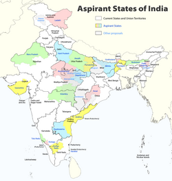
The Kamtapur Liberation Organisation is a militant organisation based in Northeast India whose objective is to unite the Kamtapur nation from West Bengal and Assam. The proposed state is to comprise all districts in West Bengal and four contiguous districts of Assam which are Cooch Behar, Darjeeling, Jalpaiguri, North and South Dinajpur and Malda, Kokrajhar, Bongaigaon, Dhubri and Goalpara, Kishanganj districts in Bihar, and Jhapa District in Nepal. The KLO was formed to address problems of the Koch Rajbongshi people such as large-scale unemployment, land alienation, perceived neglect of Kamtapuri language, identity, and grievances of economic deprivation.

<span class="mw-page-title-main">Nilambar</span> Last ruler of the Kamata Kingdom In Assam

Nilambar or Nīlambara was the last Khen ruler or Kamadeswar of the Kamata kingdom in Western Assam and North Bengal. He ruled from the city of Kamatapur.

<span class="mw-page-title-main">Gohain Kamal Ali</span>

Gohain Kamal Ali was an embanked road that connected the capital of the Koch dynasty, Cooch Behar in North Bengal to heart of Agomani in Dhubri and Narayanpur in Lakhimpur district in Assam, and ran along the foot of the Bhutan hills and the Dafla (Nishi) hills. This was constructed under the supervision of Gohain Kamal, the step-brother of the king, Nara Narayan and was completed in 1547. This was the road that the Koch general Chilarai used soon after for his invasion of the Ahom kingdom, and attacked the Ahom fort at Pichala, which was not a success, but a later movement in 1562 was greatly successful.

<span class="mw-page-title-main">Rajpat</span> Archaeological site in West Bengal, India

Rajpat or Kamtapur Fort is an archaeological site in present-day Gosanimari in the Dinhata I CD block in the Dinhata subdivision of the Cooch Behar district in West Bengal, India.

Sandhya was a king of Kamarupa kingdom in north-eastern India in the present-day state of Assam, India. He founded the Kamata Kingdom when he moved his capital west to Kamatapur sometime after 1257 CE.

References

  1. Shaw, U. K. (2014). UNDERSTANDING THE POST COLONIAL AGRARIAN HISTORY OF WEST BENGAL: A CASE STUDY OF THE WORKING OF OPERATION BARGA IN THE NAXALBARI SINCE 1977. Proceedings of the Indian History Congress, 75, 1200–1207. http://www.jstor.org/stable/44158510
  2. Barma, S. (2007). Socio-Political Movements in North Bengal (A Sub-Himalayan Tract). Global Vision. p. 3. ISBN   978-8182202177.
  3. Nath, D. (1989). History of the Koch Kingdom, C. 1515–1615. Mittal Publications. p. 1. ISBN   978-8170991090.
  4. 1 2 Debnath, Sailen (1 January 2010). The Dooars in Historical Transition. N.L. Publishers. ISBN   978-81-86860-44-1.
  5. Khondker, I. N. (2016, February 18). 9 Things About the Rajbongshi Community of Assam We Bet You Didn't Know. In Bordoisila. Retrieved May 1, 2018, from http://www.bordoisila.in/lifestyle/9-Things-About-the-Rajbongshi-Community-of-Assam-We-Bet-You-Didn't-Know.php
  6. 1 2 Chaudhuri, H. N. (1903). The Cooch Behar State and its Land Revenue Settlements (pp. 135-136). Cooch Behar, Cooch Behar Princely State: Cooch Behar State Press.
  7. History (n.d.). In Cooch Behar. Retrieved May 1, 2018, from http://www.coochbehar.gov.in/HTMfiles/royal_history.html
  8. Patani makes its way to upper Assam. (2015, June 2). In Kamatapur. Retrieved May 1, 2018, from http://www.kamatapur.com/patani-makes-its-way-to-upper-assam-with-priyanka-rajkhowa-wining-the-traditional-dress-competition-title/
  9. Das, A. J. (n.d.). History of Kamatapur. In Kamatapur. Retrieved May 1, 2018, from http://www.kamatapur.com/history