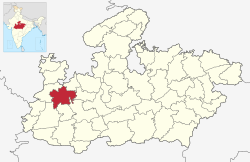
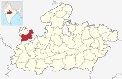
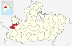
New map of 55 districts of Madhya Pradesh along with list
The Indian state of Madhya Pradesh came into existence on 1 November 1956. Madhya Pradesh has various geographic regions which have no official administrative governmental status; some correspond to historic countries, states or provinces. Currently, the number of districts in the state is 55. [1] These districts are grouped into 10 administrative divisions. Districts are subdivided into tehsils, of which there are 428 in Madhya Pradesh.
There are 55 districts in Madhya Pradesh, categorized into ten divisions. [2] [3]
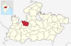
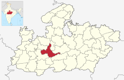
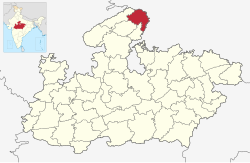
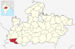
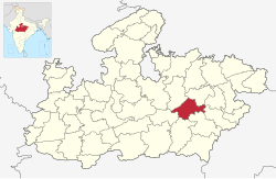
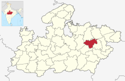
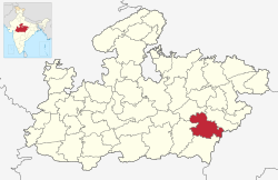
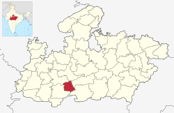
District | Code [4] | Headquarters | Division | Area (km2) [5] | Population (2011) [5] | Population density (per km2) | Location Map |
---|---|---|---|---|---|---|---|
Bhopal | BP | Bhopal | Bhopal division | 2,772 | 2,371,061 | 855 | |
Raisen | RS | Raisen | 8,446 | 1,331,597 | 158 | ||
Rajgarh | RG | Rajgarh | 6,154 | 1,545,814 | 251 | ||
Sehore | SR | Sehore | 6,578 | 1,311,332 | 199 | ||
Vidisha | VI | Vidisha | 7,371 | 1,458,875 | 198 | ||
Morena | MO | Morena | Chambal | 4,991 | 1,965,970 | 394 | |
Sheopur | SP | Sheopur | 6,585 | 687,861 | 104 | ||
Bhind | BD | Bhind | 4,459 | 1,703,005 | 382 | ||
Gwalior | GW | Gwalior | Gwalior | 5,214 | 2,032,036 | 390 | |
Ashoknagar | AS | Ashoknagar | 4,674 | 845,071 | 181 | ||
Shivpuri | SV | Shivpuri | 10,278 | 1,726,050 | 168 | ||
Datia | DT | Datia | 2,038 | 786,754 | 386 | ||
Guna | GU | Guna | 6,485 | 1,241,519 | 191 | ||
Alirajpur | AL | Alirajpur | Indore | 3,182 | 728,999 | 229 | |
Barwani | BR | Barwani | 5,432 | 1,385,881 | 255 | ||
Burhanpur | BU | Burhanpur | 2,473 | 757,847 | 306 | ||
Indore | IN | Indore | 3,898 | 3,276,697 | 841 | ||
Dhar | DH | Dhar | 8,153 | 2,185,793 | 268 | ||
Jhabua | JH | Jhabua | 6,782 | 1,025,048 | 151 | ||
Khandwa | EN [a] | Khandwa | 4,927 | 1,310,061 | 262 | ||
Khargone | WN [b] | Khargone | 4,927 | 1,873,046 | 262 | ||
Balaghat | BL | Balaghat | Jabalpur | 9,229 | 1,701,698 | 184 | |
Chhindwara | CN | Chhindwara | 10,293 | 1,716,612 | 177 | ||
Jabalpur | JA | Jabalpur | 5,210 | 2,463,289 | 473 | ||
Katni | KA | Katni | 4,927 | 1,292,042 | 262 | ||
Mandla | ML | Mandla | 5,805 | 1,054,905 | 182 | ||
Narsinghpur | NA | Narsinghpur | 5,133 | 1,091,854 | 213 | ||
Seoni | SO | Seoni | 8,758 | 1,379,131 | 157 | ||
Dindori | DI | Dindori | 7,427 | 704,524 | 95 | ||
Pandhurna | PD | Pandhurna | 1,522 | 374,310 | |||
Betul | BE | Betul | Narmadapuram | 10,043 | 1,575,362 | 157 | |
Harda | HA | Harda | 3,339 | 570,465 | 171 | ||
Narmadapuram | NA | Narmadapuram | 6,698 | 1,241,350 | 185 | ||
Rewa | RE | Rewa | Rewa | 6,434 | 1,748,461 | 368 | |
Satna | ST | Satna | 7,502 | 2,228,935 | 297 | ||
Sidhi | SI | Sidhi | 4,851 | 1,127,033 | 230 | ||
Singrauli | SH | Waidhan | 5,672 | 1,178,273 | 208 | ||
Mauganj | MG | Mauganj | 1,866 | 6,16,645 | |||
Maihar | MH | Maihar | 2,722.79 | 8,56,028 | |||
Chhatarpur | CT | Chhatarpur | Sagar | 8,687 | 1,762,375 | 203 | |
Damoh | DM | Damoh | 7,306 | 1,264,219 | 173 | ||
Panna | PA | Panna | 7,135 | 1,016,520 | 142 | ||
Sagar | SG | Sagar | 10,252 | 2,378,458 | 232 | ||
Tikamgarh | TI | Tikamgarh | 3,878 | 1,040,359 | 268 | ||
Niwari | NI | Niwari | 1,170 | 404,807 | 346 | ||
Anuppur | AP | Anuppur | Shahdol | 3,746 | 749,237 | 200 | |
Shahdol | SH | Shahdol | 6,205 | 1,066,063 | 172 | ||
Umaria | UM | Umaria | 4,026 | 644,758 | 160 | ||
Agar Malwa | AG | Agar Malwa | Ujjain | 2,785 | 571,275 | 205 | |
Dewas | DE | Dewas | 7,020 | 1,563,715 | 223 | ||
Mandsaur | MS | Mandsaur | 5,530 | 1,340,411 | 242 | ||
Neemuch | NE | Neemuch | 4,267 | 826,067 | 194 | ||
Ratlam | RL | Ratlam | 4,861 | 1,455,069 | 299 | ||
Shajapur | SJ | Shajapur | 3,460 | 941,403 | 272 | ||
Ujjain | UJ | Ujjain | 6,091 | 1,986,864 | 326 | ||
A bill giving in-principle approval to the creation of three districts was passed on 19 March 2020. The following districts would be created: [6]
There is demand of districts from various regions like:
Madhya Pradesh is a state in central India. Its capital is Bhopal, and its largest city is Indore, with Jabalpur, Gwalior being the other major cities. Madhya Pradesh is the second largest Indian state by area and the fifth largest state by population with over 72 million residents. It borders the states of Uttar Pradesh to the northeast, Chhattisgarh to the east, Maharashtra to the south, Gujarat to the west, and Rajasthan to the northwest.
Chhatarpur is a city and a municipality in Chhatarpur district in the state of Madhya Pradesh, India. It is the administrative headquarters of Chhatarpur District.
Sagar is a city, municipal corporation and administrative headquarter in Sagar district of the state of Madhya Pradesh in central India. It's Madhya Pradesh's 6th largest city of by Population. The city is situated on a spur of the Vindhya Range, 1,758 feet (536 m) above sea-level around 172 kilometres (107 mi) northeast of the state capital, Bhopal.
Nimar / Nimad is the southwestern region of Madhya Pradesh state in west-central India. This region has sub-regions which include Nimar, Khargone Khandwa Barwani Burhanpur and Dhar.
Chhatarpur District is a district of Madhya Pradesh state of central India. The town of Chhatarpur is the district headquarters.
Sagar Division is an administrative geographical unit of the Madhya Pradesh state of India. The city of Sagar is the division's administrative headquarters. As of 2023, the division consists of the districts of Sagar, Chhatarpur, Damoh, Panna, Tikamgarh, and Niwari.
Sagar district is a district of Madhya Pradesh state in central India. The town of Sagar serves as its administrative center. Sagar district is called the heart district of India. Tropic of Cancer (23°3') passes through Rangir Tiraha on NH26 present NH44 in Sagar district.
Guna district is one of the 52 districts of Madhya Pradesh in central India. Its administrative headquarters is Guna. The district has a population of 1,241,519. It has an area of 6390 km², and is bounded on the northeast by Shivpuri District, on the east by Ashoknagar District, on the southeast by Vidisha District, on the southwest by Rajgarh District, on the west and northwest by Jhalawar and Baran districts of Rajasthan state. The Sindh River flows northward along the eastern edge of the district, forming part of the boundary with Ashoknagar District, and the Parvati River flows northwestward through the southern portion of the district, forming part of the boundary with Baran District before flowing into Rajasthan.
Khandwa district, formerly known as the East Nimar district, is a district of the Madhya Pradesh state in central India. The city of Khandwa is the administrative headquarters of the district. Other notable towns in the district include Mundi, Harsud, Punasa, Pandhana and Omkareshwar.
The administrative divisions of India are subnational administrative units of India; they are composed of a nested hierarchy of administrative divisions.
Bada Malhera, is a town in the Chhatarpur district of the state of Madhya Pradesh, India.
Mandi Bamora is a census town in Sagar district in the state of Madhya Pradesh, India. This place has a railway station Mandi Bamora. Mandi Bamora located as half- half way in two different district Sagar and Vidisha. Tehsil is Bina. Mandi Bamora is very famous as a name "Great country" because two different districts boundaries separated two places Bamora and Sihora.
Sihora is a town and a municipality in Jabalpur district in the Indian state of Madhya Pradesh. Sihora is located at 23.48°N 80.12°E. The first cooperative society in Madhya Pradesh state was established in Sihora block of Jabalpur district in 1904.
Rehli is one of the 230 Vidhan Sabha constituencies of Madhya Pradesh state in central India. This constituency came into existence in 1951, as one of the Vidhan Sabha constituencies of Madhya Pradesh state.
Damoh Assembly constituency is one of the 230 Vidhan Sabha constituencies of Madhya Pradesh state in central India. This constituency came into existence in 1951, as one of the Vidhan Sabha constituencies of Madhya Pradesh state.
Sironj Assembly constituency is one of the 230 Vidhan Sabha constituencies of Madhya Pradesh state in central India. This constituency came into existence in 1957, as one of the Vidhan Sabha constituencies of Madhya Pradesh state.
Shamshabad is one of the 230 Vidhan Sabha constituencies of Madhya Pradesh state in central India. This constituency came into existence in 1977, as one of the Vidhan Sabha constituencies of Madhya Pradesh state. Shamshabad is one of the 5 Vidhan Sabha constituencies located in Vidisha district. This constituency covers the entire Shamshabad tehsil, Nateran tehsil and Vidisha tehsil. Shamshabad is part of Sagar Lok Sabha constituency.