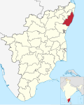
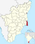
Districts of Tamil Nadu | |
---|---|
Category | Districts |
Location | Tamil Nadu |
Number | 38 districts |
Populations | Perambalur – 565,223 (lowest); Chennai – 7,139,630 (highest) |
Areas | Chennai – 426 km2 (164 sq mi) (smallest); Dindigul – 6,266.64 km2 (2,419.56 sq mi) (largest) |
Government | |
Subdivisions |
The Indian state of Tamil Nadu is divided into 38 districts. Districts are the major administrative units of a state which are further sub-divided into taluks. There were 13 districts in the erstwhile Madras Province the boundaries of the present-day Tamil Nadu. Post the reorganization in 1956, Madras state had 13 re-organized districts which was further divided in the later years.
Before 1947, Madras Presidency under British Raj was made up of 26 districts, of which 12 districts were part of the boundaries of the present-day Tamil Nadu, namely, Chingleput, Coimbatore, Nilgiris, North Arcot, Madras, Madura, Ramnad, Salem, South Arcot, Tanjore, Tinnevely, and Trichinopoly. [1]
After Indian Independence, the Madras Presidency] became the Madras Province on 15 August 1947. Pudukottai, a princely state acceded to the Indian Union on 4 March 1948 and became a division in Trichinopoly district. [2] When the new constitution came into force on 26 January 1950, Madras Province became Madras State. Madras state included most of the present-day Tamil Nadu, Coastal Andhra and Rayalaseema of Andhra Pradesh, the Malabar region of Kerala, Bellary and South Canara districts of Karnataka. [3] Coastal Andhra and Rayalaseema were separated to form Andhra State in 1953. [4] As a result of the re-organization of states in 1956, South Canara and Bellary districts were merged with Mysore State to form Karnataka and Malabar district with the State of Travancore-Cochin to form Kerala in 1956. [5] The Tamil speaking regions of Kanyakumari which was earlier a part of Travancore-Cochin was merged to Madras state. [5] Madras state had 13 districts namely: Chingleput, Coimbatore, Kanyakumari, Madras, Madurai, Nilgiris, North Arcot, Ramanathapuram, Salem, South Arcot, Thanjavur, Tiruchirappalli and Tirunelveli. [6]
No. District Code Headquarters Estd. Predecessor Area (km2) [34] Population [34] Pop.
density
(/km2)Divisions [35] Taluks [35] Assembly constituencies Lok sabha constituencies Map 1 Ariyalur ARI Ariyalur 23 November 2007 Perambalur 2,027.6 754,894 372 2 Chengalpattu CHG Chengalpattu 29 November 2019 Kanchipuram 2,802.6 2,556,244 912 3 Chennai
(formerly Madras)CHN Chennai 1 November 1956 None 462.3 46,46,732 10,052 4 Coimbatore COI Coimbatore 1 November 1956 None 4,950.7 3,458,045 699 5 Cuddalore CUD Cuddalore 30 September 1993 South Arcot District 3,870 2,605,914 673 6 Dharmapuri DHA Dharmapuri 2 October 1965 Salem 4,735.7 1,506,843 318 7 Dindigul DIN Dindigul 15 September 1985 Madurai 6,289.1 2,159,775 343 8 Erode ERO Erode 31 August 1979 Coimbatore 6,036 2,251,744 373 9 Kallakurichi KAL Kallakurichi 26 November 2019 Viluppuram 3,440.8 1,370,281 398 10 Kancheepuram KAC Kancheepuram 1 July 1997 Chingleput 1,800.2 1,166,401 648 11 Kanyakumari KAY Nagercoil 1 November 1956 None 1,729.2 1,870,374 1,082 12 Karur KAR Karur 30 September 1995 Tiruchirappalli 3,022.3 1,064,493 352 13 Krishnagiri KRI Krishnagiri 9 February 2004 Dharmapuri 5,414.4 1,883,731 348 14 Madurai MAD Madurai 1 November 1956 None 3,846.4 3,038,252 790 15 Mayiladuthurai MAY Mayiladuthurai 28 December 2020 Nagapattinam 1,237.1 918,356 742 16 Nagapattinam NAG Nagapattinam 18 October 1991 Thanjavur 1,459 697,069 478 17 Namakkal NAM Namakkal 1 January 1997 Salem 3,573.4 1,726,601 483 18 Nilgiris NIL Ooty 1 November 1956 None 2,452.5 735,394 300 19 Perambalur PER Perambalur 30 September 1995 Tiruchirappalli 1,836.6 565,223 308 20 Pudukkottai PUD Pudukkottai 14 January 1974 Thanjavur and Tiruchirappalli 4,847.8 1,618,345 334 21 Ramanathapuram RAM Ramanathapuram 1 November 1956 None 4,243.1 1,353,445 319 22 Ranipet RAN Ranipet 28 November 2019 Vellore 2,234.3 1,210,277 542 23 Salem SAL Salem 1 November 1956 None 5,245 3,482,056 669 24 Sivaganga SIV Sivaganga 15 March 1985 Ramanathapuram 4,086 1,339,101 328 25 Tenkasi TEN Tenkasi 22 November 2019 Tirunelveli 2,916.1 1,407,627 483 26 Thanjavur THA Thanjavur 1 November 1956 None 3,396.6 2,405,890 708 27 Theni THE Theni 25 July 1996 Madurai 3,066 1,245,899 406 28 Thoothukudi THO Thoothukudi 20 October 1986 Tirunelveli 4,621 1,750,176 379 29 Tiruchirappalli TIC Tiruchirappalli 1 November 1956 None 4,407 2,722,290 618 30 Tirunelveli TIN Tirunelveli 1 November 1956 None 3842.4 1,665,253 433 31 Tirupathur TIA Tirupattur 28 November 2019 Vellore 1,792.9 1,111,812 620 32 Tiruppur TIP Tiruppur 22 February 2009 Coimbatore and Erode 5,186.3 2,479,052 478 33 Tiruvallur TAL Tiruvallur 1 July 1997 Chingleput 3,444.2 3,728,104 1,082 34 Tiruvannamalai TAN Tiruvannamalai 30 September 1989 North Arcot 6,191 2,464,875 398 35 Tiruvarur TAR Thiruvarur 18 October 1991 Thanjavur 2,161 1,264,277 585 36 Vellore VEL Vellore 30 September 1989 North Arcot 2,222.1 1,614,242 726 37 Viluppuram VIL Viluppuram 30 September 1993 South Arcot 3,725.5 2,093,003 562 38 Virudhunagar VIR Virudhunagar 15 March 1985 Ramanathapuram 4,288.0 1,942,288 453
District | Span | Successor districts | Map |
---|---|---|---|
Chingleput | 1956–98 | Kanchipuram, Chengalpattu and Tiruvallur | |
North Arcot | 1956–89 | Tiruvannamalai, Vellore, Ranipet and Tirupattur | |
South Arcot | 1956–93 | Cuddalore, Villupuram and Kallakurichi |
Kanchipuram district is one of the 38 districts in the state of Tamil Nadu in India. The area comprising the present day Kancheepuram district was earlier a part of Chingleput district. The original Chingleput district was split in 1997 into form the present day Kanchiepuram and Tiruvallur districts.
Tiruvallur district, also spelled as Thiruvallur district, is one of the 38 districts in the Indian state of Tamil Nadu. The fast developing city of Tiruvallur is the district headquarters. The district has a mixture of urban and rural characteristics. The eastern part of Tiruvallur district is dominated by urban characteristics while the Northern part of the district has influence of Andhra culture due to its position. In 2011, the district had a population of 3,728,104 with a sex-ratio of 987 females for every 1,000 males.
Chennai district, formerly known as Madras district, is one of the 38 districts in the state of Tamil Nadu, India. It is the smallest and the most densely populated district in the state. The district is coterminous with the city of Chennai, which is administered by the Greater Chennai Corporation. It is surrounded by Tiruvallur district in the north and the west, Kanchipuram district in the south-west, Chenglpattu district in the south, and the Bay of Bengal in the east.
Sholinghur is a municipality under Sholinghur taluk in Ranipet District of Tamil Nadu, India. The town is famous in Tamil Nadu and other neighboring states for the Lakshmi Narasimha Swamy temple.
Vellore district is one of the 38 districts in the Tamil Nadu state of India. It is one of the eleven districts that form the north region of Tamil Nadu. Vellore city is the headquarters of this district. As of 2011, the district had a population of 1,614,242 with a sex ratio of 1,007 females for every 1,000 males. In 2017 Vellore district ranked eleventh in list of districts in Tamil Nadu by Human Development Index.
Chittoor district is one of the eight districts in the Rayalaseema region of the Indian state of Andhra Pradesh. It had a population of 18,72,951 at the 2011 census of India. It is a major market centre for mangoes, grains, sugarcane, and peanuts. The district headquarters is at Chittoor City.
Tiruttani is a town in the Tiruvallur district, a suburb of Chennai within the Chennai Metropolitan Area, located in the state of Tamil Nadu, India. The town is renowned for the Tiruttani Murugan Temple, which is one of the Arupadaiveedu and is dedicated to Kartikeya (Murugan). Tiruttani was added to the Chennai Metropolitan Area in October 2022.
Thiruthuraipoondi is a municipality in Tiruvarur district in the Indian state of Tamil Nadu. Thiruthuraipoondi is an agricultural town located south of Thiruvarur district. The town is located at a distance of 28 km from the district headquarters Thiruvarur.
Aarani, officially spelled as Arni, and also known as Periya Aarani, is a major commercial, industrial and cultural hub and also a divisional headquarter in the Thiruvanamalai district of Tamil Nadu, India. The town is the second largest urban center next to the district headquarters, Thiruvannamalai, and is administered by a selection grade municipality. Aarani is home to silk weaving, spinning mills and agricultural industries. Famous Aarani silk and a paddy variety named Aarani Ponni, known for its rich aroma, originates from Aarani. The town is often nicknamed as The Silk City. Aarani also has a rich cultural heritage as it is a major center of Tamil Jainism.
The Chennai Metropolitan Development Authority (CMDA), formerly known as the Madras Metropolitan Development Authority (MMDA), is the nodal planning agency of Chennai in the Indian state of Tamil Nadu. The CMDA administers the Chennai Metropolitan Region, spread over an area of 5,904 km2 (2,280 sq mi) and covers the districts of Chennai, Thiruvallur, Chengalpattu, Ranipet and Kancheepuram. It was set up for the purposes of planning, co-ordination, supervising, promoting and securing the planned development of the Chennai Metropolitan Area. It coordinates the development activities of the municipal corporations, municipalities and other local authorities.
Greater Chennai Metropolitan Area, or simply the Chennai Metropolitan Area (CMA), is fourth-most populous metropolitan area in India and the 35th most populous in the world. The CMA consists of the core city of Chennai, which is coterminous with the Chennai district, and its suburbs in Kanchipuram, Chengalpattu, Thiruvallur and Ranipet districts. The Chennai Metropolitan Development Authority (CMDA) is the nodal agency that handles town planning and development within the metro area. In 1974, an area encompassing 1,189 km2 (459 sq mi) around the city was designated as the metropolitan area which was subsequently expanded to 5,904 km2 (2,280 sq mi) in 2022.
Thiruvarur district is one of the 38 districts in the Tamil Nadu state of India. As of 2011, the district had a population of 1,264,277 with a sex-ratio of 1,017 females for every 1,000 males.
The Madras Presidency was a province of British India comprising most of the present day Tamil Nadu and Andhra Pradesh along with a few districts and taluks of Karnataka, Kerala and Odisha. A few princely states, notably Ramnad and Pudukkottai also merged into the Presidency at some or the other time. The Presidency lasted till 1950, when it became the Madras State after India became a republic. In 1953, Telugu-speaking regions of the state split to form Andhra State. Subsequently, in 1956, Kannada- and Malayalam-speaking areas were merged with Mysore and Travancore-Cochin respectively.
Tiruvannamalai district is the second largest district in Tamil Nadu by area after Dindigul District and one of the 38 districts in the state of Tamil Nadu, in South India. It was formed in the year 1989 through the bifurcation of North Arcot into the Tiruvannamalai Sambuvarayar and Vellore Ambedkar districts. The city of Tiruvannamalai is the district headquarters.
This article gives a list of the territories of the dioceses of the Catholic Church in India.
Tiruvannamalai is predominantly connected by road to other major cities in the state including Chennai, Bengaluru, Vellore, Arani, Trichy, Tiruppur, Salem, Thanjavur, Coimbatore, Shimoga and Kanchipuram. And also other state major cities such as Hyderabad, Tirupati, Puducherry and Mangaluru. Tiruvannamalai serves as one of the important Road junction of Tamil Nadu and north roadways Zone. The nearest domestic airport is Vellore, which has a no daily chartered flights. The nearest international airports are Chennai and Tiruchirappalli.
Tondaimandalam, also known as Tondai Nadu, is a historical region located in the northernmost part of Tamil Nadu and southernmost part of Andhra Pradesh. The region comprises the districts which formed a part of the legendary kingdom of Athondai Chakravarti. The boundaries of Tondaimandalam are ambiguous – between the river basins of Penna River and Ponnaiyar River. During the reign of Rajaraja I, this region was called as Jayankonda Cholamandalam.
Kadambathur, also spelt Kadambattur, is a town located in Tiruvallur district in the Indian state of Tamil Nadu. It is a census town in Tiruvallur taluk. According to the 2011 census, the town has a population of 11,235.