This article is about the district. For its eponymous headquarters, see Theni.
This article may require cleanup to meet Wikipedia's quality standards. The specific problem is: Entire sections are only partially and badly translated into English. See: so many moovies taken by tamilnadu film industry the moovies are list out below pithamagan. Please help improve this article if you can.(February 2018) ( Learn how and when to remove this message )
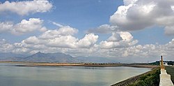
Theni district is one of the 38 districts of Tamil Nadu state in India. Surrounded by hills, the district is located to the west of Madurai district. The town of Theni is the district headquarters. The district is divided into two natural divisions by the hills and is further subdivided into five Taluks: Theni, Bodinayakanur, Periyakulam, Uthamapalayam and Andipatti. The area is rich in natural features, with thick vegetation and perennial streams from the hills on the western side, and Cumbum Valley, which lies in Uthamapalayam taluk.[6] As of 2011, Theni district had a population of 1,245,899.
Theni District was formed by the splitting from the former Madurai District as per G.O. Ms. No. 679 Revenue Department, dated 7 July 1996. Because of the bifurcation, a new Revenue Division (Uthamapalayam) and two new taluks—Theni and Bodinayakanur—were created on 1 January 1997. Theni Municipal town was not a district headquarters until this date.
The region covered by present-day Theni District was sparsely populated before the 1900s. In 1886 Mullaperiyar dam project bought part of the water from Periyar River downhill to the Cumbum Valley and merged it into the Mullayar River. This project lead more people to settle down in Cumbum Valley. Theni was a small, lesser-known town through the 1900s. After the Mullai-Periyar merger project, many people from nearby arid regions (Sivakasi, Kovilpatti, Virudhunagar, Sattur, and others) settled in Cumbum Valley, the present day Theni District, leading to an influx of people from the 1890s to 1920s. Later, the area developed rapidly due to commerce.
A range of hills which runs parallel to Western Ghats from north to south separate it from the neighboring state of Kerala.[7]
Climate
In the plains, the temperatures range from a minimum of 15°C (59°F) to a maximum of 40°C (104°F).[citation needed] In the hills, the temperatures can range from as low as 4–5°C (39–41°F) to 25°C (77°F). The district is known for its pleasant climate, hills, and lakes.[citation needed]
Paddy fields across the backdrop of the Western GhatsCoconut groves in Theni District
The economy of Theni district is mostly agricultural. Utilization of land area for cultivation in the district is 40.33%.[6]:29 The principal crops produced (in tonnes) in 2005-2006 were sugarcane 1,201,221, cotton 95,360 (561 bales of 170. kg lint each), rice (paddy) 66,093, millets and other cereals 57,081, pulses 6,677, groundnut 4,021 and gingelly 325.[11]Silk, Banana, Coconut, Tea, Coffee, Cardamom, Grapes and Mangoes are the other main produce of the district.[12]Kolukkumalai located in Theni district atop the Western Ghats is the home to the highest-altitude tea plantation in the world. Cumbum Valley is a major centre for grape production with 4,000 small farmers producing over 90,000 tonnes of Muscat grapes, locally known as panneer dhrakshai, and about 10,000 tonnes of Thomson seedless grapes. The unique feature here is that the grapes are harvested throughout the year, while in most grape growing centres elsewhere the season ends with summer.[citation needed]
Grapes Cultivation.
Cotton spinning mills and sugar mills are the major industries in this district. In Andipatti Taluk, handloom weaving and power looms flourish, while in Uthamapalayam Taluk, the Highwavis Estate produces a large amount of tea. Bodinayakanur is a major market place for cardamom, coffee, tea and black pepper. The city is often called "Cardamom City" because of the large quantity of cardamom trade in this area. It has an auction centre for cardamom.[7]
The Periyar and Surliar Hydro Power Stations and the Vaigai Micro Hydro Power Station have 181 MW installed capacity and actual power generation of 494 MW in 1996 in this district.[6]:15 Theni is one of the active business hubs in the western side of Tamil Nadu, inviting more industries to its locality. The district has 41.09km of Metre gauge track serving 3 Railway Stations which connect to Madurai[6]:29 now converted to broad gauge.[13][14] The Teni Junction Railway Station is the largest civilian railway station in the district.[citation needed]
Forest resources
Meghamalai Falls.
The forest area in Theni district is about 33.70%. There are 27 forest areas in the district, constituting a total area of 795.81km2 (307.26sqmi).[citation needed] Of these, 19 areas fall under the Reserve Forest category with 255.44km2 (98.63sqmi) and 8 areas under Reserve Land category with 540.37km2 (208.64sqmi). Total area of forest (under green cover classification) was 806.86km2 (311.53sqmi). Dense forest and sparse forest are 292.81km2 (113.05sqmi) and 22.43km2 (8.66sqmi), respectively. About 44.65km2 (17.24sqmi) of artificial forest area are cultivated in the district. Wattle, softwood, fuel wood, cashew, neem, and tamarind are the main forest plantation species in the district.[6] The forest area in the district is 1,179.29km2 (455.33sqmi), which is 40.98% of the total geographical area of the district.[15] The Meghamalai Wildlife sanctuary, Srivilliputhur elephant reserve, and part of Kodaikanal Wildlife Sanctuary are situated in Theni district.[citation needed]
There has been no conservation of biological resources in the district. The information of wild life census in Theni district is yet to be made available.[6]
According to 2011 census, Theni district had a population of 1,245,899 with a sex-ratio of 991 females for every 1,000 males, much above the national average of 929. 53.81% of the population lived in urban areas.[17] A total of 119,661 were under the age of six, constituting 61,873 males and 57,788 females. Scheduled Castes and Scheduled Tribes accounted for 20.72% and 0.15% of the population respectively. The average literacy of the district was 69.84%, compared to the national average of 72.99%.[17] The district had a total of 338,112 households. There were a total of 591,642 workers, comprising 36,371 cultivators, 275,585 main agricultural labourers, 12,714 in house hold industries, 205,921 other workers, 61,051 marginal workers, 1,996 marginal cultivators, 39,576 marginal agricultural labourers, 2,225 marginal workers in household industries and 17,254 other marginal workers.[18]
Theni district is home to many cultural festivals, celebrating both Hindu and local culture.
The Karuppaswamy festival celebration at Anaipatti.
Arilmigu Krishnan Kovil Thiruvizha in Purattasi thingal at Lakshmipuram (Jangal Patti Panchayat).
B.Ammapatti, Kaliamman kovil is the famous god to solve problems and has a great festival on 1 April.
The Ramzan Peru naal Thozhuhai at Periyakulam,[20] Uthamapalayam, Cumbum, Devadhanapatti, Gudalur, Kottur, Bodinayakanur, Chinnamanur, Batalagundu in Theni. Mariyamman Temple Festival also famous.
The celebration of "Gowmariyamman Temple" festival at Veerapandi and Cumbum during the month of May.
Shri Bathirakaliyamman Chiththirai Thiruvizha Festival at Bathirakalipuram and visuvasapuram near Bodi.
Shri Veerappa Ayyanar Festival during Chiththirai Thiruvizha at Theni-Allinagaram.
Kamatchi Amman festival at Devadanapatti and Suyambu Saneeswara Bagavan and the month of Aadi every friday celebration on Temple festival at Kuchanur.
Apart from Pongal celebrations in other areas, the birthday of John Pennycuick who built the MullaiPeriyar Dam is celebrated in Surulipatty[21] and other places.
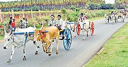
Theni district is known for its celebration of Pongal, which is considered to be one of the most important festivals of Tamil Nadu. Pallavarayanpatti, Ayyampatti and Pudupatti is known for its Jallikattu during the Pongal festival.[22]
Other important festivals of the region are festivals of Masi Maham and Shivarathri which are celebrated in the Kamatchi Amman Temple during the months of February–March and kottur Ekadasi.[24]
Christmas and New Year are celebrated in Anaimalayanpatty.[citation needed]
Arulmigu Pattalamman, Kaliyamman, Karuppasamy temple festival in Kattunaickenpatty
Uppukottai Varatharaja Perumal Kovil.
Our Lady of Snow's Church festival celebration at Royappanpatti in the month of August.[25]
Holy spirit church in Hanumanthanpatti, they celebrate St. Xavier festival on 2 December every year.[26]
Manthaiyamman temple festival is celebrated in Gudalur(Melagudalur) of Theni district.
Srinivasaka Perumal Kovil temple festival is celebrated in Silamalai(Bodi Taluk) of Theni district.
Sri Guru Boga Eswara Ananda Swami is offering Pooja to Lord Shanmuganatha SwamiThai Poosam Festival at Shanmuganathar Temple at Kamayagoundanpatti.[27]Siddar Sri Guru Boga Eswara Ananda Swami had visited this Temple during Thai Poosam Festival.
↑Collectorate staff (2006–2007). "District Profile Theni District"(PDF). District Collectorate, Theni. pp.1–15. Archived from the original(PDF) on 21 July 2011. Retrieved 15 September 2008.
12"Census Info 2011 Final population totals". Office of The Registrar General and Census Commissioner, Ministry of Home Affairs, Government of India. 2013. Retrieved 26 January 2014.
This page is based on this Wikipedia article Text is available under the CC BY-SA 4.0 license; additional terms may apply. Images, videos and audio are available under their respective licenses.