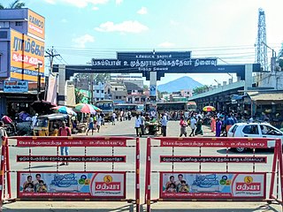
Ramanagara is a city in the Indian state of Karnataka. It is also the headquarters of Ramanagara district. It is approximately 50 kilometres from Bangalore. There are buses and trains as public transportations which approximately takes 90 minutes from Bangalore.

Puthunagaram is a town and gram panchayat in the Palakkad district, state of Kerala, India. It is about 10 km south of Palakkad and 8 Km from Kollengode. Palakkad-Pollachi railway line passes through this town.

Theni District is one of the 38 districts of Tamil Nadu state in India. Well protected by the scenic hill locks, the district is located besides Madurai district. The town of Theni is the district headquarters. The district is divided into two natural divisions: The hilly areas are constituted by parts of the five taluk's Theni, Bodinayakanur, Periyakulam, Uthamapalayam and Andipatti with thick vegetation and perennial streams from the hills on the western side and Cumbum valley which lies in Uthamapalayam taluk. As of 2011, Theni district had a population of 1,245,899 with a sex ratio of 980 females for every 1,000 males.
Dhariawad is a census town in Pratapgarh district in the state of Rajasthan, India. It is the administrative headquarters for Dhariawad Tehsil.
Elumalai is a Panchayat town in the district of Madurai, in the Indian state of Tamil Nadu. Originally named Aezhumalai, the town is located near Usilampatti (18 km), Madurai (58 km), Theni (56 km), Peraiyur (24 km) and Tirumangalam (40 km) in the Western ghats.
Cumbum, natively spelt as Kambam, is a town and municipality in Theni district, an Indian state of Tamil Nadu.
Kilpennathur is a Panchayat Town in Tiruvanamalai district in the Indian state of Tamil Nadu. Kilpennathur is one of the taluks of Tiruvannamalai district and an assembly constituency of Tamil Nadu. The MLA of Kilpennathur assembly constituency is DMK party Mr. K. Pichandi. Vettavalam is the most populous town panchayat in this taluk. Kilpennathur is located a 12.25 degrees latitude and 79.224 degrees longitude. Nearest towns are Avalurpet, Vettavalam, Gingee and Tiruvannamalai, and Chennai is about 177 km away.

Manapakkam is a is a neighborhood in Chennai in the Indian state of Tamil Nadu. A census town, Manapakkam is located along the Mount-Poonamallee Road in Chennai. It is now a home to many IT companies, like DLF Cybercity Chennai and Larsen & Toubro. Manappakam has beautiful and scenic Adyar River Bank Trail suitable for morning walkers and joggers, it is a 3-km stretch extended till Chennai Airport's secondary Runway Bridge.

Palani Chettipatti is a panchayat grama in Theni district in the Indian state of Tamil Nadu. It is located on the road between Theni and Cumbum. The Mullai river flows via this village from Uthamapalayam and goes down the valley pin code is 625531.
Palavakam is a locality in the south of Chennai and census town in Chennai district in the Indian state of Tamil Nadu. It is located on the East Coast Road about 6 km south of Adyar.
Pannaipuram is a panchayat town in Theni district in the Indian state of Tamil Nadu. It is located hill foot of "Western Ghats" sharing its border with Kerala State and has very good literacy. Pannaipuram Town panchayat includes 4 villages namely Pannaipuram, Kariyanampatty, Mallingapuram and P. Renganathapuram. Mahalingeswarar Temple, Kaliamman Temple and Bommaiyaswamy Temple are located in Pannaipuram. Veereswarar Temple is located in Kariyanampatty. Most of the people in Pannaipuram are engaged in Cardamom cultivation and trade in nearby Kerala hills.
Peringathur is a census town in Thalassery taluk of Kannur district in the Indian state of Kerala. It is a part of the municipality of Panoor.

Polur is a scenic town and a Religious site for Lord Narasimha called Sampathgiri, divisional headquarters and a market center in Tiruvannamalai district of Tamil Nadu in India. Located at the foothills of Javvadhi hills, a popular section of Eastern Ghats, Polur is often regarded as Gateway of Eastern ghats. Polur was once a eminent center of Tamil Jainism. The town is home to Dharani sugars, chemicals and fertiliser Pvt., Ltd, and number of agro based industries including coir industries. The famous Chittor - Cuddalore road passes through the town. The town is located 29 Kilometres north of city of Tiruvannamalai and 45 kilometres south of Vellore Metropolis.

Puthukkad is a town on the banks of Kurumali River, also known as Mupliyam River, in Kerala. The town is 15 km (9.3 mi) to the south of Thrissur, 16 km (9.9 mi) to the north of Chalakudy, and 1.2 km (0.75 mi) west of Cheruval. The National highway NH 544 passes through thi town.

Usilampatti is a town and a second grade municipality in the Indian state of Tamil Nadu. It is also a designated taluk and revenue division.
Vilapakkam is a panchayat town in Ranipet district in the Indian state of Tamil Nadu.
Ramgarh or Ramgarh Shekhawati is a town and a municipality in Ramgarh tehsil of Sikar district in the Indian state of Rajasthan.
Sivagiri is a panchayat town in Erode district in the Indian state of Tamil Nadu.
Sukkangalpatti is a panchayat town in Theni district in the Indian state of Tamil Nadu.
Mungurwadi is a town in Gadhinglaj Taluka of Kolhapur district in Maharashtra, India. In 2001 it had a population of 3,271, but as of 2011, it has a population of 12,199. It is a major market place and the tenth largest settlement in Gadhinglaj taluka. Mungurwadi is about 24 km from Gadhinglaj, 29 km from second-largest settlement Kadgaon and 12 km from National Highway 48 (NH48).


