Shanmuganathi Dam

Last updated
Shanmuganathi Dam Shanmuganathi Dam.jpg
Shanmuganathi Dam

The Shanmuganathi Dam is built across the Shanmugha River near Rayapanpatty, in the Theni district of Tamil Nadu, southern India. It provides water for irrigation for the dry lands such as Pusarikoundan patti, Appipatti, SukkangalPatti, Vellaiammalpuram, Odaipatti and Sepalakottai of Theni district. This dam is more scenery and situated at the foot hill of Meghamalai mountain range just 4 km from Rayapanpatty Village near Uthamapalayam and just 2km from Anaipatty village.

Theni district District in Tamil Nadu, India

Theni District is a district of Tamil Nadu state in South India.Theni district is Located beside Madurai. The town of Theni is the district headquarters. The district is divided into two natural divisions: The hilly areas are constituted by parts of the Five taluk's Theni,Periyakulam, Uthamapalayam, Usilampatti and Andipatti with thick vegetation and perennial streams from the hills on the western side and Cumbum valley which lies in Uthamapalayam taluk. As of 2011, Theni district had a population of 1,245,899 with a sex-ratio of 980 females for every 1,000 males.

Tamil Nadu State in Southern India

Tamil Nadu, formerly Madras State, is one of the 29 states of India. Its capital and largest city is Chennai. Tamil Nadu lies in the southernmost part of the Indian subcontinent and is bordered by the union territory of Puducherry and the South Indian states of Kerala, Karnataka, and Andhra Pradesh. It is bounded by the Eastern Ghats on the north, by the Nilgiri Mountains, the Meghamalai Hills, and Kerala on the west, by the Bay of Bengal in the east, by the Gulf of Mannar and the Palk Strait on the southeast, and by the Indian Ocean on the south. The state shares a maritime border with the nation of Sri Lanka.

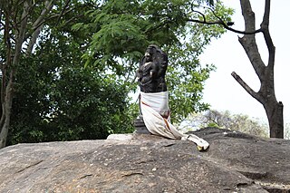
Sukkangalpatti is a panchayat town in Theni district in the Indian state of Tamil Nadu.

Coordinates: 9°43′55″N77°21′15″E / 9.732078°N 77.35427°E / 9.732078; 77.35427

Geographic coordinate system Coordinate system

A geographic coordinate system is a coordinate system that enables every location on Earth to be specified by a set of numbers, letters or symbols. The coordinates are often chosen such that one of the numbers represents a vertical position and two or three of the numbers represent a horizontal position; alternatively, a geographic position may be expressed in a combined three-dimensional Cartesian vector. A common choice of coordinates is latitude, longitude and elevation. To specify a location on a plane requires a map projection.


Related Research Articles

Vaigai River river in south India

The Vaigai is a river in the Tamil Nadu state of southern India; it passes through the towns of Theni, Andipatti and Madurai. It originates in Varusanadu Hills, the Periyar Plateau of the Western Ghats range, and flows northeast through the Kambam Valley, which lies between the Palni Hills to the north and the Varushanad Hills to the south. The Vattaparai Falls are located on this river. As it rounds the eastern corner of the Varushanad Hills, the river turns southeast, running through the region of Pandya Nadu. Madurai, the largest city in the Pandya Nadu region and its ancient capital, lies on the Vaigai. The river empties into the Palk Strait near Uchipuli, close to Pamban bridge in Ramanathapuram District.

Cumbum, Tamil Nadu Town in Tamil Nadu, India

.

Palani Chettipatti city in Tamil Nadu, India

Palani Chettipatti (P.C.Patti) is a panchayat town in Theni district in the Indian state of Tamil Nadu. It is located on the road between Theni and Cumbum. The Mullai river flows via this town from Uthamapalayam and goes down the valley. It was founded by Palaniappa Chettiar. He and his family members constructed a small dam across the suruliyar river basin in 1840-1845, when John Black Burn was the district collector and magistrate of Madurai-Ramnad Jilla well before the Mullaiperiyar dam was constructed by Colonel John PennyCuick(1895). This dam is used for the irrigation and drinking water supply for several places: Theni - Allinagaram, Palanichettipatti and some near by villages. This dam has the distinction of being the *only* privately owned dam in Tamil Nadu.

Periyakulam Town in Tamil Nadu, India

Periyakulam is a major Town and a Municipality in Theni district in the Madurai Region . South Indian state of Tamil Nadu. As of 2011, the town had a population of 42,976. Periyakulam is the northern gateway of the district.

Theni Allinagaram Town in Tamil Nadu, India

Theni Allinagaram is a town and a municipality in Theni district in the Indian state of Tamil Nadu. As of 2011, the town had a population of 94,453.

Usilampatti Town in Tamil Nadu, India

Usilampatti is a Town and a Municipality in Theni District in the Madurai Region at Indian state of Tamil Nadu.

Gudalur, Theni Town in Tamil Nadu, India

Gudalur is a municipal town in Theni district in the Indian state of Tamil Nadu. As of 2011, the population of the town was 41,915.

Vadugapatti is a Village in Periyakulam Taluk Theni district Madurai Region in the Indian state of Tamil Nadu.

Veerapandi, Theni panchayat town in Tamil Nadu, India

Veerapandi is a panchayat town in Theni district in the Indian state of Tamil Nadu.

Kumbakkarai Falls waterfall

Kumbakkarai Falls are lesser known falls in the foothills of the Kodaikanal Hills. They are located at 10°10′48″N77°31′50″E in Theni district, 9 kilometers (5.6 mi) from Periyakulam. Kumbakkarai Falls are located along the Kodai-Vellagavi-Periyakulam footpath.

Vaigai Dam dam on the Vaigai River

The Vaigai Dam is built across the Vaigai River near Andipatti, in the Theni district of Tamil Nadu, southern India. It provides water for irrigation for the Madurai district and the Dindigul district as well as drinking water to Madurai and Andipatti. Near the dam, the Government of Tamil Nadu has constructed an Agricultural Research Station for researching the growing of a variety of crops, including rice, sorghum, blackgram, cowpea and cotton.

Cumbum Valley, also called Kambam Valley, is a valley in the Theni district of Tamil Nadu state in India near the Kerala state border.This is the most fertile valley in south India, The valley includes lands between Thekkadi Hills, Varusanadu Hills, and Kodaikanal Hills.

Andipatti taluk is a taluk of Theni district of the Indian state of Tamil Nadu. The headquarters of the taluk is the town of Andipatti.

Mallappuram Mallappuram, or மல்லபுரம் Mallapuram, or மள்ளப்புரம் Maḷḷappuram) is a village in Madurai district, India.

Bodimettu Hill Station in Tamil Nadu, India

Bodimettu is a locality in Theni district in the state of Tamil Nadu in India, near the border with Kerala. It is 10 km from Poopara on the way to Bodinayakkanur by the side of National Highway 85, which runs from Madurai to Kochi. Bodimettu is the main cardamom-growing area of Tamil Nadu. It is close to famous tourist destinations such as Munnar, Marayur, Thekkady, Kodaikanal, Idukki Dam.

Kadamalaigundu is a village in Theni district, Tamil Nadu state, India. It is near Kandamanur and has very nice places and a natural mount near Vaigai River about 8 kilometres (5.0 mi) from the Suruli Falls.

Venkatachalapuram Village in Tamil Nadu, India

Venkatachalapuram is a small village situated in Theni District, Tamil Nadu, India and with direct road connectivity to Theni and Odaipatti. The district headquarters, Theni, is situated 11 kilometres (6.8 mi) north of this village. The village consists mostly of Hindu people, with 99% belonging to the Kamma caste.