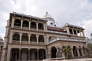
Tiruchirapalli District is located along the Kaveri River in Tamil Nadu, India. The main town in Tiruchirappalli District is the city of Tiruchirappalli, also known as Trichy. During the British Raj, Tiruchirappalli was known as Trichinopoly, and was a district of the Madras Presidency; it was renamed upon India's declaration of independence in 1947. As of 2011, the district had a population of 2,722,290 with 1,013 females for every 1,000 males.

Pudukkottai District is a district of Tamil Nadu state in southern India. The city of Pudukkottai is the district headquarters. It is also known colloquially as Pudhugai. Pudukkottai district is one of the least urbanised district in Tamil Nadu.
Pallipattu taluk is a taluk of Tiruvallur district of the Indian state of Tamil Nadu. The headquarters of the taluk is the town of Pallipattu.
Thiruvallur taluk is a taluk of Tiruvallur district of the Indian state of Tamil Nadu. The headquarters of the taluk is the town of Thiruvallur.
Madurantakam taluk is a taluk of Kanchipuram district of the Indian state of Tamil Nadu. The headquarters of the taluk is the town of Madurantakam. Madurantakam taluk is bounded by Chengalpattu taluk in north, Uthiramerur taluk in West, Thirukklaukkundram Taluk in north east and Tindivanam lauk of Villupuram district in south.
Sriperumbudur taluk is a taluk of Kanchipuram district of the Indian state of Tamil Nadu. The headquarters of the taluk is the town of Sriperumbudur
Tambaram taluk is a taluk of Kanchipuram district of the Indian state of Tamil Nadu. The headquarters of the taluk is the town of Tambaram. It comes under the Chennai Metropolitan Area and it is a suburb of Chennai city.
Lalgudi taluk is an administrative area of Tiruchirapalli district of the Indian state of Tamil Nadu. The headquarters of the taluk is the town of Lalgudi. The taluk of Lalgudi was formed 100 years ago by the British East India Company. Lalgudi taluk consists of two revenue blocks named Pullambadi block and Lalgudi block.
Manachanallur taluk is a taluk of Tiruchirapalli district of the Indian state of Tamil Nadu. The headquarters of the taluk is the town of Manachanallur.
Manapparai taluk is a taluk of Tiruchirapalli district of the Indian state of Tamil Nadu. The headquarters of the taluk is the town of Manapparai.
Musiri taluk is a taluk of Tiruchirapalli district of the Indian state of Tamil Nadu. The headquarters of the taluk is the town of Musiri.
Srirangam taluk is a taluk of Tiruchirapalli district of the Indian state of Tamil Nadu. The headquarters of the taluk is the town of Srirangam.This taluk has a 1 to 6 wards of city as jurisdictional areas and some villages are under this taluk of Trichy.
Thottiyam taluk is a taluk of Tiruchirapalli district of the Indian state of Tamil Nadu. The headquarters of the taluk is in the town of Thottiyam.
Thuraiyur taluk is a taluk of Tiruchirapalli district of the Indian state of Tamil Nadu. The headquarters of the taluk is the town of Thuraiyur. This taluk is surrounded by the Kolli Hills of Namakkal district to the west, the Pachaimalai Hills range of Tiruchirappalli district to the east, Salem district in the north and Musiri taluk and Manachanallur taluk in the south.
Arakkonam Taluk is a taluk in Vellore district of the Indian state of Tamil Nadu. The headquarters of the taluk is the town of Arakkonam.
Thiruverumbur taluk is a taluk of Tiruchirappalli district of the Indian state of Tamil Nadu. The headquarters is the town of Thiruverumbur.Corporation wards 61 to 65 takes place. This taluk consist of 30 revenue villages.
Kuvalakkudy is a village in Tiruchirappalli taluk of Tiruchirappalli district in Tamil Nadu, India.

Navalur Kuttapattu is a Suburb and Revenue Divisional headquarters of Srirangam taluk in Tiruchirappalli district, Tamil Nadu, India.It is located 12 km to the west of Tiruchirapalli. 4 km from Manikandam Union. 365 km from State capital Chennai.

Tirukalukundram taluk or Thirukalukundram taluk is a taluk of Kanchipuram district of the Indian state of Tamil Nadu. The headquarters of the taluk is the town of Tambaram.
Tiruchirappalli East Taluk is a taluk of Tiruchirapalli district in the Indian state of Tamil Nadu from 2013. The office is at a fort near town hall. Wards 7 to 38 and 43 of the City Corporation come under the East Taluk. This taluk covers most parts of Tiruchirapalli East constituency and has a separate regional transport office at Sanjeevi Nagar at Devadhanam.


