
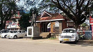
Aruppukottai is a town and a municipality in Virudhunagar district in the state of Tamil Nadu, India. Aruppukottai's classical name is "Sengattu Aravakotai". Aruppukottai is about 50 km from Madurai. It is in the middle of Madurai-Tuticorin National Highways NH-38. The villages and towns surrounding Aruppukottai makes this as a major town as well as a major transit hub and they are also famous for production of jasmine. Aruppukottai is always famous for producing yarn. Sri Ramana Maharishi was born in Tiruchuli near Aruppukottai town. Aruppukottai was part of king Sethupathi of Ramnad. King Sethupathi has Zamin Palace in Palyampatti. As of 2011, the town had a population of 87,722. The town also hosts two famous temples – Arulmigu Meenakshi Chokkanatha Swamy Temple built in 13th century by Pandiya King Maravarma Sundarapandiyan and Seenivasa Perumal Temple Built on the top of Malai arasan Hill.

Dharmapuri is a city in the north western part of Tamil Nadu, India. It serves as the administrative headquarters of Dharmapuri district which is the first district created in Tamil Nadu after the independence of India by splitting it from then Salem district on 2 October 1965. The city is located 50 km from Krishnagiri, 69 km from Salem, 60 km from Tirupattur, 90 km from Hosur, 117 km from Thiruvannamalai, 126 km from Bangalore and Erode, 181 km from Tiruppur, 200 km from Coimbatore and Tiruchirappalli, 300 km from Madurai and the state capital Chennai. It is located between latitudes N 11 47’ and 12 33’ and longitudes E 77 02’ and 78 40’. It is one of the major leading cultivators and producers of mangoes in the state along with Krishnagiri, and is often referred as Mango Capital of India.

Perambalur is one of the 38 districts in the state of Tamil Nadu, India. The district headquarters is located at Perambalur. The district occupies an area of 1,752 km2 and had a population of 565,223 with a sex-ratio of 1,003 females for every 1,000 males in 2011.

Vellore district is one of the 38 districts in the Tamil Nadu state of India. It is one of the eleven districts that form the north region of Tamil Nadu. Vellore city is the headquarters of this district. As of 2011, the district had a population of 1,614,242 with a sex ratio of 1,007 females for every 1,000 males. In 2017 Vellore district ranked eleventh in list of districts in Tamil Nadu by Human Development Index.
Adoor is a municipality in the Pathanamthitta district of Kerala, India. It is the headquarters of the Adoor Taluk and Adoor Revenue Division. Adoor is located 13.2 km (8.2 mi) southwest of the district headquarters Pathanamthitta and 78.1 km (48.5 mi) north of the state capital Thiruvananthapuram.

Tiruchirappalli District is one of the 38 districts, located along the Kaveri River, in Tamil Nadu, India. The headquarters of the district is the city of Tiruchirappalli.
Karur District is one of the 38 districts in the Indian state of Tamil Nadu. The main town in Karur District is the city of Karur, which is also the district headquarters. The district has a population of 1,064,493 with a sex-ratio of 1,015 females for every 1,000 males, according to 2011 census.

Lalgudi is a town in Tiruchirapalli district in the Indian state of Tamil Nadu. The town of Lalgudi heads the Lalgudi taluk, Lalgudi division, Lalgudi Educational District, Lalgudi DSP and Lalgudi Constituency.
Pullambadi is a Panchayat town in Tiruchirappalli district in the Indian state of Tamil Nadu. Pullambadi town panchayat heads the revenue block of Pullambadi in the taluk of Lalgudi.

Sangagiri is a panchayat town in Salem district in the Indian state of Tamil Nadu. It is situated on the National Highway 544, on the Coimbatore - Salem section.
Tindivanam is a town and a municipality in Viluppuram district in the Indian state of Tamil Nadu. It is the second largest town in Villupuram District after the headquarters town Villupuram. Important roads from north to south Tamil Nadu pass through Tindivanam and similarly from west to east.

Sendamangalam also known as Senthamangalam Taluka is a Town and Municipality in the Indian state of Tamil Nadu is situated in Namakkal District.

Viluppuram, Villupuram, or Vizhuppuram is a Municipality and the administrative headquarters of Viluppuram district.
Konalai is a village in Manachanallur Taluk, Tiruchirappalli District, in the Indian state of Tamil Nadu. It is 67 meters above sea level with good road connections amidst a network of rivers and waterways north of the Kolladam River. The state capital of Chennai is 331 km northeast with the district headquarters of Tiruchirappalli 22 km to the south and Manachanallur Taluk 14 km southwest. The nearest major railway station to Konalai is in Tiruchirappalli.
Lalgudi block is a revenue block in the Tiruchirappalli district of Tamil Nadu, India. It has a total of 45 panchayat villages. Lalgudi block is one of the two revenue blocks in the taluk of Lalgudi, the other one is Pullambadi revenue block. Lalgudi union office is in the small town of Puvallur just 2 km from Lalgudi. Most area of this block are fertile wet lands. very few areas are dry lands. Kothari sugars and chemicals pvt ltd. Kattur is present in this block.
Lalgudi division is a revenue division in the Tiruchirapalli district of Tamil Nadu, India. It comprises the taluks of Manachanallur and Lalgudi. Town of lalgudi is the headquarters of lalgudi revenue division. It is the one of three revenue divisions in the district of Tiruchirapalli.
Ulundurpettai or Ulundurpet is a municipality in Ulundurpet taluka of Kallakurichi district of Tamil Nadu, India. It is at the intersection of NH 68 and NH 45 located 205 km from Chennai and 129 km from Tiruchirappalli. Ulundurpettai itself is a Constituency for Tamil Nadu State Assembly, and is the Taluk headquarters for Ulundurpet taluka in the eastern region of Kallakurichi district, and is in Ulundurpet revenue block.
Dharmanathapuram is a village near Lalgudi in Tiruchirapalli district in the Indian state of Tamil Nadu. It heads the revenue village of Neikuppai south. The village of Dharmanathapuram is surrounded by fertile wet lands. The village had the population of 200 in 2001.
Sendamangalam is a Taluk in the Indian state of Tamil Nadu is situated in Namakkal District.
Venkatachalapuram is a small village situated in Theni District, Tamil Nadu, India and with direct road connectivity to Theni and Odaipatti. The district headquarters, Theni, is situated 11 kilometres (6.8 mi) north of this village.

