List of districts of the Andaman and Nicobar Islands

Last updated

Districts of Andaman and Nicobar Islands
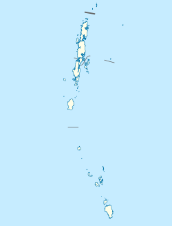
India Andaman and Nicobar Islands location map.svg
Districts of Andaman and Nicobar Islands
Category Districts
Location Andaman and Nicobar Islands
Number3 districts
Populations Nicobar – 36,819 (lowest); South Andaman – 237,586 (highest)
Areas Nicobar – 1,841 km2 (711 sq mi) (smallest); North and Middle Andaman –3,227 km2 (1,246 sq mi) (largest)
Government
Subdivisions

Districts

Currently, the Union Territory of Andaman and Nicobar Islands comprises 3 districts:

Contents

Code [1] Official nameHeadquartersSub
divisions
TalukasPopulation [2] Area
(in sq.km)
Density
(per sq.km) [2]
Map
NI Nicobar Malacca 3736,8191,84120
NA North and Middle Andaman Mayabunder 23105,5393,22732
SA South Andaman Sri Vijaya Puram 35237,5863,18180

History

On 1 August 1974 Nicobar district was separated from Andaman district. On 18 August 2006, Andaman district was bifurcated into two districts: North and Middle Andaman district and South Andaman district.

Related Research Articles

Nicobar district is one of three districts in the Indian union territory of the Andaman and Nicobar Islands. The district's administrative territory encompasses all of the Nicobar Islands, which are located in the Indian Ocean, between the Bay of Bengal and the Andaman Sea. The headquarters of the district is the village of Malacca, located on the island of Car Nicobar.

Interview Island is an island of the Andaman Islands. It belongs to the North and Middle Andaman administrative district, part of the Indian union territory of Andaman and Nicobar Islands. It lies 125 km (78 mi) north of Port Blair.

Patisang is a village in the Nicobar district of Andaman and Nicobar Islands, India. It is located in the Great Nicobar tehsil.

Lanaya is a village in the Nicobar district of Andaman and Nicobar Islands, India. It is located in the Great Nicobar tehsil.

Alhiat is a village in the Nicobar district of Andaman and Nicobar Islands, India. It is located in the Nancowry tehsil, on the Chowra island.

Vikas Nagar is a village in the Nicobar district of Andaman and Nicobar Islands, India. It is located in the Nancowry tehsil. It is populated by people from the former Trinket village, which was evacuated after the 2004 Indian Ocean earthquake and tsunami.

Changua, also known as Changup, is a village in the Nicobar district of Andaman and Nicobar Islands, India. It is located in the Nancowry tehsil.

Chanel, also known as Chanol, is a village in the Nicobar district of Andaman and Nicobar Islands, India. It is located in the Nancowry tehsil.

Daring is a village in the Nicobar district of Andaman and Nicobar Islands, India. It is located in the Nancowry tehsil.

Pulomilo is an island in the Nicobar district of Andaman and Nicobar Islands, India, and is home to a village of the same name. It is located just north of Little Nicobar Island.

Luxi is a village in the Nicobar district of Andaman and Nicobar Islands, India. It is located in the Nancowry tehsil.

<span class="mw-page-title-main">Alexandera River</span> Village in Andaman and Nicobar Islands, India

Alexandera River is a village in the Nicobar district of Andaman and Nicobar Islands, India. It is located in the Great Nicobar tehsil.

Chingen is a village in the Nicobar district of Andaman and Nicobar Islands, India. It is located in the Great Nicobar tehsil.

Kokeon is a village in the Nicobar district of Andaman and Nicobar Islands, India. It is located in the Great Nicobar tehsil.

Govinda Nagar is a village in the Nicobar district of Andaman and Nicobar Islands, India. It is located in the Great Nicobar tehsil. It was developed as a tsunami shelter to house people displaced by the 2004 Indian Ocean earthquake and tsunami.

Gandhi Nagar is a village in the Nicobar district of Andaman and Nicobar Islands, India. It is located in the Great Nicobar tehsil.

East Island is an island of the Andaman Islands. It belongs to the North and Middle Andaman administrative district, part of the Indian union territory of Andaman and Nicobar Islands. The island is located 220 km (137 mi) north from Port Blair.

Curlew Island is an island of the Andaman Islands. It belongs to the North and Middle Andaman administrative district, part of the Indian union territory of Andaman and Nicobar Islands. The island lies 150 km (93 mi) north of Port Blair.

Stewart Island is an island of the Andaman Islands. It belongs to the North and Middle Andaman administrative district, part of the Indian union territory of Andaman and Nicobar Islands. The island lies 150 km (93 mi) north of Port Blair. Its population only consists of two people.

Aves Island is an island of the Andaman Islands. It belongs to the North and Middle Andaman administrative district, part of the Indian union territory of Andaman and Nicobar Islands. The island lies 140 km (87 mi) north from Port Blair.

References

  1. "NIC Policy on format of e-mail Address: Appendix (2): Districts Abbreviations as per ISO 3166–2" (PDF). Ministry Of Communications and Information Technology, Government of India. 18 August 2004. pp. 5–10. Archived from the original (PDF) on 11 September 2008. Retrieved 24 November 2008.
  2. 1 2 "Indian Districts by Population, Growth Rate, Sex Ratio 2011 Census". 2011 census of India . Retrieved 27 December 2012.