Malacca, Car Nicobar

Last updated

Malacca

U-rèk-ka
Village
India Andaman and Nicobar Islands location map.svg
Red pog.svg
Malacca
Location in Andaman and Nicobar Islands, India
India location map.svg
Red pog.svg
Malacca
Malacca (India)
Coordinates: 9°10′14″N92°49′08″E / 9.170610°N 92.818755°E / 9.170610; 92.818755 Coordinates: 9°10′14″N92°49′08″E / 9.170610°N 92.818755°E / 9.170610; 92.818755
CountryFlag of India.svg  India
Union Territory Andaman and Nicobar Administration Banner.png Andaman and Nicobar Islands
District Nicobar
Tehsil Car Nicobar
Population
 (2011)
  Total1,637
Time zone UTC+5:30 (IST)
Census code645019

Malacca is a village in the Nicobar district of Andaman and Nicobar Islands, India. [1] It is located in the Car Nicobar tehsil, near the Car Nicobar Air Force Base.

Demographics

According to the 2011 census of India, Malacca has 368 households. The effective literacy rate (i.e. the literacy rate of population excluding children aged 6 and below) is 77.9%. [2]

Demographics (2011 Census) [2]
TotalMaleFemale
Population1637928709
Children aged below 6 years1357560
Scheduled caste 000
Scheduled tribe 1362704658
Literates1170715455
Workers (all)807583224
Main workers (total)38032357
Main workers: Cultivators000
Main workers: Agricultural labourers000
Main workers: Household industry workers651
Main workers: Other37431856
Marginal workers (total)427260167
Marginal workers: Cultivators11110
Marginal workers: Agricultural labourers220
Marginal workers: Household industry workers1095455
Marginal workers: Others305203102
Non-workers830345485

Related Research Articles

Car Nicobar One of the Nicobar Islands

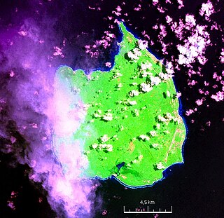
Car Nicobar is the northernmost of the Nicobar Islands. It is also one of three local administrative divisions of the Indian district of Nicobar, part of the Indian union territory of Andaman and Nicobar Islands.

Campbell Bay (Great Nicobar) village in Andaman and Nicobar Islands, India

Campbell Bay is a village in the Nicobar district of Andaman and Nicobar Islands, India. It is located in the Great Nicobar tehsil. The island's Indira Point is famous for being the southernmost point of India.

Kakana, Car Nicobar village in Andaman and Nicobar Islands, India

Kakana is a village in the Nicobar district of Andaman and Nicobar Islands, India. It is located in the Car Nicobar tehsil.

Mus, Car Nicobar village in Andaman and Nicobar Islands, India

Mus is a village in the Nicobar district of Andaman and Nicobar Islands, India. It is located in the Car Nicobar tehsil.

Teetop village in Andaman and Nicobar Islands, India

Teetop is a village in the Nicobar district of Andaman and Nicobar Islands, India. It is located in the Car Nicobar tehsil.

Tapoiming village in Andaman and Nicobar Islands, India

Tapoiming is a village in the Nicobar district of Andaman and Nicobar Islands, India. It is located in the Car Nicobar tehsil.

Arong, Car Nicobar village in Andaman and Nicobar Islands, India

Arong is a village in the Nicobar district of Andaman and Nicobar Islands, India. It is located in the Car Nicobar tehsil.

Kinyuka village in Andaman and Nicobar Islands, India

Kinyuka is a village in the Nicobar district of Andaman and Nicobar Islands, India. It is located in the Car Nicobar tehsil.

Big Lapati village in Andaman and Nicobar Islands, India

Big Lapati is a village in the Nicobar district of Andaman and Nicobar Islands, India. It is located in the Car Nicobar tehsil, near Small Lapati.

Tamaloo village in Andaman and Nicobar Islands, India

Tamaloo is a village in the Nicobar district of Andaman and Nicobar Islands, India. It is located in the Car Nicobar tehsil.

Kimois village in Andaman and Nicobar Islands, India

Kimois is a village in the Nicobar district of Andaman and Nicobar Islands, India. It is located in the Car Nicobar tehsil.

Perka, Car Nicobar village in Andaman and Nicobar Islands, India

Perka is a village in the Nicobar district of Andaman and Nicobar Islands, India. It is located in the Car Nicobar tehsil.

Mildera is a village in the Nicobar district of Andaman and Nicobar Islands, India. It is located in the Nancowry tehsil, on the Katchal Island.

Itoi (Hitui) village in Andaman and Nicobar Islands, India

Itoi is a village in the Nicobar district of Andaman and Nicobar Islands, India. It is located in the Nancowry tehsil.

Malacca, Nancowry village in Andaman and Nicobar Islands, India

Malacca is a village in the Nicobar district of Andaman and Nicobar Islands, India. It is located in the Nancowry tehsil.

Kinmai village in Andaman and Nicobar Islands, India

Kinmai is a village in the Nicobar district of Andaman and Nicobar Islands, India. It is located in the Car Nicobar tehsil.

Small Lapati village in Andaman and Nicobar Islands, India

Small Lapati is a village in the Nicobar district of Andaman and Nicobar Islands, India. It is located in the Car Nicobar tehsil, near Big Lapati.

Chuckchucha village in Andaman and Nicobar Islands, India

Chuckchucha is a village in the Nicobar district of Andaman and Nicobar Islands, India. It is located in the Car Nicobar tehsil. The headquarters of the island's central tribal cooperative society 'Ellon Hinengo Limited'(EHL) was established here in 1945. The society was started by the Jadwet family of Burma (Myanmar).

IAF Camp village in Andaman and Nicobar Islands, India

IAF Camp is a village in the Nicobar district of Andaman and Nicobar Islands, India. It is located in the Car Nicobar tehsil. The Car Nicobar Air Force Base is located here.

Anul village in Andaman and Nicobar Islands, India

Anul is a village in the Nicobar district of Andaman and Nicobar Islands, India. It is located in the Great Nicobar tehsil.

References

  1. "Andaman and Nicobar Islands villages" (PDF). Land Records Information Systems Division, NIC. Archived from the original (PDF) on 4 March 2016. Retrieved 25 July 2015.
  2. 1 2 "District Census Handbook - Andaman & Nicobar Islands" (PDF). 2011 Census of India . Directorate of Census Operations, Andaman & Nicobar Islands. Archived from the original (PDF) on 1 August 2015. Retrieved 21 July 2015.