Teetop

Last updated

Teetop

Rit-töp

Tee Top
village
India Andaman and Nicobar Islands location map.svg
Red pog.svg
Teetop
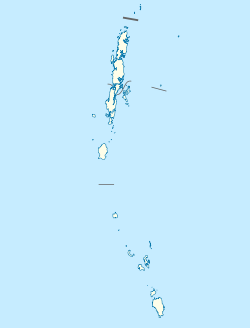
Location in Andaman and Nicobar Islands, India
India location map.svg
Red pog.svg
Teetop
Teetop (India)
Coordinates: 9°12′33″N92°44′16″E / 9.209099°N 92.737860°E / 9.209099; 92.737860 Coordinates: 9°12′33″N92°44′16″E / 9.209099°N 92.737860°E / 9.209099; 92.737860
Country India
State Andaman and Nicobar Islands
District Nicobar
Tehsil Car Nicobar
Population
(2011)
  Total522
Time zone UTC+5:30 (IST)
Census code645013

Teetop is a village in the Nicobar district of Andaman and Nicobar Islands, India. It is located in the Car Nicobar tehsil. [1]

Nicobar district district of the Andaman and Nicobar Islands, India

Nicobar district is one of three districts in the Indian Union Territory (UT) of Andaman and Nicobar Islands. The district's administrative territory encompasses all of the Nicobar Islands, which are located in the Indian Ocean. The headquarters of the district is located on the island of Car Nicobar.

Andaman and Nicobar Islands Southeast Union Territory of India

The Andaman and Nicobar Islands, one of the seven union territories of India comprising 572 islands of which 37 are inhabited, are a group of islands at the juncture of the Bay of Bengal and Andaman Sea.

India Country in South Asia

India, also known as the Republic of India, is a country in South Asia. It is the seventh largest country by area and with more than 1.3 billion people, it is the second most populous country and the most populous democracy in the world. Bounded by the Indian Ocean on the south, the Arabian Sea on the southwest, and the Bay of Bengal on the southeast, it shares land borders with Pakistan to the west; China, Nepal, and Bhutan to the northeast; and Bangladesh and Myanmar to the east. In the Indian Ocean, India is in the vicinity of Sri Lanka and the Maldives, while its Andaman and Nicobar Islands share a maritime border with Thailand and Indonesia.

Demographics

According to the 2011 census of India, Teetop has 135 households. The effective literacy rate (i.e. the literacy rate of population excluding children aged 6 and below) is 90.83%. [2]

Demographics (2011 Census) [2]
TotalMaleFemale
Population522264258
Children aged below 6 years643232
Scheduled caste 000
Scheduled tribe 518262256
Literates416223193
Workers (all)354175179
Main workers (total)296147149
Main workers: Cultivators101
Main workers: Agricultural labourers000
Main workers: Household industry workers235103132
Main workers: Other604416
Marginal workers (total)582830
Marginal workers: Cultivators000
Marginal workers: Agricultural labourers000
Marginal workers: Household industry workers532627
Marginal workers: Others523
Non-workers1688979

Related Research Articles

Kakana, Nancowry village in Andaman and Nicobar Islands, India

Kakana is a village in the Nicobar district of Andaman and Nicobar Islands, India. It is located in the Nancowry tehsil.

Tapoiming village in Andaman and Nicobar Islands, India

Tapoiming is a village in the Nicobar district of Andaman and Nicobar Islands, India. It is located in the Car Nicobar tehsil.

Patisang is a village in the Nicobar district of Andaman and Nicobar Islands, India. It is located in the Great Nicobar tehsil.
Lanaya is a village in the Nicobar district of Andaman and Nicobar Islands, India. It is located in the Great Nicobar tehsil.

Sawai, Car Nicobar village in Andaman and Nicobar Islands, India

Sawai is a village in the Nicobar district of Andaman and Nicobar Islands, India. It is located in the Car Nicobar tehsil.

Arong, Car Nicobar village in Andaman and Nicobar Islands, India

Arong is a village in the Nicobar district of Andaman and Nicobar Islands, India. It is located in the Car Nicobar tehsil.

Aloorang village in Andaman and Nicobar Islands, India

Aloorang is a village in the Nicobar district of Andaman and Nicobar Islands, India. It is located in the Nancowry tehsil.

Bengali, Nancowry village in Andaman and Nicobar Islands, India

Bengali is a village in the Nicobar district of Andaman and Nicobar Islands, India. It is located in the Nancowry tehsil.

Kalasi village in Andaman and Nicobar Islands, India

Kalasi is a village in the Nicobar district of Andaman and Nicobar Islands, India. It is located in the Nancowry tehsil.

Kimois village in Andaman and Nicobar Islands, India

Kimois is a village in the Nicobar district of Andaman and Nicobar Islands, India. It is located in the Car Nicobar tehsil.

Altheak is a village in the Nicobar district of Andaman and Nicobar Islands, India. It is located in the Nancowry tehsil.

Pulloullo village in Andaman and Nicobar Islands, India

Pulloullo is a village in the Nicobar district of Andaman and Nicobar Islands, India. It is located on the Little Nicobar Island, and is administered as part of the Great Nicobar tehsil.

Chukmachi village in Andaman and Nicobar Islands, India

Chukmachi is a village in the Nicobar district of Andaman and Nicobar Islands, India. It is located in the Nancowry tehsil.

Hinnunga is a village in the Nicobar district of Andaman and Nicobar Islands, India. It is located in the Nancowry tehsil.

Perka, Car Nicobar village in Andaman and Nicobar Islands, India

Perka is a village in the Nicobar district of Andaman and Nicobar Islands, India. It is located in the Car Nicobar tehsil.

Daring, Nancowry village in Andaman and Nicobar Islands, India

Daring is a village in the Nicobar district of Andaman and Nicobar Islands, India. It is located in the Nancowry tehsil.

Itoi (Hitui) village in Andaman and Nicobar Islands, India

Itoi is a village in the Nicobar district of Andaman and Nicobar Islands, India. It is located in the Nancowry tehsil.

Enam, Nancowry village in Andaman and Nicobar Islands, India

Enam is a village in the Nicobar district of Andaman and Nicobar Islands, India. It is located in the Nancowry tehsil.

Small Lapati village in Andaman and Nicobar Islands, India

Small Lapati is a village in the Nicobar district of Andaman and Nicobar Islands, India. It is located in the Car Nicobar tehsil, near Big Lapati.

Bewai/Kuwak is a village in the Nicobar district of Andaman and Nicobar Islands, India. It is located in the Great Nicobar tehsil.

References

  1. "Andaman and Nicobar Islands villages" (PDF). Land Records Information Systems Division, NIC. Archived from the original (PDF) on 2016-03-04. Retrieved 2015-07-25.
  2. 1 2 "District Census Handbook - Andaman & Nicobar Islands" (PDF). 2011 Census of India . Directorate of Census Operations, Andaman & Nicobar Islands. Retrieved 2015-07-21.