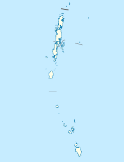
Indira Point, the southernmost point of India's territory, is a village in the Nicobar district at Great Nicobar Island of Andaman and Nicobar Islands in India. It is located in the Great Nicobar tehsil.
Landfall Island is the northernmost island of the Indian union territory of Andaman and Nicobar Islands. It belongs to the territory's North and Middle Andaman administrative district. The island lies 220 km (137 mi) north of Port Blair, and is situated 300 km (186 mi) south of Myanmar. It is home to the Kari tribe.
Lanaya is a village in the Nicobar district of Andaman and Nicobar Islands, India. It is located in the Great Nicobar tehsil.
Trinket Bay is a village in the Nicobar district of Andaman and Nicobar Islands, India. It is located in the Great Nicobar tehsil. It is located between Lawful and Afra on Great Nicobar island.
Alhiat is a village in the Nicobar district of Andaman and Nicobar Islands, India. It is located in the Nancowry tehsil, on the Chowra island.
Kinyuka is a village in the Nicobar district of Andaman and Nicobar Islands, India. It is located in the Car Nicobar tehsil.
Kimois is a village in the Nicobar district of Andaman and Nicobar Islands, India. It is located in the Car Nicobar tehsil.
Kanahinot is a village in the Nicobar district of Andaman and Nicobar Islands, India. It is located in the Nancowry tehsil.
Hinnunga is a village in the Nicobar district of Andaman and Nicobar Islands, India. It is located in the Nancowry tehsil.

Lawful or Laful is a village in the Nicobar district of Andaman and Nicobar Islands, India. It is located in the Great Nicobar tehsil.
Japan Tikri is a village in the Nicobar district of Andaman and Nicobar Islands, India. It is located in the Nancowry tehsil, on the Katchal Island.
Katahu is a village in the Nicobar district of Andaman and Nicobar Islands, India. It is located in the Great Nicobar tehsil.
Itoi is a village in the Nicobar district of Andaman and Nicobar Islands, India. It is located in the Nancowry tehsil.
Enam is a village in the Nicobar district of Andaman and Nicobar Islands, India. It is located in the Nancowry tehsil.
Chongkamong is a village in the Nicobar district of Andaman and Nicobar Islands, India. It is located in the Nancowry tehsil, on the Chowra island.

Alexandera River is a village in the Nicobar district of Andaman and Nicobar Islands, India. It is located in the Great Nicobar tehsil.
Makachua is a village in the Nicobar district of Andaman and Nicobar Islands, India. It is located in the Great Nicobar tehsil.
Hintona is a village in the Nicobar district of Andaman and Nicobar Islands, India. It is located in the Nancowry tehsil.
Gandhi Nagar is a village in the Nicobar district of Andaman and Nicobar Islands, India. It is located in the Great Nicobar tehsil.
East Island is an island of the Andaman Islands. It belongs to the North and Middle Andaman administrative district, part of the Indian union territory of Andaman and Nicobar Islands. The island is located 220 km (137 mi) north from Port Blair.


