IAF Camp

Last updated

IAF Camp
village
India Andaman and Nicobar Islands location map.svg
Red pog.svg
IAF Camp
Location in Andaman and Nicobar Islands, India
India location map.svg
Red pog.svg
IAF Camp
IAF Camp (India)
Coordinates: 9°09′13″N92°49′28″E / 9.153547°N 92.824377°E / 9.153547; 92.824377 Coordinates: 9°09′13″N92°49′28″E / 9.153547°N 92.824377°E / 9.153547; 92.824377
Country India
State Andaman and Nicobar Islands
District Nicobar
Tehsil Car Nicobar
Population
 (2011)
  Total731
Time zone UTC+5:30 (IST)
Census code645018

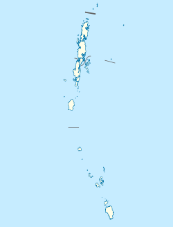
IAF Camp (short for Indian Air Force Camp) is a village in the Nicobar district of Andaman and Nicobar Islands, India. It is located in the Car Nicobar tehsil. [1] The Car Nicobar Air Force Base is located here.
Indian Air Force Air warfare branch of Indias military

The Indian Air Force (IAF) is the air arm of the Indian Armed Forces. Its complement of personnel and aircraft assets ranks fourth amongst the air forces of the world. Its primary mission is to secure Indian airspace and to conduct aerial warfare during armed conflict. It was officially established on 8 October 1932 as an auxiliary air force of the British Empire which honoured India's aviation service during World War II with the prefix Royal. After India gained independence from the United Kingdom in 1947, the name Royal Indian Air Force was kept and served in the name of Dominion of India. With the government's transition to a Republic in 1950, the prefix Royal was removed after only three years.

Nicobar district district of India in Andaman and Nicobar Islands

Nicobar district is one of three districts in the Indian union territory of Andaman and Nicobar Islands. The district's administrative territory encompasses all of the Nicobar Islands, which are located in the Indian Ocean, between the Bay of Bengal and the Andaman Sea. The headquarters of the district is the village of Malacca, located on the island of Car Nicobar.

Andaman and Nicobar Islands Southeast Union Territory of India

The Andaman and Nicobar Islands, is a Union territory of India comprising 572 islands of which 37 are inhabited, are a group of islands at the juncture of the Bay of Bengal and Andaman Sea.

Demographics

According to the 2011 census of India, IAF Camp has 31 households. The effective literacy rate (i.e. the literacy rate of population excluding children aged 6 and below) is 100%. [2]

Demographics (2011 Census) [2]
TotalMaleFemale
Population7317238
Children aged below 6 years202
Scheduled caste 000
Scheduled tribe 000
Literates7297236
Workers (all)7247231
Main workers (total)7187171
Main workers: Cultivators19190
Main workers: Agricultural labourers000
Main workers: Household industry workers000
Main workers: Other6996981
Marginal workers (total)660
Marginal workers: Cultivators220
Marginal workers: Agricultural labourers000
Marginal workers: Household industry workers000
Marginal workers: Others440
Non-workers707

Related Research Articles

Car Nicobar island

Car Nicobar is the northernmost of the Nicobar Islands. It is also one of three local administrative divisions of the Indian district of Nicobar, part of the Indian union territory of Andaman and Nicobar Islands.

Kakana, Car Nicobar village in Andaman and Nicobar Islands, India

Kakana is a village in the Nicobar district of Andaman and Nicobar Islands, India. It is located in the Car Nicobar tehsil.

Teetop village in Andaman and Nicobar Islands, India

Teetop is a village in the Nicobar district of Andaman and Nicobar Islands, India. It is located in the Car Nicobar tehsil.

Tapoiming village in Andaman and Nicobar Islands, India

Tapoiming is a village in the Nicobar district of Andaman and Nicobar Islands, India. It is located in the Car Nicobar tehsil.

Trinkat Bay is a village in the Nicobar district of Andaman and Nicobar Islands, India. It is located in the Great Nicobar tehsil. It is located between Lawful and Afra on Great Nicobar island.

Arong, Car Nicobar village in Andaman and Nicobar Islands, India

Arong is a village in the Nicobar district of Andaman and Nicobar Islands, India. It is located in the Car Nicobar tehsil.

Kinyuka village in Andaman and Nicobar Islands, India

Kinyuka is a village in the Nicobar district of Andaman and Nicobar Islands, India. It is located in the Car Nicobar tehsil.

Big Lapati village in Andaman and Nicobar Islands, India

Big Lapati is a village in the Nicobar district of Andaman and Nicobar Islands, India. It is located in the Car Nicobar tehsil, near Small Lapati.

Tamaloo village in Andaman and Nicobar Islands, India

Tamaloo is a village in the Nicobar district of Andaman and Nicobar Islands, India. It is located in the Car Nicobar tehsil.

Kalasi village in Andaman and Nicobar Islands, India

Kalasi is a village in the Nicobar district of Andaman and Nicobar Islands, India. It is located in the Nancowry tehsil.

Kimois village in Andaman and Nicobar Islands, India

Kimois is a village in the Nicobar district of Andaman and Nicobar Islands, India. It is located in the Car Nicobar tehsil.

Hinnunga is a village in the Nicobar district of Andaman and Nicobar Islands, India. It is located in the Nancowry tehsil.

Daring, Nancowry village in Andaman and Nicobar Islands, India

Daring is a village in the Nicobar district of Andaman and Nicobar Islands, India. It is located in the Nancowry tehsil.

Itoi (Hitui) village in Andaman and Nicobar Islands, India

Itoi is a village in the Nicobar district of Andaman and Nicobar Islands, India. It is located in the Nancowry tehsil.

Kinmai village in Andaman and Nicobar Islands, India

Kinmai is a village in the Nicobar district of Andaman and Nicobar Islands, India. It is located in the Car Nicobar tehsil.

Small Lapati village in Andaman and Nicobar Islands, India

Small Lapati is a village in the Nicobar district of Andaman and Nicobar Islands, India. It is located in the Car Nicobar tehsil, near Big Lapati.

Chuckchucha village in Andaman and Nicobar Islands, India

Chuckchucha is a village in the Nicobar district of Andaman and Nicobar Islands, India. It is located in the Car Nicobar tehsil. The headquarters of the island's central tribal cooperative society 'Ellon Hinengo Limited'(EHL) was established here in 1945. The society was started by the Jadwet family of Burma (Myanmar).

Malacca, Car Nicobar Village in Andaman and Nicobar Islands, India

Malacca is a village in the Nicobar district of Andaman and Nicobar Islands, India. It is located in the Car Nicobar tehsil, near the Car Nicobar Air Force Base.

Joginder Nagar, Great Nicobar village in Andaman and Nicobar Islands, India

Joginder Nagar is a village in the Nicobar district of Andaman and Nicobar Islands, India. It is located in the Great Nicobar tehsil.

Laxmi Nagar, Great Nicobar village in Andaman and Nicobar Islands, India

Laxmi Nagar is a village in the Nicobar district of Andaman and Nicobar Islands, India. It is located in the Great Nicobar tehsil. It is the location of India's southernmost land tip, Indira Point.

References

  1. "Andaman and Nicobar Islands villages" (PDF). Land Records Information Systems Division, NIC. Archived from the original (PDF) on 4 March 2016. Retrieved 25 July 2015.
  2. 1 2 "District Census Handbook - Andaman & Nicobar Islands" (PDF). 2011 Census of India . Directorate of Census Operations, Andaman & Nicobar Islands. Archived from the original (PDF) on 1 August 2015. Retrieved 21 July 2015.