Luxi, Nancowry

Last updated

Luxi
village
India Andaman and Nicobar Islands location map.svg
Red pog.svg
Luxi
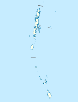
Location in Andaman and Nicobar Islands, India
India location map.svg
Red pog.svg
Luxi
Luxi (India)
Coordinates: 8°13′26″N93°08′44″E / 8.223768°N 93.145636°E / 8.223768; 93.145636 Coordinates: 8°13′26″N93°08′44″E / 8.223768°N 93.145636°E / 8.223768; 93.145636
Country India
State Andaman and Nicobar Islands
District Nicobar
Tehsil Nancowry
Population
 (2011)
  Total149
Time zone UTC+5:30 (IST)
Census code645037

Luxi is a village in the Nicobar district of Andaman and Nicobar Islands, India. It is located in the Nancowry tehsil. [1]

Nicobar district district of India in Andaman and Nicobar Islands

Nicobar district is one of three districts in the Indian union territory of Andaman and Nicobar Islands. The district's administrative territory encompasses all of the Nicobar Islands, which are located in the Indian Ocean, between the Bay of Bengal and the Andaman Sea. The headquarters of the district is the village of Malacca, located on the island of Car Nicobar.

Andaman and Nicobar Islands Southeast Union Territory of India

The Andaman and Nicobar Islands, is a Union territory of India comprising 572 islands of which 37 are inhabited, are a group of islands at the juncture of the Bay of Bengal and Andaman Sea.

India Country in South Asia

India is a country in South Asia. It is the seventh-largest country by area, the second-most populous country, and the most populous democracy in the world. Bounded by the Indian Ocean on the south, the Arabian Sea on the southwest, and the Bay of Bengal on the southeast, it shares land borders with Pakistan to the west; China, Nepal, and Bhutan to the north; and Bangladesh and Myanmar to the east. In the Indian Ocean, India is in the vicinity of Sri Lanka and the Maldives; its Andaman and Nicobar Islands share a maritime border with Thailand and Indonesia.
Demographics

According to the 2011 census of India, Luxi has 39 households. The effective literacy rate (i.e. the literacy rate of population excluding children aged 6 and below) is 67.21%. [2]

Demographics (2011 Census) [2]
TotalMaleFemale
Population1498663
Children aged below 6 years271413
Scheduled caste 000
Scheduled tribe 1428161
Literates825527
Workers (all)36342
Main workers (total)532
Main workers: Cultivators000
Main workers: Agricultural labourers110
Main workers: Household industry workers000
Main workers: Other422
Marginal workers (total)31310
Marginal workers: Cultivators000
Marginal workers: Agricultural labourers000
Marginal workers: Household industry workers000
Marginal workers: Others31310
Non-workers1135261

Related Research Articles

Kakana, Nancowry village in Andaman and Nicobar Islands, India

Kakana is a village in the Nicobar district of Andaman and Nicobar Islands, India. It is located in the Nancowry tehsil.

Teetop village in Andaman and Nicobar Islands, India

Teetop is a village in the Nicobar district of Andaman and Nicobar Islands, India. It is located in the Car Nicobar tehsil.

Tapoiming village in Andaman and Nicobar Islands, India

Tapoiming is a village in the Nicobar district of Andaman and Nicobar Islands, India. It is located in the Car Nicobar tehsil.

Trinkat Bay is a village in the Nicobar district of Andaman and Nicobar Islands, India. It is located in the Great Nicobar tehsil. It is located between Lawful and Afra on Great Nicobar island.

Alhiat is a village in the Nicobar district of Andaman and Nicobar Islands, India. It is located in the Nancowry tehsil, on the Chowra island.

Aloorang village in Andaman and Nicobar Islands, India

Aloorang is a village in the Nicobar district of Andaman and Nicobar Islands, India. It is located in the Nancowry tehsil.

Bengali, Nancowry village in Andaman and Nicobar Islands, India

Bengali is a village in the Nicobar district of Andaman and Nicobar Islands, India. It is located in the Nancowry tehsil.

Kalasi village in Andaman and Nicobar Islands, India

Kalasi is a village in the Nicobar district of Andaman and Nicobar Islands, India. It is located in the Nancowry tehsil.

Altheak is a village in the Nicobar district of Andaman and Nicobar Islands, India. It is located in the Nancowry tehsil.

Kanahinot is a village in the Nicobar district of Andaman and Nicobar Islands, India. It is located in the Nancowry tehsil.

Chukmachi village in Andaman and Nicobar Islands, India

Chukmachi is a village in the Nicobar district of Andaman and Nicobar Islands, India. It is located in the Nancowry tehsil.

Hinnunga is a village in the Nicobar district of Andaman and Nicobar Islands, India. It is located in the Nancowry tehsil.

Minyuk village in Andaman and Nicobar Islands, India

Minyuk is a village in the Nicobar district of Andaman and Nicobar Islands, India. It is located in the Nancowry tehsil.

Daring, Nancowry village in Andaman and Nicobar Islands, India

Daring is a village in the Nicobar district of Andaman and Nicobar Islands, India. It is located in the Nancowry tehsil.

Itoi (Hitui) village in Andaman and Nicobar Islands, India

Itoi is a village in the Nicobar district of Andaman and Nicobar Islands, India. It is located in the Nancowry tehsil.

Malacca, Nancowry village in Andaman and Nicobar Islands, India

Malacca is a village in the Nicobar district of Andaman and Nicobar Islands, India. It is located in the Nancowry tehsil.

Upper Katchal village in Andaman and Nicobar Islands, India

Upper Katchal is a village in the Nicobar district of Andaman and Nicobar Islands, India. It is located in the Nancowry tehsil, on the Katchal Island.

Enam, Nancowry village in Andaman and Nicobar Islands, India

Enam is a village in the Nicobar district of Andaman and Nicobar Islands, India. It is located in the Nancowry tehsil.

Hintona village in Andaman and Nicobar Islands, India

Hintona is a village in the Nicobar district of Andaman and Nicobar Islands, India. It is located in the Nancowry tehsil.

Alukian village in Andaman and Nicobar Islands, India

Alukian or Alhukheck is a village in the Nicobar district of Andaman and Nicobar Islands, India. It is located in the Nancowry tehsil, on the Kamorta Island.

References

  1. "Andaman and Nicobar Islands villages" (PDF). Land Records Information Systems Division, NIC. Archived from the original (PDF) on 4 March 2016. Retrieved 25 July 2015.
  2. 1 2 "District Census Handbook - Andaman & Nicobar Islands" (PDF). 2011 Census of India . Directorate of Census Operations, Andaman & Nicobar Islands. Archived from the original (PDF) on 1 August 2015. Retrieved 21 July 2015.