Ramzoo

Last updated

Ramzoo
Ramjaw, Ramjoo
village
India Andaman and Nicobar Islands location map.svg
Red pog.svg
Ramzoo
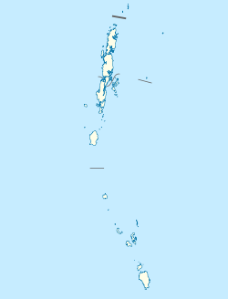
Location in Andaman and Nicobar Islands, India
India location map.svg
Red pog.svg
Ramzoo
Ramzoo (India)
Coordinates: 8°07′16″N93°28′45″E / 8.121189°N 93.479112°E / 8.121189; 93.479112 Coordinates: 8°07′16″N93°28′45″E / 8.121189°N 93.479112°E / 8.121189; 93.479112
Country India
State Andaman and Nicobar Islands
District Nicobar
Tehsil Nancowry
Population
 (2011)
  Total98
Time zone UTC+5:30 (IST)
ISO 3166 code IND
Census code645126

Ramzoo is a village in the Nicobar district of Andaman and Nicobar Islands, India. It is located in the Nancowry tehsil. [1]
Demographics

The village was severely affected by the 2004 Indian Ocean earthquake and tsunami. [2] According to the 2011 census of India, Ramzoo had 23 households. The effective literacy rate (i.e. the literacy rate of population excluding children aged 6 and below) was 77.5%. [3]

Demographics (2011 Census) [3]
TotalMaleFemale
Population984850
Children aged below 6 years18810
Scheduled caste 000
Scheduled tribe 974750
Literates623230
Workers (all)362016
Main workers (total)312
Main workers: cultivators000
Main workers: agricultural labourers101
Main workers: household industry workers000
Main workers: other211
Marginal workers (total)331914
Marginal workers: cultivators101
Marginal workers: agricultural labourers000
Marginal workers: household industry workers312
Marginal workers: others291811
Non-workers622834

Related Research Articles

Indira Point, the southernmost point of India's territory, is a village in the Nicobar district at Great Nicobar Island of Andaman and Nicobar Islands in India. It is located in the Great Nicobar tehsil.

<span class="mw-page-title-main">Pulopanja</span> Village in Andaman and Nicobar Islands, India

Pulopanja is a village in the Nicobar district of Andaman and Nicobar Islands, India. It is on the Little Nicobar Island and is administered as part of the Great Nicobar tehsil. The village suffered severe damage during the 2004 Indian Ocean earthquake and tsunami.

Trinkat Bay is a village in the Nicobar district of Andaman and Nicobar Islands, India. It is located in the Great Nicobar tehsil. It is located between Lawful and Afra on Great Nicobar island.

Al-Hit-Touch/Balu Basti is a village in the Nicobar district of Andaman and Nicobar Islands, India. It is located in the Nancowry tehsil.

Jhoola is a village in the Nicobar district of Andaman and Nicobar Islands, India. It is located in the Nancowry tehsil.

Munak is a village in the Nicobar district of Andaman and Nicobar Islands, India. It is located in the Nancowry tehsil.

Payuha is a village in the Nicobar district of Andaman and Nicobar Islands, India. It is located in the Nancowry tehsil.

Vikas Nagar is a village in the Nicobar district of Andaman and Nicobar Islands, India. It is located in the Nancowry tehsil. It is populated by people from the former Trinket village, which was evacuated after the 2004 Indian Ocean earthquake and tsunami.

Shompen Village-B is a village in the Nicobar district of the Andaman and Nicobar Islands, India. It is located in the Great Nicobar tehsil.

<span class="mw-page-title-main">Pulobha</span> Village in Andaman and Nicobar Islands, India

Pulobha is a village in the Nicobar district of Andaman and Nicobar Islands, India. It is located on the Little Nicobar Island, and is administered as part of the Great Nicobar tehsil.

Tapong is a village in the Nicobar district of Andaman and Nicobar Islands, India. It is located on the Nancowry Island, around 10 km from the Champin village, and comes under the administration of the Nancowry tehsil.

Pulomilo is an island in the Nicobar district of Andaman and Nicobar Islands, India, and home to a village of the same name. It is located just north of Little Nicobar Island.

Champin is a village in the Nicobar district of Andaman and Nicobar Islands, India. It is located on the Nancowry Island, around 10 km from the Tapong village, and comes under the administration of the Nancowry tehsil.

Makachua is a village in the Nicobar district of Andaman and Nicobar Islands, India. It is located in the Great Nicobar tehsil.

Anul is a village in the Nicobar district of Andaman and Nicobar Islands, India. It is located in the Great Nicobar tehsil.

Chingen is a village in the Nicobar district of Andaman and Nicobar Islands, India. It is located in the Great Nicobar tehsil.

Kokeon is a village in the Nicobar district of Andaman and Nicobar Islands, India. It is located in the Great Nicobar tehsil.

Shompen Village-A is a village in the Nicobar district of Andaman and Nicobar Islands, India. It is located in the Great Nicobar tehsil.

Bewai/Kuwak is a village in the Nicobar district of Andaman and Nicobar Islands, India. It is located in the Great Nicobar tehsil.

Govinda Nagar is a village in the Nicobar district of Andaman and Nicobar Islands, India. It is located in the Great Nicobar tehsil. It was developed as a tsunami shelter to house people displaced by the 2004 Indian Ocean earthquake and tsunami.

References

  1. "Andaman and Nicobar Islands villages" (PDF). Land Records Information Systems Division, NIC. Retrieved 25 July 2015.
  2. M. G. Thakkar and Bhanu Goyal, "Historic submergence and tsunami destruction of Nancowrie, Kamorta, Katchall and Trinket Islands of Nicobar district: Consequences of 26 December 2004 Sumatra–Andaman earthquake",[ dead link ]Current Science, Volume 90, No. 7. 10 April 2006.
  3. 1 2 "District Census Handbook - Andaman & Nicobar Islands" (PDF). 2011 Census of India . Directorate of Census Operations, Andaman & Nicobar Islands. Retrieved 21 July 2015.