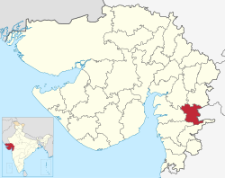
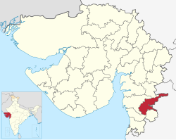
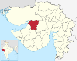
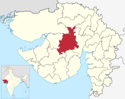
List of districts of Gujarat

Last updated

Districts of Gujarat
Administrative map of Gujarat.png
Districts of Gujarat
CategoryDistricts
Location Gujarat
Number34 districts [1]
Populations Dang – 228,291 (lowest); Ahmedabad – 7,214,225 (highest)
Areas Dang – 1,764 km2 (681 sq mi) (smallest); Kutch – 45,674 km2 (17,635 sq mi) (largest)
Government
Subdivisions

The western Indian state of Gujarat has 34 districts after several splits of the original 17 districts at the formation of the state in 1960. [2] Kutch is the largest district of Gujarat while Dang is the smallest. Ahmedabad is the most populated district while Dang is the least. There are 252 Talukas (subdivisions of districts) in Gujarat. [3] [4]

Contents

History

1960

Gujarat state was created on 1 May 1960, out of the 17 northern districts of Bombay State when that was split on a linguistic basis (also creating Marathi speaking Maharashtra).

They are as follow : Ahmedabad, Amreli, Banaskantha, Bharuch, Bhavnagar, Dang, Jamnagar, Junagadh, Kheda, Kachchh, Mehsana, Panchmahal, Rajkot, Sabarkantha, Surat, Surendranagar and Vadodara.

1964

In 1964, Gandhinagar was formed from parts of Ahmedabad and Mehsana.

1966

In 1966, Valsad was split from Surat.

1997

On 2 October 1997, five new districts were created:

2000

In 2000, Patan District was formed from parts of Banaskantha and Mehsana.

2007

On 2 October 2007, Tapi was split from Surat, as the state's 26th district.

2013

On 15 August 2013, seven new districts were created: [5]

2025

In 2025, Vav-Tharad was formed from parts of Banaskantha

The newly formed Vav-Tharad district will include a total of 8 talukas namely Vav, Bhabhar, Tharad, Dhanera, Suigam, Lakhni, Deodar and Kankrej and four municipalities namely Bhabhar, Tharad, Thara and Dhanera. The remaining 6 talukas of Banaskantha district will include a total of 6 talukas namely Palanpur, Danta, Amirgarh, Dantiwada, Vadgam and Deesa and two municipalities namely Palanpur and Deesa. (Source: Gujarati Jagran)

List of districts

S.No.DistrictHeadquartersYear of FormationArea (km2)PopulationPopulation

density (/km2)

2011

TaluksTotal VillagesMap
2001 Census [6] 2011 Census [7]
1 Ahmedabad Ahmedabad City
1960
80875,673,0907,045,313890
No.Talukas
1 Ahmedabad
2 Bavla
3 Daskroi
4 Detroj-Rampura
5 Dhandhuka
6 Dholera
7 Dholka
8 Mandal
9 Sanand
10 Viramgam
558 [8] Ahmedabad in Gujarat (India).svg
2 Amreli Amreli
1960
1,393,8801,513,614
No.Talukas
1 Amreli
2 Babra
3 Bagasara
4 Dhari
5 Jafrabad
6 Khambha
7Kunkavav vadia
8 Lathi
9Lilia
10 Rajula
11 Savarkundla
598 Amreli in Gujarat (India).svg
3 Anand Anand
1997
1,856,7122,090,276
No.Talukas
1 Anand
2 Anklav
3 Borsad
4 Khambhat
5 Petlad
6 Sojitra
7 Tarapur
8 Umreth
365 Anand in Gujarat (India).svg
4 Aravalli Modasa
2013
908,7971,039,918
No.Talukas
1Bayad
2 Bhiloda
3 Dhansura
4 Malpur
5 Meghraj
6 Modasa
682 Aravalli in Gujarat (India).svg
5 Banaskantha Palanpur
1960
4,4862,502,8433,116,045
No.Talukas
1 Amirgadh
2Danta
3Dantiwada
4 Deesa
5 Palanpur
6 Vadgam
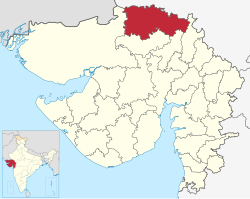
1250 Banaskantha in Gujarat (India).svg
6 Bharuch Bharuch
1960
1,370,1041,550,822
No.Talukas
1 Bharuch
2 Amod
3 Ankleshwar
4 Hansot
5 Jambusar
6 Jhagadia
7 Netrang
8Vagra
9Valia
647 Bharuch in Gujarat (India).svg
7 Bhavnagar Bhavnagar
1960
2,065,4922,393,272
No.Talukas
1 Bhavnagar
2 Gariadhar
3 Ghogha
4 Jesar
5 Mahuva
6 Palitana
7 Sihor
8 Talaja
9Umrala
10 Vallabhipur
800 Bhavnagar in Gujarat (India).svg
8 Botad Botad
2013
547,567656,005
No.Talukas
1 Botad
2 Barwala
3 Gadhada
4 Ranpur
53 Botad in Gujarat (India).svg
9 Chhota Udaipur Chhota Udaipur
2013
909,7991,071,831
No.Talukas
1 Chhota Udaipur
2 Bodeli
3Jetpur pavi
4Kavant
5 Nasvadi
6 Sankheda
894 Chhota Udaipur in Gujarat (India).svg
10 Dahod Dahod
1997
1,635,3742,126,558
No.Talukas
1 Dahod
2 Devgadh baria
3Dhanpur
4Fatepura
5Garbada
6 Limkheda
7 Sanjeli
8 Jhalod
9Singvad
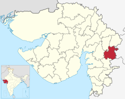
696 Dahod in Gujarat (India).svg
11 Dang Ahwa
1960
186,712226,769
No.Talukas
1 Ahwa
2 Subir
3 Waghai
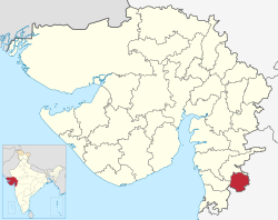
311 Dang in Gujarat (India).svg
12 Devbhoomi Dwarka Khambhalia
2013
623,091752,484
No.Talukas
1 Bhanvad
2Kalyanpur
3 Khambhalia
4Okhamandal
249 Devbhoomi Dwarka in Gujarat (India).svg
13 Gandhinagar Gandhinagar
1964
1,334,7311,387,478
No.Talukas
1 Gandhinagar
2 Dehgam
3 Kalol
4 Mansa
302 Gandhinagar in Gujarat (India).svg
14 Gir Somnath Veraval
2013
1,059,6751,217,477
No.Talukas
1 Gir-Gadhada
2 Kodinar
3 Sutrapada
4 Talala
5 Una
6 Veraval
345 Gir Somnath in Gujarat (India).svg
15 Jamnagar Jamnagar
1960
1,281,1871,407,635
No.Talukas
1Jamnagar
2Dhrol
3Jamjodhpur
4Jodiya
5Kalavad
6Lalpur
113 Jamnagar in Gujarat (India).svg
16 Junagadh Junagadh
1960
1,388,4981,525,605
No.Talukas
1Junagadh City
2Bhesana
3Junagadh Rural
4Keshod
5Malia
6Manavadar
7Mangrol
8Mendarda
9Vanthali
10Visavadar
547 Junagadh in Gujarat (India).svg
17 Kutch Bhuj
1960
1,526,3212,090,313
No.Talukas
1Abdasa
2Anjar
3Bhachau
4Bhuj
5Gandhidham
6Lakhpat
7Mandvi
8Mundra
9Nakhatrana
10Rapar
1389 Kutch in Gujarat (India).svg
18 Kheda Nadiad
1960
1,806,9292,053,769
No.Talukas
1Kheda
2Galteshwar
3Kapadvanj
4Kathlal
5Mahudha
6Matar
7Mehmedabad
8Nadiad
9Thasra
10Vaso
620 Kheda in Gujarat (India).svg
19 Mahisagar Lunavada
2013
861,562994,624
No.Talukas
1Balasinor
2Kadana
3Khanpur
4Lunawada
5Santrampur
6Virpur
941 Mahisagar in Gujarat (India).svg
20 Mehsana Mehsana
1960
1,837,6962,027,727
No.Talukas
1Mehsana
2Becharaji
3Jotana
4Kadi
5Kheralu
6Satlasana
7Unjha
8Vadnagar
9Vijapur
10Visnagar
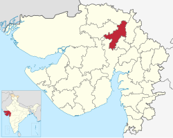
614 Mehsana in Gujarat (India).svg
21 Morbi Morbi
2013
825,301960,329
No.Talukas
1Halvad
2Maliya
3Morbi
4Tankara
5Wankaner
78 Morbi in Gujarat (India).svg
22 Narmada Rajpipla
1997
514,083590,379
No.Talukas
1Dediapada
2Garudeshwar
3Nandod
4Sagbara
5Tilakwada
527 Narmada in Gujarat (India).svg
23 Navsari Navsari
1997
1,229,2501,330,711
No.Talukas
1Navsari
2Vansda
3Chikhli
4Gandevi
5Jalalpore
6Khergam
389 Navsari in Gujarat (India).svg
24 Panchmahal Godhra
1960
1,381,0021,642,268
No.Talukas
1Ghoghamba
2Godhra
3Halol
4Jambughoda
5Kalol
6Morwa Hadaf
7Shehera
604 Panchmahal in Gujarat (India).svg
25 Patan Patan
2000
1,181,9411,342,746
No.Talukas
1Patan
2Chanasma
3Harij
4Radhanpur
5Sami
6Sankheswar
7Santalpur
8Sarasvati
9Sidhpur
521 Patan in Gujarat (India).svg
26 Porbandar Porbandar
1997
536,854586,062
No.Talukas
1Porbandar
2Kutiyana
3Ranavav
149 Porbandar in Gujarat (India).svg
27 Rajkot Rajkot
1960
2,488,8853,015,229
No.Talukas
1Rajkot
2Dhoraji
3Gondal
4Jamkandorna
5Jasdan
6Jetpur
7Kotada Sangani
8Lodhika
9Paddhari
10Upleta
11Vinchchiya
856 Rajkot in Gujarat (India).svg
28 Sabarkantha Himmatnagar
1960
1,173,7341,388,671
No.Talukas
1Himatnagar
2Idar
3Khedbrahma
4Poshina
5Prantij
6Talod
7Vadali
8Vijaynagar
702 Sabarkantha in Gujarat (India).svg
29 Surat Surat City
1960
4,996,3916,079,231
No.Talukas
1Surat
2Bardoli
3Choryasi
4Kamrej
5Mahuva
6Mandvi
7Mangrol
8Olpad
9Palsana
10Umarpada
729 Surat in Gujarat (India).svg
30 Surendranagar Surendranagar
1960
1,370,8431,585,268
No.Talukas
1Chotila
2Chuda
3Dasada
4Dhrangadhra
5Lakhtar
6Limbdi
7Muli
8Sayla
9Thangadh
10Wadhwan
654 Surendranagar in Gujarat (India).svg
31 Tapi Vyara
2007
719,634806,489
No.Talukas
1Nizar
2Songadh
3Uchhal
4Valod
5Vyara
6Kukarmunda
7Dolvan
523 Tapi in Gujarat (India).svg
32 Vadodara Vadodara City
1960
2,732,0033,093,795
No.Talukas
1Vadodara
2Dabhoi
3Desar
4Karjan
5Padra
6Savli
7Sinor
8Waghodia
694 Vadodara in Gujarat (India).svg
33 Valsad Valsad
1966
1,410,6801,703,068
No.Talukas
1Valsad
2Dharampur
3Kaprada
4Pardi
5Umbergaon
6Vapi
460 Valsad in Gujarat (India).svg
34 Vav-Tharad Tharad 20256,257
No.Talukas
1Vav
2Tharad
3Bhabhar
4Dhanera
5Suigam
6Lakhani
7Deodar
8Kankrej
TotalTalukas: 251

Proposed districts

Proposed district [9] Current district
Ahmedabad city Ahmedabad
Dholera
Anart or Vadnagar Gandhinagar
Mehsana
East Kutch Kutch
West Kutch
Viramgam Ahmedabad
Surendranagar

See also

Administrative Division in Details
Divisions 4
Districts 34
Cities and towns 140
Blocks (Taluks) 252
Villages 18000
Panchayats 14,273
Police Districts?
Police Stations?

Related Research Articles

<span class="mw-page-title-main">Sabarkantha district</span> District of Gujarat in India

Sabarkantha district is one of the 33 districts of Gujarat state of India, located in the northeastern part of the state. The administrative headquarters of the district are located in Himatnagar.

Kheda is a city and a municipality in the Indian state of Gujarat. Kheda was known as Kaira during the British Raj. It was the former administrative capital of Kheda district. The city is known for tobacco farming. The nearest railway station is Mahemadavad Kheda Road and the nearest airport is Ahmedabad Airport.

<span class="mw-page-title-main">Banaskantha district</span> District of Gujarat in India

Banaskantha district is one of the thirty-three districts of the Gujarat state of India. The administrative headquarters of the district is at Palanpur which is also its largest city. The district is located in the Northeast of Gujarat and is presumably named after the West Banas River which runs through the valley between Mount Abu and Aravalli Range, flowing to the plains of Gujarat in this region and towards the Rann of Kutch. The district is famous for the Ambaji temple which draws many tourists. It covers an area of 12703 km2 and is the second largest district in the state.

<span class="mw-page-title-main">Palanpur</span> City in Gujarat, India

Palanpur is a city and a headquarters of Banaskantha district in the Indian state of Gujarat. Palanpur is the ancestral home to an industry of Indian diamond merchants.

<span class="mw-page-title-main">Patan district</span> District in Gujarat, India

Patan district is one of the 33 districts of Gujarat state in western India. Its main city is Patan. This district is located in northern Gujarat and bounded by Vav-Tharad district in the north, Banaskantha district in the northeast, Mehsana district in the east and southeast, Surendranagar district in the south and Kutch District and the Kutch nu Nanu Ran in the west. The district occupies an area of 5792 km2.

<span class="mw-page-title-main">Mehsana district</span> District of Gujarat in India

Mehsana district is one of the 33 districts of Gujarat state in western India. Mehsana city is the administrative headquarters of this district. The district has a population of over 1.8 million and an area of over 4,500 km2. There are over 600 villages in this district with a population of 2,035,064 of which 22.40% were urban as of 2011.

<span class="mw-page-title-main">Tharad</span> Urban Town in Gujarat, India

Tharad is a administrative center of the Vav-Tharad district. Here is 134 villages are there. Tharad is 45km near to international boarder with Pakistan and 40km away from the state boarder with the Rajasthan state. main industries are agriculture and private businesses. It is one of the first major towns in Gujarat on National Highway 68.

<span class="mw-page-title-main">Palanpur Agency</span>

Palanpur Agency, also spelled Pahlunpore Agency, was a political agency or collection of princely states in British India, within the Gujarat Division of Bombay Presidency. In 1933, the native states of the Mahi Kantha Agency, except for Danta, were included in the Western India States Agency. The agency, headquartered at Palanpur, oversaw some 17 princely states and estates in the area, encompassing an area of 6393 square miles (16,558 km2) and a population, in 1901, of 467,271.

<span class="mw-page-title-main">North Gujarat</span> Region in West India, India

North Gujarat, the Northern part of Indian state of Gujarat includes the districts of Gandhinagar, Banaskantha, Patan, Aravalli, Mehsana Sabarkantha and Vav-Tharad district. Patan city is the administrative headquarters of North Gujarat.

Vav is one of the 182 Legislative Assembly constituencies of Gujarat state in India. It is part of Banaskantha district. It is numbered as 7-Vav.

Diyodar, also spelled Diodar or Deodar, is a town and former princely state in Diyodar Taluka of Vav-Tharad district in Gujarat, western India.

Bhabhar is a town in the Vav-Tharad District of Gujarat, India.

Jagana is a village in the Palanpur taluka of Banaskantha district in northern Gujarat, India. The villages Vasna, Bhagal, Sedrasana are located near to Jagana and it is just 6 km away from the district headquarters, Palanpur.

<span class="mw-page-title-main">2017 Gujarat flood</span> Floods in India

Following heavy rain in July 2017, the Indian state of Gujarat was affected by severe flooding. The floods were reported to have caused total 224 deaths between 1 June and 31 July 2017. 16 people had died in neighbouring Rajasthan state by 31 July.

Bhabhar railway station is a railway station in Banaskantha district, Gujarat, India on the Western line of the Western Railway network. Bhabhar railway station is 88 km far away from Palanpur Junction. 1 Passenger, 1 Express and 1 Superfast trains halt here.

Vav-Tharad district is one of the thirty fourth district of the Gujarat state of India. The administrative headquarter of the district is Tharad. The district was carved out from the existing Banaskantha district which is situated in Northern Gujarat which is located along with the Rajasthan State border.

References

  1. "Gujarat | District Portal". gujarat.s3waas.gov.in. Retrieved 2 March 2023.
  2. Dave, Kapil (7 October 2012). "Next Republic Day, Gujarat will be bigger..." The Indian Express. Retrieved 13 October 2012.
  3. "Village Map - Revenue Department". Internet Archive. 25 March 2016. Archived from the original on 25 March 2016. Retrieved 9 April 2016.
  4. "State Govt Announces 23 New Talukas". 10 September 2013. Archived from the original on 6 February 2016. Retrieved 5 January 2016.
  5. "Gujarat Govt made major announcement Dholera SIR at Dholera district". Dholera SIR . Government of India . Retrieved 6 January 2009.
  6. "Ranking of Districts by Population Size, 2001 and 2011". 2011 census of India . Government of India . Retrieved 3 May 2012.
  7. "Ranking of Districts by Population Size, 2001 and 2011". 2011 census of India . Government of India . Retrieved 3 May 2012.
  8. "Village & Panchayats | Ahmedabad District, Government Of Gujarat | India" . Retrieved 9 February 2023.
  9. "Gujarat government planning to carve out new districts before panchayat elections", Times of India, 24 September 2024