Bharuch district ભરૂચ જિલ્લો Bharuch district | |
|---|---|
| Bharuch district | |
  | |
| Nickname: Bharuch district | |
 Interactive map of Bharuch district | |
| Coordinates: 20°42′N72°59′E / 20.700°N 72.983°E | |
| Country | |
| State | Gujarat |
| Headquarters | Bharuch |
| Government | |
| • Type | Municipality |
| • Body | District Government of Bharuch |
| Area | |
• Total | 6,509 km2 (2,513 sq mi) |
| Population (2011) | |
• Total | 1,551,019 |
| • Density | 238.3/km2 (617.2/sq mi) |
| Languages | |
| • Official | Gujarati, Hindi, English |
| Time zone | UTC+5:30 (IST) |
| Vehicle registration | GJ-16 |
| Website | bharuch |
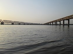
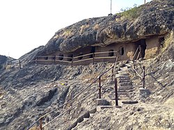
Bharuch in India, is a district in the southern regions of the Kathiawar peninsula on the west coast of the state of Gujarat in the Arabian sea with a size and population comparable to that of Greater Boston. Bharuch derives its name from the famous Hindu sage Bhrigu. A historical name for Bharuch is 'Bhrigukachchha'. The mythological sage Bhrigu is one of the many children of Brahma and Sarasvati. There is also a story which indicates that Bhrigu along with his kin asked for temporary access to Bharuch which was said to belong to Lakshmi, since Bharuch is located on the banks of river Narmada also known as Rudra Deha. Chandramaulishvara, a form of Shiva is the Kuladevata of the Hindu Bhargavas of Bharuch. Bhrigu never left the place and the Ashrama of the sage Brighu is located on the banks of the Narmada river. The Narmada River outlets into the Gulf of Khambhat through its lands and that shipping artery gave inland access to the kingdoms and empires located all over the Indian subcontinent.

