Jamnagar district

Last updated

Jamnagar District
Lakhota Lake Museum.JPG
Mangroves Jungle.jpg
Top: Lakhota Lake and museum, Jamnagar
Bottom: Mangroves in Pirotan Marine Reserve
Jamnagar district
Interactive Map Outlining Jamnagar District
Jamnagar in Gujarat (India).svg
Location of district in Gujarat
Coordinates: 22°15′0″N70°0′0″E / 22.25000°N 70.00000°E / 22.25000; 70.00000
CountryFlag of India.svg  India
State Gujarat
Region Saurashtra
Headquarters Jamnagar
Government
  Collector & DMShri Bijal Shah, IAS [1]
  District Development OfficerShri Vikalp Bhardwaj, IAS [1]
  District Supply OfficerShri Avani A Haran [1]
  ICT OfficerShri R. N. Thakariya [1]
Area
  Total14,184 km2 (5,476 sq mi)
Population
 (2023)
  Total2,516,000 [2]
Languages
  Official Gujarati, Hindi
Time zone UTC+5:30 (IST)
Vehicle registration GJ-10
Website jamnagar.nic.in [3]

Jamnagar District is a district of Gujarat in Western India. Its headquarters are located in the eponymous city of Jamnagar. It hosts the production facilities of large Indian companies [4] such as Reliance. Among its attractions are several palaces, [4] a Marine National Park and a Bird Sanctuary, known as Khijadiya Bird Sanctuary. [5] In 2013, Devbhoomi Dwarka district was carved out of the western part of the district.

Contents

India's largest private company, Reliance Industries is developing world's largest zoo near by 28 kms from Jamnagar city. [6] Luxury hotel chain Lemon Tree Hotels will open its new luxury hotel in Jamnagar in FY25. [6] 
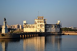
Jamnagar Municipal Corporation is planning to be develop riverfront on Rangmati – Nagmati river which cost of around 500 crore. [7]

History

Jamnagar was founded by Jam Rawalji Jadeja in 1540 A.D. as the capital of the Princely State of Nawanagar. Jamnagar, historically known as Nawanagar (the new town), was one of the most important princely states of the Jadeja's in the region of Saurashtra. According to Pauranik literature, Lord Krishna established his kingdom at Dwarka town in Jamnagar district, after migrating from Mathura and accordingly, it is to the Yadava race that the Jams of Nawanagar trace their ancestry.

According to bardic chronicles, impressed by Jam Lakhaji's role in at the siege of Pawagadh, Bahadurshah, the Emperor of Gujarat, bestowed 12 villages on him. As Jam Lakaji was going to take possession of his new fief, he was treacherously killed by his cousins, Tamachi Deda and Hamirji Jadeja. Jam Lakhajis son Jam Rawal escaped and on growing up, took vengeance of his father's murder in the same manner by killing Hamirji Jadeja.

Hamirji's two sons Khengarji and Sahibji fled to Delhi to pay obeisance to the mughal Emperor Humayun. During a lion hunt, the two brothers saved the Emperor from being killed by the lion. As a reward for their valour, an army was sent with them to regain their kingdom. When Jam Rawal heard of the two princes coming back to the Kutch with the imperial army, he started getting ready for the battle. On one night, he dreamt of the goddess Ashapura who told him that as he had broken an oath taken on her name about not killing Hamirji, even though, he was the person responsible for the death of his father. She had refrained from punishing him as he had at all other times honored her, but he was no longer to dwell in Kutch but cross the sea and reside in Kathiawar instead.

Jam Rawal and his entourage marched out of Kutch, attacked and killed King Tamachi the other conspirator in the killing of his father, and conquered the town of Dhrol and its dependencies. Jam Rawal bestowed the rule of Dhrol province to his brother Hardholji, who was later killed in battle, and the throne passed to his eldest son, Jasoji. Jam Rawal conquered parts of Saurashtra and formed his kingdom.

Once on a hunting trip on the land of present day Jamnagar, a hare was found to be brave enough to turn on the hunting dogs and putting them to flight. Deeply impressed by this, Jam Rawal thought that if this land can breed such hares, the men born here would be superior than other men, and accordingly made this place his capital. On the 7th day of the bright half of the month of Srawan, VS 1596 (August 1540 AD) on the banks of two rivers Rangmati and Nagmati, he lay the foundation of his new capital and named it Nawanagar (new town). Nawanagar eventually came to be known as Jamnagar meaning the town of the Jams.

Geography

Jamnagar district lies between 22°13’N and 69°42’E in the region of Gujarat popularly referred to as Saurashtra. The Gulf of Kutch lies to the north of Jamnagar district and the Arabian Sea on the west. In the east lies the Rajkot district and the Junagadh district is to the south. [8] The city has a hot dry climate for most of the year with extreme hot summers during March–May when the temperatures reach an average of 40 °C. The winter season begins from October and ends in February with average temperatures around 30 °C. June–September is the monsoon with frequent occurrences of tropical storms. The best time to visit Jamnagar is between October and February. Geologists have often debated on the exact origins of Jamnagar but deduce that the district was probably an island or a group of islands with volcanic sites. [8]

Talukas (Administrative Divisions)

  1. Jam Jodhpur
  2. Jodiya
  3. Dhrol
  4. Jamnagar
  5. Jamnagar Rural
  6. Lalpur
  7. Kalavad Taluka

Transport

There are many private bus service providers with coaches running between Jamnagar and Bhuj, Ahmedabad, Surat, Vadodara, Mumbai, Pune, and other major cities. State Transport has bus services to almost all cities of Gujarat State and interstate transport facilities. The Jamnagar Municipal Corporation runs local buses. Also, Ola Cabs and auto rickshaws are available.[ citation needed ]

Jamnagar Railway Station platform Jamnagar Railway Station Platform 1 - panoramio.jpg
Jamnagar Railway Station platform

Jamnagar has a railway station connected with a variety of India's destinations. [9] Four daily trains go to Mumbai and weekly trains to the major cities to the north, east, and south of the country.[ citation needed ]

The city has an airport with a daily direct flight to Mumbai and thrice-in-a-week flights to Hyderabad and Bengaluru. The airport is within a military enclave of the Indian Air Force.[ citation needed ]

Amritsar–Jamnagar Expressway(NH-754)

Amritsar–Jamnagar Expressway(NH-754) is an under-construction 1,257 km long, 6-lane wide expressway in the north-western part of India. The expressway will reduce the distance between Amritsar and Jamnagar from earlier 1,430 km to 1,316 km (including Kapurthala-Amritsar section) and the time travel from 26 hours to only 13 hours. It is a part of the Bharatmala and Amritsar–Jamnagar Economic Corridor (EC-3). It will pass through four states of Punjab, Haryana, Rajasthan and Gujarat. [10]

The expressway is strategically important, as it will connect 3 big oil refineries of HMEL Bathinda, HPCL Barmer and Reliance Industries Limited(RIL) Jamnagar. It will also connect Guru Nanak Dev Thermal Plant (Bathinda) and Suratgarh Super Thermal Power Plant (Sri Ganganagar). [10]

The expressway will meet the Ludhiana-Bathinda-Ajmer Expressway of the Pathankot–Ajmer Economic Corridor at Bathinda. The construction work on the expressway started in Haryana and Rajasthan in 2019. The Rajasthan section of the expressway from Jakhrawali in Hanumangarh district to Khetlawas in Jalore district was completed in early 2023 and was inaugurated by Prime Minister Narendra Modi on 8 July 2023, while the entire expressway is expected to be opened by September 2023. [10]

Utilities

The Sikka Thermal Power Station is a coal-fired power station near Jamnagar. Various cable operators like GTPL are available in the city, along with DTH services from Tata Play, Airtel, DishTV, and Videocon D2H. Bharat Sanchar Nigam Limited (BSNL) provides broadband. Reliance has started its 5G service, Reliance Jio. All mobile operators are available in Jamnagar, including Vi, Airtel, Reliance, BSNL.

Jamnagar is a large city and district in the western part of India. There are many modern tourist spots here for which many tourists come. This is a city moving on the path of continuous development. There are many good hotels and resorts so tourists can visit this city comfortably. Many modern facilities are available here. Bandhani, Ghughra, brass items and many other things are famous here. [11]

Demographics

Historical population
YearPop.±% p.a.
1901352,150    
1911359,604+0.21%
1921359,631+0.00%
1931425,463+1.70%
1941517,833+1.98%
1951616,896+1.77%
1961828,419+2.99%
19711,111,343+2.98%
19811,393,076+2.29%
19911,563,558+1.16%
20011,904,278+1.99%
20112,160,119+1.27%
source: [12]

According to the 2023 estimated population of Jamnagar district is 2,516,000, [13] roughly equal to the nation of Namibia [14] or the US state of New Mexico. [15] This gives it a district population ranking of 87th in India (out of a total of 640). [16] The district has a population density of 153 inhabitants per square kilometre (400/sq mi) . [16] Its population growth rate over the decade 2011–2023 was 16.48%. [16] Jamnagar has a sex ratio of 938 females for every 1000 males. [16] It had literacy rate of 66.4% in 2001 which rose impressively in a decade to literacy rate of 74.4% by 2011. [16]

According to 2023 estimate population, the divided district had a population of 2,516,000, of which 6,68,000 lived in city areas. The residual district had a sex ratio of 939 females per 1000 males. Total male population is 1,297,811 and female population is 1,218,296. [13]

Religions in Jamnagar district (2023) [17]
ReligionPercent
Hinduism
83.81%
Islam
14.85%
Jainism
0.87%
Other or not stated
0.47%

In the residual district, Hindus were 2,108,804 (83.81), Muslims were 373,674 (14.85) and Jains 21,963 (0.87%). [13]

Language

Languages of Jamnagar district (2011) [18]

   Gujarati (89.75%)
   Kachchhi (5.84%)
   Hindi (2.24%)
   Sindhi (0.44%)
   Urdu (0.36%)
   Marathi (0.24%)
  Others (1.13%)

At the time of the 2011 census, 89.75% of the population spoke Gujarati, 5.84% Kachchhi and 2.24% Hindi as their first language. [18]

Politics

DistrictNo.ConstituencyNamePartyRemarks
Jamnagar 76 Kalavad (SC)Meghjibhai Chavda Bharatiya Janata Party
77 Jamnagar Rural Raghavjibhai Patel Bharatiya Janata Party Cabinet Minister
78 Jamnagar North Rivaba Jadeja Bharatiya Janata Party
79 Jamnagar South Divyeshbhai Akbari Bharatiya Janata Party
80 Jamjodhpur Hemant Khava Aam Aadmi Party AAP Deputy LP Leader

See also

Related Research Articles

<span class="mw-page-title-main">Kathiawar</span> Peninsula in Western India

Kathiawar is a peninsula, near the far north of India's west coast, of about 61,000 km2 (23,500 sq mi) bordering the Arabian Sea. It is bounded by the Gulf of Kutch in the northwest and by the Gulf of Khambhat in the east. In the northeast, it is connected to the rest of Gujarat and borders on the low, fertile hinterland of Ahmedabad. It is crossed by two belts of hill country and is drained radially by nine rivers which have little natural flow aside from in monsoon months, thus dams have been built on some of these. Kathiawar ports have been flourishing centres of trade and commerce since at least the 16th century.

<span class="mw-page-title-main">Jamnagar</span> Indian municipality

Jamnagar is a city located on the western coast of India in the state of Gujarat of Saurashtra region. It is the administrative headquarters of the Jamnagar district and the fifth largest city in Gujarat. The city lies just to the south of the Gulf of Kutch, some 337 kilometres (209 mi) west of the state capital, Gandhinagar.

<span class="mw-page-title-main">Nawanagar State</span> Former princely state in Gujarat, India

Nawanagar was an Indian princely state in the historical Halar region, located on the southern shores of the Gulf of Kutch. It was ruled by the Jadeja Rajput dynasty and became the part of newly formed India. Its capital city was Nawanagar city, now known as Jamnagar. It had an area of 3,791 square miles (9,820 km2) and a population estimated at 336,779 in 1901. Its rulers, who use the title of "Jam Saheb" are of the same clan as the Rao of Kutch. They were entitled to a 13-gun salute. The state flag was a rectangular red flag with a white elephant, near and facing the hoist. During the British, the state was part of the Kathiawar Agency, within the Gujarat Division of Bombay Presidency.

<span class="mw-page-title-main">Jadeja</span> Rajput clan

Jadeja is a Rajput clan that inhabits the Indian state of Gujarat and the Tharparkar district of Sindh, Pakistan. They originated from Sammas of Sindh, a pastoral group, and laid a claim on the Rajput identity after marriages with Sodha Rajput women by adopting a process called Rajputisation.

<span class="mw-page-title-main">Halar</span> Historical region in Gujarat, India

Halar (Haalaar) is a historical region of western India, located by the Gulf of Kutch coast on the northwestern area of Nawanagar, now Jamnagar, in Gujarat State, on Saurashtra peninsula, roughly corresponding to the present Jamnagar District, Devbhumi Dwarka district, Morbi District and Rajkot District.

Dhrol is a city and a municipality in Jamnagar district in the state of Gujarat, India.

<span class="mw-page-title-main">Rajkot State</span> Princely state of India

Rajkot State was one of the princely states of India during the period of British rule. It was a 9-gun salute state belonging to the Kathiawar Agency of the Bombay Presidency. Its capital was in Rajkot, located in the historical Halar region of Kathiawar on the banks of the Aji River. Nowadays, Rajkot is the fourth largest city of Gujarat state.

<span class="mw-page-title-main">Digvijaysinhji Ranjitsinhji Jadeja</span> Maharaja of Nawanagar from 1933–1948

Sir Digvijaysinhji Ranjitsinhji Jadeja was the Maharaja Jam Sahib of Nawanagar from 1933 to 1966, succeeding his uncle, the famed cricketer Ranjitsinhji.

<span class="mw-page-title-main">Cutch State</span> Monarchy in India (1147–1947)

Cutch, also spelled Kutch or Kachchh and also historically known as the Kingdom of Kutch, was a kingdom in the Kutch region from 1147 to 1819 and a princely state under British rule from 1819 to 1947. Its territories covered the present day Kutch region of Gujarat north of the Gulf of Kutch. Bordered by Sindh in the north, Cutch State was one of the few princely states with a coastline.

Khengarji I (1510-1585) was an Indian ruler belonging to Jadeja clan of Rajputs. He was the ruler of Morbi from 1538-1585 and later became ruler of Cutch, assuming title of Rao of Cutch, ruling unified Cutch from 1548 to 1585.

<span class="mw-page-title-main">Jam Rawal</span> Ruler of Kutch from 1524–1548 and founder-ruler of Nawanagar from 1540–1562

Jam Rawal Lakh (1480–1562), was a Jadeja Rajput ruler, who ruled Kutch State from 1524 to 1548 and later was founder-ruler of Nawanagar State from 1540 to 1562.

H.H. Jamsaheb Shatrusalyasinhji Jadeja is a former first-class cricketer and the current Titular Maharaja of Nawanagar State.

<span class="mw-page-title-main">Dhrol State</span> Princely state of India

Dhrol State was one of the 562 princely states of British India. It was a 9 gun salute state belonging to the Kathiawar Agency of the Bombay Presidency. Its capital was in the town of Dhrol, located in the historical Halar region of Kathiawar.

<span class="mw-page-title-main">History of Kutch</span>

The history of Kutch, (kachchh) a region in the extreme west of the western Indian state of Gujarat, can be traced back to prehistorical times. There are several sites related to Indus valley civilization in region and is mentioned in Hindu mythology. In historical times, Kutch is mentioned in Greek writings during Alexander. It was ruled by Menander I of Greco-Bactrian Kingdom which was overthrown by Indo-Scythians followed by Maurya Empire and Sakas. in the first century, it was under Western Satraps followed by Gupta Empire. By fifth century, Maitraka of Valabhi took over from which its close association with ruling clans of Gujarat started. Chavdas ruled the eastern and central parts by seventh century but then came under Chaulukyas by tenth century. After fall of Chaulukya, Vaghelas ruled the state. Following conquest of Sindh by Muslim rulers, Rajput Samma started moving southwards to Kutch and ruled western regions initially. By tenth century, they controlled significant area of Kutch and by thirteenth century they controlled whole of Kutch and adopted a new dynastic identity, Jadeja.

<span class="mw-page-title-main">Makaji Meghpar</span> Village in Gujarat, India

Makaji Meghpar is a village and former chiefdom of Hardhrol Jadeja chieftains in the Jamnagar district of Gujarat, India. It was founded in 1754 by Makanji Jadeja of Dhrol State. Gujarati writer Harilal Upadhyay was from the village. The people are mainly Jadeja Rajputs with some Brahmins, Patels and Dalits.

<span class="mw-page-title-main">Battle of Bhuchar Mori</span>

The Battle of Bhuchar Mori, also known as Battle of Dhrol, was fought between the army of Kathiawar led by Nawanagar State and the Mughal army at Bhuchar Mori plateau near Dhrol, Saurashtra. It was meant to protect Muzaffar Shah III, the last Sultan of Gujarat Sultanate who had taken asylum under Jam Sataji of Nawanagar after his escape from the Mughal emperor Akbar. It was fought in July 1591. The Kathiawar army included the armies of Junagadh who betrayed Nawanagar and joined the Mughal army at last. The battle led to a large number of casualties on both sides. The battle resulted in the victory of the Mughal army.

Bhuchar Mori is a plateau and historic site about two kilometres northwest of Dhrol, a town about 50 kilometres north of Rajkot, Gujarat, India. The place is known for the Battle of Bhuchar Mori and a memorial site dedicated to it. The annual fair dedicated to the event is organised in July and August.

Jam is a native title of rulers of a few princely states, notably born in western British India by the Samaa dynasty and their Jadeja branch which denotes their claimed descent from the legendary Jamshed of Iran.

Amritsar–Jamnagar Expressway (NH-754A) is an under-construction 1,257 km long, 6-lane wide expressway in the north-western part of India. The expressway will reduce the distance between Amritsar and Jamnagar from earlier 1,430 km to 1,316 km and the time travel from 26 hours to only 13 hours. It is a part of the Bharatmala and Amritsar–Jamnagar Economic Corridor (EC-3). It will pass through four states of Punjab, Haryana, Rajasthan and Gujarat.

Tumbel is a clan and division of the Charanas of Gujarat, Sindh, and Balochistan. Historically, they were known for their military services in the kingdoms of Kutch and Nawanagar.

References

  1. 1 2 3 4 "Who's Who | District Jamnagar, Government of Gujarat | India".
  2. "Jamnagar Population 2023".
  3. https://gujaratindia.gov.in/.{{cite web}}: Missing or empty |title= (help)
  4. 1 2 "Jamnagar District Map". Mapsofindia.com. 12 September 2011. Retrieved 12 March 2014.
  5. Mustak Amin Mepani. "Jamnagar the beautiful – Tourist information". Jamnagar.org. Retrieved 12 March 2014.
  6. 1 2 "Lemon Tree Hotels signs new property in India's Jamnagar". 9 October 2023.
  7. "Jamnagar: રંગમતી, નાગમતિ નદી પર રિવરફ્રન્ટ બનાવવાની યોજના 7 વર્ષથી માત્ર કાગળ પર, જાણો વિકાસને ક્યા ગ્રહણ લાગ્યુ ?". 17 April 2022.
  8. 1 2 "Geography of Jamnagar, Jamnagar Climate, Population of Jamnagar".
  9. "Jamnagar/JAM Railway Station – Today's Train Departure Timings – India Rail Info – A Busy Junction for Travellers & Rail Enthusiasts". India Rail Info. 6 August 2010. Retrieved 22 June 2012.
  10. 1 2 3 "Amritsar – Jamnagar Economic Corridor – Information & Status".
  11. "Famous Things of Jamnagar".
  12. Decadal Variation In Population Since 1901
  13. 1 2 3 "Jamnagar Population 2023".
  14. "Population by Country (2023) - Worldometer".
  15. "2010 Resident Population Data". U. S. Census Bureau. Archived from the original on 19 October 2013. Retrieved 30 September 2011. New Mexico – 2,059,179
  16. 1 2 3 4 5 "District Census Hand Book – Jamnagar" (PDF). Census of India . Registrar General and Census Commissioner of India.
  17. "Population by Religion – Gujarat". censusindia.gov.in. Registrar General and Census Commissioner of India. 2011.
  18. 1 2 "Table C-16 Population by Mother Tongue: Gujarat". censusindia.gov.in. Registrar General and Census Commissioner of India.