Amrapur, Jamnagar district

Last updated

See Amrapur for namesakes
Amrapur [1] [2]
Village
India Gujarat location map.svg
Red pog.svg
Amrapur [7] [8]
Location in Gujarat, India
India location map.svg
Red pog.svg
Amrapur [13] [14]
Amrapur [15] [16] (India)
Coordinates: 22°22′17″N70°23′11″E / 22.371262°N 70.38633°E / 22.371262; 70.38633
CountryFlag of India.svg India
State Gujarat
District Jamnagar
Population
 (2001)
  Total
250
Languages
  Official Gujarati, Hindi
Time zone UTC+5:30 (IST)
Postal Index Number
361130
Vehicle registration GJ
Website gujaratindia.com

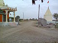
Amrapur is a town and former petty princely state in Jamnagar, in Kathiawar, Gujarat state, western India.

Contents

Village

Most inhabitants are farmers, some connected with animal husbandry. Mr Vijaybhai Borsadiya is currently sarpanch of the village‍.

Location

Amrapur is surrounded on three sides by a dam. Amrapur is located at 22°22′17″N70°23′11″E / 22.371262°N 70.38633°E / 22.371262; 70.38633 On Globe. [17] The road to it is from Kalavad to Ranuja, Dhutarpur, Sumary,[ clarification needed ] Kharavedha, Amrapur.

Statistics

History

Amrapur was the seat of an eponymous non-salute princely state in Halar prant, comprising it and another village on Saurashtra peninsula in present Gujarat, western India. It was ruled by Muslim Chieftains of a Shaikh family.

It had a population of 1210 in 1901, yielding a state revenue of 8,000 Rupees (all from land, 1903–04) and paying 511 Rupees to the British.

References

  1. "જામનગર જીલ્લા પંચાયત". Archived from the original on 2 February 2020. Retrieved 20 October 2013.
  2. "જામનગર જીલ્લા પંચાયત | મારો તાલુકો | જામનગર". Archived from the original on 20 January 2019. Retrieved 12 March 2014.
  3. "જામનગર જીલ્લા પંચાયત". Archived from the original on 2 February 2020. Retrieved 20 October 2013.
  4. "જામનગર જીલ્લા પંચાયત | મારો તાલુકો | જામનગર". Archived from the original on 20 January 2019. Retrieved 12 March 2014.
  5. "જામનગર જીલ્લા પંચાયત". Archived from the original on 2 February 2020. Retrieved 20 October 2013.
  6. "જામનગર જીલ્લા પંચાયત | મારો તાલુકો | જામનગર". Archived from the original on 20 January 2019. Retrieved 12 March 2014.
  7. "જામનગર જીલ્લા પંચાયત". Archived from the original on 2 February 2020. Retrieved 20 October 2013.
  8. "જામનગર જીલ્લા પંચાયત | મારો તાલુકો | જામનગર". Archived from the original on 20 January 2019. Retrieved 12 March 2014.
  9. "જામનગર જીલ્લા પંચાયત". Archived from the original on 2 February 2020. Retrieved 20 October 2013.
  10. "જામનગર જીલ્લા પંચાયત | મારો તાલુકો | જામનગર". Archived from the original on 20 January 2019. Retrieved 12 March 2014.
  11. "જામનગર જીલ્લા પંચાયત". Archived from the original on 2 February 2020. Retrieved 20 October 2013.
  12. "જામનગર જીલ્લા પંચાયત | મારો તાલુકો | જામનગર". Archived from the original on 20 January 2019. Retrieved 12 March 2014.
  13. "જામનગર જીલ્લા પંચાયત". Archived from the original on 2 February 2020. Retrieved 20 October 2013.
  14. "જામનગર જીલ્લા પંચાયત | મારો તાલુકો | જામનગર". Archived from the original on 20 January 2019. Retrieved 12 March 2014.
  15. "જામનગર જીલ્લા પંચાયત". Archived from the original on 2 February 2020. Retrieved 20 October 2013.
  16. "જામનગર જીલ્લા પંચાયત | મારો તાલુકો | જામનગર". Archived from the original on 20 January 2019. Retrieved 12 March 2014.
  17. "22°22'16.5"N 70°23'10.8"E".