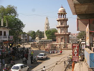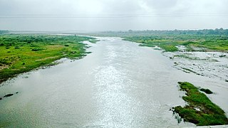
Banaskantha district is one of the thirty-three districts of the Gujarat state of India. The administrative headquarters of the district is at Palanpur which is also its largest city. The district is located in the Northeast of Gujarat and is presumably named after the West Banas River which runs through the valley between Mount Abu and Aravalli Range, flowing to the plains of Gujarat in this region and towards the Rann of Kutch. The district is famous for the Ambaji temple which draws many tourists. It covers an area of 12703 km2 and is the second largest district in the state.

Upleta is a city and tehsil in the Rajkot district of the state of Gujarat, India.
Jambuda is a small village in Jamnagar district, which is a part of the Indian state of Gujarat. It is a village with history of Gadhavi and Rajgor Brahmins And shadhu, situated 16 kilometres (9.9 mi) from Jamnagar towards Rajkot on State Highway. The major population includes shadhu, Gadhavi, Rajgor Brahmin, Patels, Rajputs (Kshatriya), shepherd, Charaniya and Kori communities. The village is situated on the way to the only Sainik School of Gujarat, "Sainik School Balachadi".
Krushnanagar is a village in Jodiya taluka of Jamnagar District of Gujarat in India. The village has a Government School.

Morbi district is in the state of Gujarat, India. It was formed on August 15, 2013, along with several other districts, on the 67th Independence Day of India. Morbi city is the administrative headquarters of the district. The district has 5 talukas - Morbi, Maliya, Tankara, Wankaner and Halvad. Morbi city is the administrative headquarters of Morbi district. The town of Morbi is situated on the Machchhu River, 35 km from the sea and 60 km from Rajkot. As per 2011 census data, the city had a population of 2,10,451 and average literacy rate of 83.64%.

Chhota Udaipur district is a district in the state of Gujarat in India. It was carved out of the Vadodara district on 26 January 2013 with its headquarters at Chhota Udaipur town and is the 28th district of Gujarat.
Amrapur is a town and former petty princely state in Jamnagar, in Kathiawar, Gujarat state, western India.
Dumara is a panchayat village in Gujarat, India. Administratively it is under Abdasa Taluka, Kutch District, Gujarat. The village of Dumara sits on the left (west) bank of the Chok River, an intermittent stream. It is 20 km (12 mi) by road southeast of the village of Kothara along National Highway 8A, and 38 km (24 mi) along the same road northwest of the town of Mandvi.
Tankara is one of the 182 Legislative Assembly constituencies of Gujarat state in India. It is part of Morbi district.
Rajkot Rural is one of the 182 Legislative Assembly constituencies of Gujarat state in India. It is part of Rajkot district and is reserved for candidates belonging to the Scheduled Castes.
Kalavad is one of the 182 Legislative Assembly constituencies of Gujarat state in India. It is part of Jamnagar district and is reserved for candidates belonging to the Scheduled Castes.
Jamnagar Rural is one of the 182 Legislative Assembly constituencies of Gujarat state in India. It is part of Jamnagar district.
Jamnagar North is one of the 182 Legislative Assembly constituencies of Gujarat state in India. It is part of Jamnagar district and it came into existence after 2008 delimitation.
Jamnagar South is one of the 182 Legislative Assembly constituencies of Gujarat state in India. It is part of Jamnagar district and covers a major area of Jamnagar Municipal Corporation.
Jamjodhpur is one of the 182 Legislative Assembly constituencies of Gujarat state in India. It is part of Jamnagar district.

Makaji Meghpar is a village and former chiefdom of Hardhrol Jadeja chieftains in the Jamnagar district of Gujarat, India. It was founded in 1754 by Makanji Jadeja of Dhrol State. Gujarati writer Harilal Upadhyay was from the village. The people are mainly Jadeja Rajputs with some Brahmins, Patels and Dalits.
Balachadi is a village in Jodiya Taluka of Jamnagar district, Gujarat, India. It is 25 kilometres east of Jamnagar, near the Gulf of Kutch.


