Amreli district is one of the 33 administrative districts of the state of Gujarat in western India. The district headquarters are located at Amreli. The district occupies an area of 6,760 km2 and has a population of 1,514,190 of which 22.45% were urban. Amreli is the land of Yogiji Maharaj (Dhari), Dan Bapu (Chalala), Sage Muldas, Sage Bhojalram Bapa, Sage Muktanand Swami, Magician K.Lal, Zaverchand Meghani's place (Bagasara), Dr. Jivaraj Mehta etc. Amreli covers Dhari Gir National forest sanctuary area. Now it is developing as a Hub of Education.

Amreli is a city and a municipality in Amreli district in Indian state of Gujarat.

Gondal is a city of about 115,000 residents and a municipality of about 175,000 in the Rajkot district of the Indian state of Gujarat. Gondal Village was one of the eight first-class princely states of Kathiawar Agency, Bombay Presidency in British India. Ruled by a Hindu Rajput dynasty of the Jadeja.
Dhrangadhra is a town, taluka headquarters and a municipality in Surendranagar district in the state of Gujarat, India. During the period of the British Raj, the city was the capital of Dhrangadhra State, one of the eight first-class princely states of the Kathiawar Agency in the Bombay Presidency.
Bagasara is a municipality in Bagasara Taluka of Amreli district, Gujarat, India. The town is situated on the northern bank of the Satalli river. nearest airport div airport.
Botad is a city and the district headquarters of Botad district, Gujarat, India. It is about 92 km (57 mi) from Bhavnagar and 133 km (83 mi) from Ahmedabad by road distance.

Dhoraji is a town situated on the banks of the River Safura, a tributary of the River Bhadar. It is a municipality in the Rajkot district in the state of Gujarat, India.
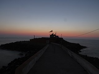
Mahuva is a town and taluka of Bhavnagar District, in the state of Gujarat, India. Located on the coast of the Arabian Sea, Mahuva is known for its mild weather and green, lush surroundings, including many coconut tree plantations. The town is a part of the Saurashtra region and is known as the Kashmir of Saurashtra. Mahuva is also known for wooden toys, raw onions, groundnuts, and a local variety of mango called the Jamadar. The region is home to a thriving agribusiness industry, particularly enterprises that dehydrate vegetables such as garlic and onions for use in processed foods.
Rajula is a city and municipality in Amreli district in the Indian state of Gujarat. City was known as Rajgadh at the time of local ruler daha dhakhda. He founded the official gadh

Sihor is a town, a municipality in Bhavnagar district in the Indian state of Gujarat. Placed along the river Gautami, this erstwhile capital of the Gohil Rajputs, surrounded by hills is situated about 20 km from Bhavnagar. It becomes Sihor by corrupting its name from Saraswatpur, Sinhalpur, Sinhpur, Sinhor, and Shihor.

Botad District is a is a district in the state of Gujarat, India.
Mavjinjava is a small village near Bagasara in the Amreli district of the Saurashtra region in the state of Gujarat, India. There is a population of around 3,754 people in Mavjinjava. More than 3000 people live outside of Manjinjava in places like Surat, Ahmedabad & Mumbai.
Chamardi is a large village located within the Vallabhipur Taluka township of the Bhavnagar district (Gujarat), in West India. It was formerly a part of Rajput princely state.
Adhewada is a village in Bhavnagar Taluka of Bhavnagar district in Gujarat, India. The village is located on the northern bank of the Maleshree or Maleshvari River and about three miles south of Bhavnagar.
Antaliya is a village in Amreli district in the Indian state of Gujarat.
Mota Bhamodra is a village in Savarkundla Taluka of Amreli district, Gujarat, India.
Bhandaria is a village in Gujarat, western India.

Sardhar is a village located on the Rajkot to Bhavnagar highway and 30 km away from Rajkot in the state of Gujarat, India.
Chogath (Thapnath) is a village in Umrala Taluka of Bhavnagar district, Gujarat, India. It is a former princely state.
Chavand is a village in Lathi taluka in Amreli district, Gujarat, India. It is situated to the north of Amreli. The main road linking Rajkot and Bhavnagar and Amreli passes through Chavand.
