This article has multiple issues. Please help improve it or discuss these issues on the talk page . (Learn how and when to remove these messages)
|
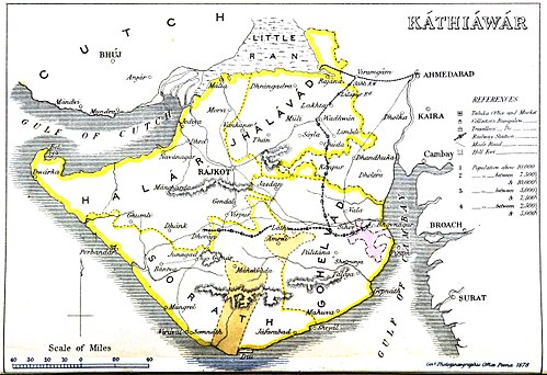
Gohilwar was one of the four prant s or traditional provinces of Saurashtra, the others being Jhalawar or Jhalavad, Halar, and Sorath.
Gohilwar covered the southeast of the Kathiawar peninsula, and roughly corresponds to the modern Bhavnagar District and Botad district.