Devbhumi Dwarka district

Last updated

Devbhumi Dwarka district
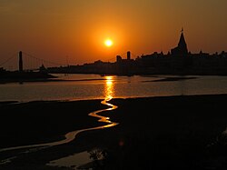
Dwarkadhish Temple - Jagat Mandir - Dwarakadheesh and surroundings during Dwaraka DWARASPDB 2015 (86).jpg
Devbhumi Dwarka district
Interactive Map Outlining Devbhumi Dwaraka District
Devbhoomi Dwarka in Gujarat (India).svg
Location in Gujarat
Coordinates: 22°12′N69°39′E / 22.200°N 69.650°E / 22.200; 69.650
CountryFlag of India.svg  India
State Gujarat
Region Saurashtra
Headquarters Jamkhambhaliya
Area
  Total4,051 km2 (1,564 sq mi)
Population
 (2011)
  Total752,484
  Density190/km2 (480/sq mi)
Languages
  Official Gujarati, Hindi
Time zone UTC+5:30 (IST)
Vehicle registration GJ-37
Website Official Website of Devbhumi Dwarka District

Devbhumi Dwarka District is a district of India located on the southern coast of the Gulf of Kutch in the state of Gujarat. Its headquarters are located in the city of Jamkhambhaliya. The district was created on 15 August 2013 from Jamnagar district. [1] [2] [3]

Contents

Talukas (Administrative Divisions)

The district consists of 4 talukas:

  1. Dwarka
  2. Bhanvad
  3. Kalyanpur
  4. Jamkhambhaliya

Demographics

The divided district had a population of 752,484, of which 241,795 (32.13%) lived in urban areas. The residual district had a sex ratio of 947 females per 1000 males. Scheduled Castes and Scheduled Tribes made up 50,937 (6.77%) and 9,687 (1.29%) of the population respectively. [4]

Religion

Religions in Devbhumi Dwarka district (2011) [5]
ReligionPercent
Hinduism
84.65%
Islam
15.00%
Other or not stated
0.35%

Hindus were 636,991 (84.65%) while Muslims were 112,894 (15.00%). [5]

Language

Languages of Devbhumi Dwarka district (2011) [6]

   Gujarati (88.12%)
   Kachchhi (9.35%)
   Hindi (1.63%)
  Others (0.90%)

At the time of the 2011 census, 88.12% of the population spoke Gujarati, 9.35% Kachchhi and 1.63% Hindi as their first language. [6]

Politics

DistrictNo.ConstituencyNamePartyRemarks
Devbhoomi Dwarka 81 Khambhaliya Mulubhai Bera Bharatiya Janata Party MoS
82 Dwarka Pabubha Manek Bharatiya Janata Party

Villages

Related Research Articles

<span class="mw-page-title-main">Banaskantha district</span> District of Gujarat in India

Banaskantha district is one of the thirty-three districts of the Gujarat state of India. The administrative headquarters of the district is at Palanpur which is also its largest city. The district is located in the Northeast of Gujarat and is presumably named after the West Banas River which runs through the valley between Mount Abu and Aravalli Range, flowing to the plains of Gujarat in this region and towards the Rann of Kutch. The district is famous for the Ambaji temple which draws many tourists. It covers an area of 12703 km2 and is the second largest district in the state.

<span class="mw-page-title-main">Amreli district</span> District of Gujarat in India

Amreli district is one of the 33 administrative districts of the state of Gujarat in western India. The district headquarters are located at Amreli. The district occupies an area of 6,760 km2 and has a population of 1,514,190 of which 22.45% were urban. Amreli is the land of Yogiji Maharaj(Dhari), Danbapu, Sage Muldas, Sage Bhojalrambapa, Sage Muktanand Swami, Magician K.Lal, Zaverchand Megahani's place (Bagasara), Dr. Jivaraj Mehata etc. Amreli covers Dhari Gir National forest sanctuary area. Now it is developing as a Hub of Education.

<span class="mw-page-title-main">Ahmedabad district</span> District of Gujarat in India

Ahmedabad district or Amdavad district, is a district comprises the city of Amdavad, in the central part of the state of Gujarat in western India. It is the seventh most populous district in India.

<span class="mw-page-title-main">Gandhinagar district</span> District of Gujarat in India

Gandhinagar district is an administrative division of Gujarat, India, whose headquarters are at Gandhinagar, the state capital. It was organized in 1964.

<span class="mw-page-title-main">Anand district</span> District of Gujarat in India

Anand District is an administrative district of Gujarat state in western India and whose popular nickname is Charotar. It was carved out of the Kheda district in 1997. Anand is the administrative headquarters of the district. It is bounded by Kheda District to the north, Vadodara District to the east, Ahmedabad District to the west, and the Gulf of Khambhat to the south. Major towns are Umreth, Khambhat, Karamsad, Tarapur, Petlad, Borsad and Sojitra.

<span class="mw-page-title-main">Kheda district</span> District of Gujarat in India

Kheda District is one of the thirty-three districts of Gujarat state in western India. It is part of the region known as Charotar, consisting of Kheda and Anand districts. Its central city Nadiad is the administrative headquarters of the district.

<span class="mw-page-title-main">Jamnagar district</span> District of Gujarat in India

Jamnagar District is a district of Gujarat in Western India. Its headquarters are located in the eponymous city of Jamnagar. It hosts the production facilities of large Indian companies such as Reliance. Among its attractions are several palaces, a Marine National Park and a Bird Sanctuary, known as Khijadiya Bird Sanctuary. In 2013, Devbhoomi Dwarka district was carved out of the western part of the district.

<span class="mw-page-title-main">Bhavnagar district</span> District in Gujarat, India

Bhavnagar District is a district of southeastern Gujarat, India, on the Saurashtra peninsula. The administrative headquarters is in the town of Bhavnagar.

<span class="mw-page-title-main">Bharuch district</span> District of Gujarat in India

Bharuch in India, is a district in the southern part of the Kathiawar peninsula on the west coast of state of Gujarat with a size and population comparable to that of Greater Boston. Bharuch derives its name from the famous Hindu sage Bhrigu. A historical name for Bharuch is 'Bhrigukachchha'. The mythological Bhrigu Rishi was said to be one of the ten sons of Brahma. There is also a story which indicates that Bhrigu along with his kin asked for temporary access to Bharuch which was said to belong to Lakshmi, since Bharuch is located on the banks of river Narmada also known as Rudra Deha. Chanra Mauli Mahadev is the Hindu Kul Devata of Bhargavs of Bharuch. Bhrigu never left the place and the Ashram of Brighu Rishi is located on the banks of Narmada. The Narmada River outlets into the Gulf of Khambat through its lands and that shipping artery gave inland access to the kingdoms and empires located in the central and northern parts of the sub-continent of India.

<span class="mw-page-title-main">Dahod district</span> District of Gujarat in India

Dahod district is a district of Gujarat state in western India. This largely tribal district is mostly covered by forests and hills.

<span class="mw-page-title-main">Porbandar district</span> District of Gujarat in India

Porbandar district is one of the 33 districts of Gujarat state in western India. The district covers an area of 2,316 km2. It had a population of 5.85,449 of which 48.77% were urban as of the 2011 census. This district was carved out of Junagadh district. It lies on the Kathiawar peninsula. Porbandar city is the administrative headquarters of this district. This district is surrounded by Jamnagar district and Devboomi Dwarka to the north, Junagadh district and Rajkot district to the east and the Arabian Sea to the west and south.

<span class="mw-page-title-main">Rajkot district</span> District of Gujarat in India

Rajkot district is one of the 33 districts of the Indian state of Gujarat. Located in Saurashtra peninsula, Rajkot city is the administrative headquarters of the district. It is the third-most advanced district in Gujarat and the fourth most populus.

<span class="mw-page-title-main">Vadodara district</span> District of Gujarat, India

Vadodara district, also known as Baroda district, is situated in the eastern part of the state of Gujarat in western India. The administrative headquarters of the district is the city of Vadodara (Baroda). The district covers an area of 7,794 km2 and had a population of 4,165,626 as of 2011. Out of this population, 49.6% were urban, 50.4% were rural, 5.3% were Scheduled Castes and 27.6% were Scheduled Tribes. As of 2011, Vadodara district is the third most populous district of Gujarat, out of 33 districts in the state.

<span class="mw-page-title-main">Morbi district</span> District of Gujarat in India

Morbi district is in the state of Gujarat, India. It was formed on August 15, 2013, along with several other districts, on the 67th Independence Day of India. Morbi city is the administrative headquarters of the district. The district has 5 talukas - Morbi, Maliya, Tankara, Wankaner and Halvad. Morbi city is the administrative headquarters of Morbi district. The town of Morbi is situated on the Machchhu River, 35 km from the sea and 60 km from Rajkot. As per 2011 census data, the city had a population of 2,10,451 and average literacy rate of 83.64%.

<span class="mw-page-title-main">Chhota Udaipur district</span> District of Gujarat in India

Chhota Udaipur district is a district in the state of Gujarat in India. It was carved out of the Vadodara district on 26 January 2013 with its headquarters at Chhota Udaipur town and is the 28th district of Gujarat.

<span class="mw-page-title-main">Aravalli district</span> District of Gujarat in India

Aravalli district is a district in the state of Gujarat in India that came into being on August 15, 2013, becoming the 29th district of the state. The district has been carved out of the Sabarkantha district. The district headquarters are at Modasa.

<span class="mw-page-title-main">Botad district</span> District of Gujarat in India

Botad District is a district of the state of Gujarat, India. It was created on 15 August 2013 from the southwestern part of Ahmedabad District and the northwestern part of Bhavnagar District. Botad consist of four talukas: Botad, Gadhada, Barvala, Ranpur. Botad city is the administrative headquarters of the district.

<span class="mw-page-title-main">Mahisagar district</span> District of Gujarat in India

Mahisagar district is a district in the state of Gujarat in India that came into being on 26 January 2013, becoming the 28th district of the state. The district has been carved out of the Panchmahal district and the Kheda district. District Name Mahisagar given from "Mahi River". Lunawada is the district headquarters of Mahisagar. It started its operation in full-fledged from 15 August 2013.

<span class="mw-page-title-main">Gir Somnath district</span> District of Gujarat in India

Gir Somnath is a district of Gujarat, India. It is located on the southern corner of the Kathiawar peninsula with its headquarters at the city of Somnath.

<span class="mw-page-title-main">Sakti district</span> District of Chhattisgarh in India

Sakti district is one of the four new district in the state of Chhattisgarh, India announced by Bhupesh Baghel on 15 August 2021. It is carved out from Janjgir-Champa district. The district was formerly the princely state of Sakti, which joined Bilaspur district after Independence.

References

  1. "Independence Day - new Dwarka district ~ Jamnagar News". jamnagar-news.blogspot.co.uk. Retrieved 25 April 2015.
  2. "Seven new districts as Gujarat's I-Day gift | Latest News & Updates at". Dnaindia.com. 14 August 2013. Retrieved 4 March 2014.
  3. "7 new districts to start functioning from Independence Day". The Times of India . 14 August 2013. Archived from the original on 17 August 2013. Retrieved 4 March 2014.
  4. "District Census Hand Book – Jamnagar" (PDF). Census of India . Registrar General and Census Commissioner of India.
  5. 1 2 "Population by Religion - Gujarat". censusindia.gov.in. Registrar General and Census Commissioner of India. 2011.
  6. 1 2 "Table C-16 Population by Mother Tongue: Gujarat". censusindia.gov.in. Registrar General and Census Commissioner of India.