Mahisagar district

Last updated

Mahisagar district
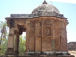
Restored Hindu Shrine at Kaleshwari, Gujarat, India.jpg
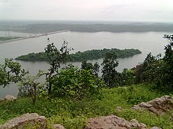
KADANA DAM WATER RESERVOIR AT KADANA PANCHMAHALS - panoramio.jpg
Temple with a Dome, Kaleshwari
Bottom: Kadana Dam
Mahisagar district
Interactive Map Outlining Mahisagar District
Mahisagar in Gujarat (India).svg
Location in Gujarat
Coordinates: 23°9′N73°39′E / 23.150°N 73.650°E / 23.150; 73.650
CountryFlag of India.svg  India
State Gujarat
HeadquartersLuneshvari
Established15 August 2013
Named for Mahi River
Government
  Type District Panchayat
Area
  Total2,260.64 km2 (872.84 sq mi)
Population
 (2011)
  Total994,624
  Density440/km2 (1,100/sq mi)
Languages
  Official Gujarati, Hindi, English
Time zone UTC+5:30 (IST)
PIN
389230
Telephone code+912674
Vehicle registration GJ-35
Website mahisagar.nic.in

Mahisagar district is a district in the state of Gujarat in India that came into being on 26 January 2013, becoming the 28th district of the state. The district has been carved out of the Panchmahal district and the Kheda district. District Name Mahisagar given from "Mahi River". [1] Lunawada is the district headquarters of Mahisagar. It started its operation in full-fledged from 15 August 2013.
Contents

Demographics

At the time of the 2011 census, Mahisagar district had a population of 9,94,624, of which 105,987 (10.66%) lived in urban areas. Mahisagar had a sex ratio of 947 females per 1000 males. Scheduled Castes and Scheduled Tribes make up 50,862 (5.11%) and 350,217 (35.21%) of the population respectively. [2] [3]

Religions in Mahisagar district (2011) [4]
ReligionPercent
Hinduism
93.85%
Islam
5.89%
Other or not stated
0.26%

Hindus are in majority with 933,421, while Muslims are 58,546. [4]

Gujarati is the predominant language, spoken by 98.95% of the population. [5]

Politics

DistrictNo.ConstituencyNamePartyRemarks
Mahisagar 122 Lunawada Gulabsinh Chauhan Indian National Congress
123 Santrampur (ST) Dr. Kuberbhai Dindor Bharatiya Janata Party

MoS

Geographic Profile [6]

SR. NOTALUKAAREA (HECTARE)NO. VILLAGEDISTA. FROM DIST. HEAD QUARTERLAND UNDER CULTIVA-TION (HECTARE)FOREST
1 Balasinor 30159474726186.002,559.00
2 Kadana 402551363625449.009,570.00
3Khanpur27833863017710.008,071.00
4 Lunawada 51645243070658.009,146.00
5 Santrampur 547161533230624.0011,060.00
6 Virpur 21456523014483.001,071.00
Total2,26,0647171,85,110.0013,497.20

Related Research Articles

<span class="mw-page-title-main">Panchmahal district</span> District of Gujarat in India

Panchmahal, also rendered as Panch Mahal, is a district in the eastern portion of Gujarat State western India. Panch-mahal means "five tehsils/talukas", and refers to the five sub-divisions that were transferred by the Maharaja Jivajirao Scindia of Gwalior State to the British: Godhra, Dahod, Halol, Kalol and Jhalod, Devgadh Baria. The district had a population of 2,390,776 of which 12.51% were urban as of 2001.

<span class="mw-page-title-main">Narmada district</span> District of Gujarat in India

Narmada district is an administrative district in the state of Gujarat in India. The district headquarters are located at Rajpipla. The district is bounded by Vadodara and Chhota Udaipur districts in the north, by Nandurbar district of Maharashtra state in the east, by Surat and Tapi districts in the south and by Bharuch district in the west. The district occupies an area of 2,755 km² and has a population of 590,297. It was 10.44% urban as of 2011. As of 2011, it is the third least populous district of Gujarat, after Dang and Porbandar.

<span class="mw-page-title-main">Ahmedabad district</span> District of Gujarat in India

Ahmedabad district comprises the city of [Amdavad], in the central part of the state of Gujarat in western India. It is the seventh most populous district in India.

<span class="mw-page-title-main">Gandhinagar district</span> District of Gujarat in India

Gandhinagar district is an administrative division of Gujarat, India, whose headquarters are at Gandhinagar, the state capital. It was organized in 1964.

<span class="mw-page-title-main">Anand district</span> District of Gujarat in India

Anand District is an administrative district of Gujarat state in western India and whose popular nickname is Charotar. It was carved out of the Kheda district in 1997. Anand is the administrative headquarters of the district. It is bounded by Kheda District to the north, Vadodara District to the east, Ahmedabad District to the west, and the Gulf of Khambhat to the south. Major towns are Umreth, Khambhat, Karamsad, Tarapur, Petlad, Borsad and Sojitra.

<span class="mw-page-title-main">Patan district</span> District in Gujarat, India

Patan district is one of the 33 districts of Gujarat state in western India. Its main city is Patan. This district is located in northern Gujarat and bounded by Banaskantha district in the north and northeast, Mehsana district in the east and southeast, Surendranagar district in the south and Kutch District and the Kutch nu Nanu Ran in the west. The district occupies an area of 5792 km2.

<span class="mw-page-title-main">Kheda district</span> District of Gujarat in India

Kheda District is one of the thirty-three districts of Gujarat state in western India. It is part of the region known as Charotar, consisting of Kheda and Anand districts.. Its central city Nadiad is the administrative headquarters of the district.

<span class="mw-page-title-main">Junagadh district</span> District of Gujarat in India

Junagadh district is a district of the Indian state of Gujarat. Its administrative headquarters is the city of Junagadh.

<span class="mw-page-title-main">Bhavnagar district</span> District in Gujarat, India

Bhavnagar District is a district of southeastern Gujarat, India, on the Saurashtra peninsula. The administrative headquarters is in the town of Bhavnagar.

<span class="mw-page-title-main">Dahod district</span> District of Gujarat in India

Dahod district is a district of Gujarat state in western India. This largely tribal district is mostly covered by forests and hills.

<span class="mw-page-title-main">Porbandar district</span> District of Gujarat in India

Porbandar district is one of the 33 districts of Gujarat state in western India. The district covers an area of 2,316 km2. It had a population of 5.85,449 of which 48.77% were urban as of the 2011 census. This district was carved out of Junagadh district. It lies on the Kathiawar peninsula. Porbandar city is the administrative headquarters of this district. This district is surrounded by Jamnagar district and Devboomi Dwarka to the north, Junagadh district and Rajkot district to the east and the Arabian Sea to the west and south.

<span class="mw-page-title-main">Rajkot district</span> District of Gujarat in India

Rajkot district is one of the 33 districts of the Indian state of Gujarat. Located in Saurashtra peninsula, Rajkot city is the administrative headquarters of the district. It is the third-most advanced district in Gujarat and the fourth most populus.

<span class="mw-page-title-main">Vadodara district</span> District of Gujarat, India

Vadodara district, also known as Baroda district, is situated in the eastern part of the state of Gujarat in western India. The administrative headquarters of the district is the city of Vadodara (Baroda). The district covers an area of 7,794 km2 and had a population of 4,165,626 as of 2011. Out of this population, 49.6% were urban, 50.4% were rural, 5.3% were Scheduled Castes and 27.6% were Scheduled Tribes. As of 2011, Vadodara district is the third most populous district of Gujarat, out of 33 districts in the state.

<span class="mw-page-title-main">Tapi district</span> District of Gujarat in India

Tapi district is one of the 33 districts of Gujarat state in western India. It has seven talukas Vyara, Songadh, Nizar, Valod, Uchhal, Dolavan, Kukarmunda. Vyara town is the district headquarters. Tapi has 523 villages and two municipalities. The district was formed in 2007 out of some talukas that were separated from Surat district.

<span class="mw-page-title-main">Morbi district</span> District of Gujarat in India

Morbi district is in the state of Gujarat, India. It was formed on August 15, 2013, along with several other districts, on the 67th Independence Day of India. Morbi city is the administrative headquarters of the district. The district has 5 talukas - Morbi, Maliya, Tankara, Wankaner and Halvad. Morbi city is the administrative headquarters of Morbi district. The town of Morbi is situated on the Machchhu River, 35 km from the sea and 60 km from Rajkot. As per 2011 census data, the city had a population of 2,10,451 and average literacy rate of 83.64%.

<span class="mw-page-title-main">Chhota Udaipur district</span> District of Gujarat in India

Chhota Udaipur district is a district in the state of Gujarat in India. It was carved out of the Vadodara district on 26 January 2013 with its headquarters at Chhota Udaipur town and is the 28th district of Gujarat.

<span class="mw-page-title-main">Aravalli district</span> District of Gujarat in India

Aravalli district is a district in the state of Gujarat in India that came into being on August 15, 2013, becoming the 29th district of the state. The district has been carved out of the Sabarkantha district. The district headquarters are at Modasa.

<span class="mw-page-title-main">Botad district</span> District of Gujarat in India

Botad District is a district of the state of Gujarat, India. It was created on 15 August 2013 from the southwestern part of Ahmedabad District and the northwestern part of Bhavnagar District. Botad consist of four talukas: Botad, Gadhada, Barvala, Ranpur. Botad city is the administrative headquarters of the district.

<span class="mw-page-title-main">Devbhumi Dwarka district</span> District of Gujarat in India

Devbhumi Dwarka District is a district of India located on the southern coast of the Gulf of Kutch in the state of Gujarat. Its headquarters are located in the city of Jamkhambhaliya. The district was created on 15 August 2013 from Jamnagar district.

<span class="mw-page-title-main">Gir Somnath district</span> District of Gujarat in India

Gir Somnath is a district of Gujarat, India. It is located on the southern corner of the Kathiawar peninsula with its headquarters at the city of Somnath.

References

  1. "Mahisagar now a district in Gujarat". DNA. 14 August 2013. Retrieved 14 August 2013.
  2. "District Census Hand Book – Kheda" (PDF). Census of India . Registrar General and Census Commissioner of India.
  3. "District Census Hand Book – Panchamahal" (PDF). Census of India . Registrar General and Census Commissioner of India.
  4. 1 2 "Population by Religion - Gujarat". censusindia.gov.in. Registrar General and Census Commissioner of India. 2011.
  5. "Table C-16 Population by Mother Tongue: Gujarat". censusindia.gov.in. Registrar General and Census Commissioner of India.
  6. "About Mahisagar". Collectorate - District Mahisagar, GOVERNMENT OF GUJARAT. Retrieved 19 April 2023.