
Amreli district is one of the 33 administrative districts of the state of Gujarat in western India. The district headquarters are located at Amreli. The district occupies an area of 6,760 km2 and has a population of 1,514,190 of which 22.45% were urban. Amreli is the land of Yogiji Maharaj, Danbapu, Sage Muldas, Sage Bhojalrambapa, Sage Muktanand Swami, Magician K.Lal, Zaverchand Megahani's place (Bagasara), Dr. Jivaraj Mehata etc. Amreli covers Gir National forest sanctuary area. Now it is developing as a Hub of Education.

Banswara is a city in Banswara District in south Rajasthan in India. It is named for the "bans" or bamboo forests in the area.

Palanpur is a city and a municipality of Banaskantha district in the Indian state of Gujarat. Palanpur is the administrative headquarters of the district. Palanpur is the ancestral home to an industry of Indian diamond merchants.
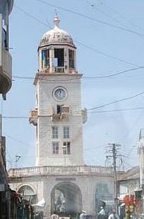
Amreli is a city and a municipality in Amreli district in Indian state of Gujarat.

Rewa Kantha was a political agency of British India, managing the relations of the British government's Bombay Presidency with a collection of princely states. It stretched for about 150 miles between the plain of Gujarat and the hills of Malwa, from the Tapti River to the Mahi River crossing the Rewa River, from which it takes its name.

Bhadran is a village in the state of Gujarat, in far western India. It is in the Anand district. Bhadran was nicknamed the "Paris of Gaekwad state" due to its prosperity and civil works carried out by Maharaja Sayajirao Gaekwad III, the visionary ruler of Baroda. It has been called the greatest village in India by Vallabhbhai Patel.
Meghraj is a town in the Indian state of Gujarat.

Tharad is a town in Tharad taluka in the Banaskantha district of the state of Gujarat in India. It is the administrative center of Tharad taluka. Tharad is near the border of Gujarat, 40 km from the border with Pakistan and 15 km from the Indian state of Rajasthan. The town was a princely state ruled by the Rajputs, and the majority of its population follow the religion of Hinduism. Its main industries are agriculture and diamond polishing. It is one of the first major towns in Gujarat on National Highway 15.
Anjar assembly constituency is one of the 182 assembly constituency of Gujarat. It is located in Kutch District
Deesa assembly constituency is one of the 182 assembly constituency of Gujarat. It is located in Banaskantha District.
Deodar assembly constituency is one of the 182 assembly constituencies of Gujarat. It is located in Banaskantha District.
Radhanpur Vidhan Sabha constituency is one of the 182 assembly constituencies in Gujarat state in India. It is one of the seven seats which make up Patan. It is located in Patan District. Currently, Raghunath Desai of INC is the Member of Legislative Assembly from Radhanour. However, Khodidan Bhimji Zula of INC holds the record of winning the assembly by maximum votes (50,574) in the 1985 Gujarat Vidhansabha Election. Khodidan Zula served as the Member of Legislative Assembly of Radhanpur from 1975-2007, also holding the record of winning the assembly most number of times.
Jamnagar Gramya assembly constituency is one of the 182 assembly constituency of Gujarat. It is located in Jamnagar District.
Mahuva assembly constituency is one of the 182 assembly constituency of Gujarat. It is located in Bhavnagar District.
Santrampur-123 assembly constituency is one of the 182 assembly constituencies of Gujarat. It is located in Mahisagar district. This seat has been reserved for member of Scheduled Tribes.
Fatepura is a village in Dahod district, Gujarat, India.Fatepura assembly constituency is one of the 182 assembly constituencies of Gujarat. It is located in Dahod district, Gujarat, India. This seat is reserved for members of Scheduled Tribes. This seat came into existence after 2008 delimitation.
Jhalod assembly constituency is one of the 182 assembly constituencies of Gujarat. It is located in Dahod district. This seat is reserved for members of Scheduled Tribes.
Chhota Udaipur assembly constituency is one of the 182 assembly constituencies of Gujarat. It is located in Chhota Udaipur district. This seat is reserved for a member of Scheduled Tribes. It is the capital of Chhota Udepur district.
Jetpur assembly constituency is one of the 182 assembly constituencies of Gujarat. It is located in Chhota Udaipur district. This seat is reserved for member of Scheduled Tribes. After the 2017 Vidhaansabhad Elections, Jayantibhai Rathwa (BJP) was dethroned by SUKHRAM RATHWA (INC)
Bhuj assembly constituency is one of the 182 assembly constituencies of Gujarat. It is one of the seven seats which make up Kachchh. It is located in Kutch district.

