
Gandhinagar is the capital of the state of Gujarat in India. Gandhinagar is located approximately 23 km north of Ahmedabad, on the west central point of the industrial corridor between the metropolitan cities of Delhi and Mumbai.

Godhra is a municipality in Panchmahal district in Indian state of Gujarat. It is the administrative headquarters of the Panchmahal district. Originally the name came from gou which means "cow" and dhara- which have two meanings depending on how you pronounce the word: 'dharaa' means a feminine thing or person that "holds" something and it usually means"land", and the other pronunciation is 'dhaaraa' in which means "flow". However, the second pronunciation is not popular nor is usually associated with this word. Hence, 'Godhra or Godharaa' means the Land of the Cow.

Dhar is a city located in Dhar district of the Malwa region in the state of Madhya Pradesh, India. The city is the administrative headquarters of the Dhar district. Before Indian independence from Great Britain, it was the capital of the Dhar princely state.

Bhandara District is an administrative district in the state of Maharashtra in India. The district headquarters are located at Bhandara. The district occupies an area of 3717 km2 and has a population of 1,200,334, of which 19.48% are urban as of 2011. The growth rate of Bhandara is 5.56% Bhandara has a mixed economy with agriculture, industries and forest resources. Bhandara is known for its large production of rice. Tumsar, a tahsil town, is a noted rice market. Bhandara town is also known as "Brass City" owing to the presence of a large brass products industry. Bhandara has several tourist destinations, like Ambagad Fort, Brahmi, Chinchgad, and Dighori.
Jalna district is an administrative district in the state of Maharashtra in western India. Jalna town is the district headquarters. The district is part of Aurangabad division.

Ayodhya district is one of the 75 districts in the northern Indian state of Uttar Pradesh. The city of Ayodhya is its administrative headquarters. The district occupies an area of 2,522 square kilometres (974 sq mi), and had a population of 2,470,996 in the 2011 census. Ayodhya district shares its borders with 6 districts of Uttar Pradesh. It is bordered by Gonda and Basti districts on the northern side, Amethi and Sultanpur districts on the south, and Ambedkar Nagar and Barabanki districts share the border on the east and west.

Satna is a city in the Indian state of Madhya Pradesh. It serves as the headquarters of Satna district. It is 7th largest city and 8th most populous city of the state. The city is 500 km east of the state capital Bhopal. The city is distributed over a land area of 111.9 square kilometres.
Wardha District is in the state of Maharashtra in western India. This district is a part of Nagpur Division. The city of Wardha is the administrative headquarter of the district. Hinganghat, Pulgaon, Arvi and Wardha are the major cities in the District. The District had a population of 1,300,774, of which 26.28% were urban as of 2011.

Mehsana district is one of the 33 districts of Gujarat state in western India. Mehsana city is the administrative headquarters of this district. The district has a population of over 1.8 million and an area of over 4,500 km2. There are over 600 villages in this district with a population of 2,035,064 of which 22.40% were urban as of 2011.
Navsari is the ninth biggest city in the state of Gujarat in India. It is the administrative headquarters of Navsari District. Navsari is situated between Surat & Mumbai. Navsari is a twin city of Surat. It is located 37 km south of Surat. As per 2011 Census of India, Navsari is 16th biggest city of Gujarat state. It ranked 10th most populous city of Gujarat in 1991 Census of India and 2001 Census of India. Navsari is the 25th cleanest city of India according to the Swachh Bharat Urban mission. Dandi village near Navsari was the focal point of the great Salt March led by Mahatma Gandhi during civil disobedience movement of India.

Rajkot district is one of the 33 districts of the Indian state of Gujarat. Located in Saurashtra peninsula, Rajkot city is the administrative headquarters of the district. It is the third-most advanced district in Gujarat and the fourth most populus.

Vadodara district, also known as Baroda district, is situated in the eastern part of the state of Gujarat in western India. The administrative headquarters of the district is the city of Vadodara (Baroda). The district covers an area of 7,794 km2 and had a population of 4,165,626 as of 2011. Out of this population, 49.6% were urban, 50.4% were rural, 5.3% were Scheduled Castes and 27.6% were Scheduled Tribes. As of 2011, Vadodara district is the third most populous district of Gujarat, out of 33 districts in the state.
Chhatrapur (ଛତ୍ରପୁର) is a town and a Municipality in Ganjam district in the state of Odisha, India.
Dhandhuka is a city and a municipality in the Ahmedabad district in the state of Gujarat, India. Moreover, it is a part of the Bhal region.
Nimapada is a town and a Notified Area Council (NAC) in Puri district on the way to Konark and 40 km from the state capital Bhubaneswar in the Indian state of Odisha.
Phulpur is a town area in Prayagraj district in the Indian state of Uttar Pradesh. It is known for being the Lok Sabha seat from which Jawaharlal Nehru got elected to the Indian Parliament. Phulpur also hosts a Vidhan Sabha seat.
Sarangpur is a city and tehsil in Rajgarh district in the Indian state of Madhya Pradesh. It is situated at the bank of the river Kali Sindh.
Raver is a city and municipal council in Jalgaon district in the Indian state of Maharashtra. It is the administrative center of Raver Taluka. Raver is famous for the Bhagvan Dattatreya-temple which is 200 years old and was founded by Sachidanand Swami Maharaj. Built in the old Mughal Kaleen tradition, it also has some ancient photos of Bhagvan Dattreyay in form of Malaang Fakir, Bhagwan Dattreyay's Charan Paduka. It is part of the Khandesh region or North Maharashtra region.

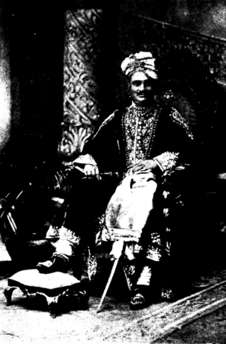
Vadodara is one of the 26 Lok Sabha constituencies in Gujarat, a state in Western India. This constituency covers 7 out of 10 Vidhan Sabha constituencies of Vadodara district and first held elections in 1957 as Baroda Lok Sabha constituency in erstwhile Bombay State. It has been known as Vadodara since the 2009 elections. Its first member of parliament (MP) was Fatehsinghrao Gaekwad of the Indian National Congress (INC) who was also re-elected in the next elections in 1962. He was the Maharaja of Baroda of the Gaekwad dynasty at the time. P. C. Patel of the Swatantra Party won the election in 1967. From 1971–80, Gaekwad was MP of this constituency again firstly as a member of the Indian National Congress (Organisation) and then as a member of the INC. His younger brother, Ranjitsinh Pratapsinh Gaekwad also of the INC represented the constituency from 1980–89 for two terms before being defeated by Prakash Brahmbhatt of the Janata Dal party in the 1989 election.
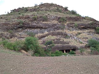
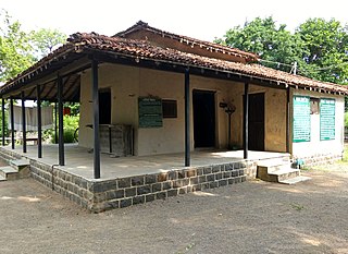
The Kingdom of Santrampur or later Sant State was a kingdom and later a princely state in subsidiary alliance with British India. It was ruled by Mahipavat branch of the Paramara dynasty.


