Betul, Madhya Pradesh

Last updated

Betul
City
baalaajiipurm mNdir.jpg
Shri Balajipuram Tample
Madhya Pradesh location map.svg
Red pog.svg
Betul
Coordinates: 21°54′18″N77°54′07″E / 21.905°N 77.902°E / 21.905; 77.902
CountryFlag of India.svg  India
State Madhya Pradesh
District Betul
Government
  TypeMunicipal Council
  BodyMunicipal Council Betul
Area
  Total193 km2 (75 sq mi)
Elevation
658 m (2,159 ft)
Population
 (2011)
  Total153,330
  Density790/km2 (2,100/sq mi)
Languages
  Official Hindi
Time zone UTC+5:30 (IST)
ISO 3166 code IN-MP
Vehicle registration MP-48
Website betul.nic.in

Betul is Municipal Council town in Madhya Pradesh, India. It is the administrative head-quarter of Betul district and forms the southernmost part of the Narmadapuram Division.

Contents

Name

During the early 20th century, Betul was known as Badnur. [1] It derives its present name from a small town called Batul Bazaar about 5 km (3 mi) to its south. The qord Betul —literally mean "without" (be) "cotton" (tool) it was referred for its position outside the area's cottonfields.

History

Balajipuram Temple in Betul Balajipuram BETUL.jpg
Balajipuram Temple in Betul

Nearby fort called Kherla Quila was formerly the seat of an independent kingdom in the medieval and early modern period. [2] Under Company Rule, its fort was permitted to fall into ruin. [3] Badnur became the headquarters of Betul District in 1822. Surrounded by hills on all sides, it was used by the British for the exportation of coal. [4] It supported two bazaars; the larger, Kothi Bazar, held 2015 people in the 1870s. [2] At that time, the town had a circuit house, a dak bungalow, a caravanserai, jail, police station, pharmacy, and schools. [2] Its population c.1901 was 3766. [1]

Following independence, Betul lay near the geographical center point of the new country, which is now marked by a stone at Barsali. Betul was connected to the Delhi–Chennai line of the Indian rail network in the early 1950s. It now serves as a junction point, providing the access to the Chhindwara District on broad-gauge rail Biggest City in India .

Geography

Betul is located at 21°55′N77°54′E / 21.92°N 77.9°E / 21.92; 77.9 , [5] near the geographical center point of modern India. It has an average elevation of 658 m (2,159 ft).

Climate

Climate data for Betul, Madhya Pradesh (1981–2010, extremes 1948–2012)
MonthJanFebMarAprMayJunJulAugSepOctNovDecYear
Record high °C (°F)34.9
(94.8)
37.8
(100.0)
42.3
(108.1)
43.7
(110.7)
48.0
(118.4)
44.5
(112.1)
38.6
(101.5)
33.6
(92.5)
35.5
(95.9)
36.8
(98.2)
35.0
(95.0)
32.7
(90.9)
48.0
(118.4)
Mean daily maximum °C (°F)27.4
(81.3)
30.1
(86.2)
34.6
(94.3)
38.7
(101.7)
40.3
(104.5)
35.7
(96.3)
29.2
(84.6)
27.6
(81.7)
29.8
(85.6)
31.1
(88.0)
29.1
(84.4)
27.8
(82.0)
31.8
(89.2)
Mean daily minimum °C (°F)10.5
(50.9)
11.9
(53.4)
16.1
(61.0)
20.6
(69.1)
24.7
(76.5)
24.4
(75.9)
22.5
(72.5)
21.8
(71.2)
21.1
(70.0)
17.3
(63.1)
13.4
(56.1)
10.2
(50.4)
17.9
(64.2)
Record low °C (°F)−0.2
(31.6)
1.1
(34.0)
2.3
(36.1)
10.6
(51.1)
16.6
(61.9)
14.9
(58.8)
14.5
(58.1)
13.1
(55.6)
10.5
(50.9)
5.0
(41.0)
2.6
(36.7)
1.3
(34.3)
−0.2
(31.6)
Average rainfall mm (inches)13.8
(0.54)
14.2
(0.56)
19.7
(0.78)
6.9
(0.27)
13.3
(0.52)
144.5
(5.69)
330.1
(13.00)
371.7
(14.63)
189.8
(7.47)
57.8
(2.28)
20.6
(0.81)
8.6
(0.34)
1,191
(46.89)
Average rainy days1.11.51.40.70.98.015.215.58.83.21.70.858.7
Average relative humidity (%) (at 17:30 IST)44342520245377847460524750
Source: India Meteorological Department [6] [7]

Demographics

During the 2011 Indian census, Betul had a population of 103,330. Males constitute 51.12% of the population, females 48.88%. Betul has an average literacy rate of 89.28%, higher than the national average of 74.04%. 10.82% of the population is under 6 years of age. [8]

Economy

Betul District's economy is predominantly an agrarian one. Its dense woods also permit forestry.[ citation needed ]

Transport

Betul railway station Betul rali stn..jpg
Betul railway station

Betul is connected to the broad-gauge Delhi–Chennai (Grand Trunk) line of the Indian rail network, which also communicates with Bhopal and Nagpur.

Betul is serviced by National Highway 46 connecting it with Bhopal and Nagpur. National Highway 47 connects it to Indore.

The nearest airports are at Nagpur and Bhopal, both about 180 km (112 mi) away.

Education

In Betul, there are total 72 number of colleges. Some main colleges are as follows [9]

In Betul, there are many schools for primary and secondary education. Some of the main schools are

Related Research Articles

<span class="mw-page-title-main">Amravati</span> City in Maharashtra, India

Amravati is the second largest city in the Vidarbha region and ninth largest city in Maharashtra, India. It is administrative headquarters of Amravati district and Amravati division which includes Akola, Buldhana, Washim, and Yavatmal districts. It is one of Maharashtra's nominated cities under Smart Cities Mission.

<span class="mw-page-title-main">Hoshangabad</span> City in Madhya Pradesh, India

Hoshangabad, officially Narmadapuram, is a city in the Indian state of Madhya Pradesh. It serves as the headquarters of both Hoshangabad district and Narmadapuram division. It is located in central India, on the south bank of the Narmada River. Hoshangabad is 76.7 km (47.7 mi) from the capital of Madhya Pradesh and the nearest airport Bhopal.

Harda is a city and a municipality in Harda district in the Indian state of Madhya Pradesh. Harda is the administrative headquarters of Harda.

<span class="mw-page-title-main">Datia</span> City in Madhya Pradesh, India


Datia is the district headquarter of the Datia District in north central Madhya Pradesh,a state of Central India. It is an ancient town, mentioned in the Mahabharata ruled by King Dantavakra. The city is 78 km from Gwalior, 325 km south of New Delhi and 344 km north of Bhopal. About 18 km from Datia is Sonagiri, a sacred Jain hill. Datia is also about 31 km from Jhansi and 52 km from Orchha. The nearest airport is at Gwalior. It was formerly the seat of the eponymous princely state in the British Raj. Datia is situated near Gwalior and on the border with Uttar Pradesh.
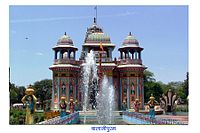
Wardha is a city and a municipal council in Wardha district in the Indian state of Maharashtra. The administrative headquarter of Wardha district is situated here. Wardha gets its name from the Wardha River which flows on the northern, western and southern boundaries of the district. Founded in 1866, the town is now an important centre for cotton trade. Wardha was an important part of the Gandhian era.

Rajnandgaon is a city in Rajnandgaon District, in the state of Chhattisgarh, India. As of the 2011 census the population of the city was 163,122. Rajnandgaon district came into existence on 26 January 1973, as a result of the division of Durg district.

Chhindwara is a city in India and a Municipal Corporation in Chhindwara district in the Indian state of Madhya Pradesh. The city is the administrative headquarters of Chhindwara District. Chhindwara is reachable by rail or road from adjacent cities Betul, Jabalpur and Nagpur. The nearest airport is in Nagpur (130 km); however there is a small airport located in the city which is not serviceable for passenger planes.

<span class="mw-page-title-main">Amravati district</span> District of Maharashtra in India

Amravati district is a district of Maharashtra state in central India. It is the administrative headquarter of Amravati division, which is one of the two divisions in Vidarbha, out of total 6 regions in state of Maharashtra.

Mandla is a city with municipality in Mandla district in the Indian state of Madhya Pradesh. It is the administrative headquarters of Mandla District. The city is situated in a loop of the Narmada River, which surrounds it on three sides, and for 15 miles between Mandla and Ramnagar, Madhya Pradesh the river flows in a deep bed unbroken by rocks. The Narmada is worshiped here, and many ghats have been constructed on the banks of the river. It was a capital of the Gondwana Kingdom who built a palace and a fort, which in the absence of proper care have gone to ruins.

<span class="mw-page-title-main">Yavatmal</span> City in Maharashtra, India

Yavatmal ( is a city and municipal council in the Indian state of Maharashtra. It is the administrative headquarters of Yavatmal District. Yavatmal is around 90 km away from divisional headquarters Amravati while it is 670 km away from the state capital Mumbai and 150 km south west of Nagpur. Yavatmal District is on 2nd position in India after Kolkata and known for its unique Navratri festival celebration, and nearly total 2,766+ durga mata is installed in the whole district. Yavatmal is known for organising huge celebration events for Navratri.

<span class="mw-page-title-main">Itarsi</span> City in Madhya Pradesh, India

Itarsi is a city and municipality in Narmadapuram in Madhya Pradesh, India. Itarsi is a key hub for agricultural goods and is the biggest railway junction in Madhya Pradesh. Rail services from all 4 major metropolitan cities of India namely Mumbai to Kolkata and Delhi to Chennai pass through Itarsi. Itarsi has large number of agro-based industries and warehouses. Itarsi got its name by "eeta(eent)", and "rassi",. Bricks and ropes had been made earlier in itarsi. It has an Ordnance Factory. The Bori Wildlife Sanctuary and Tawa Dam are nearby.

<span class="mw-page-title-main">Seoni, Madhya Pradesh</span> City in Madhya Pradesh, India

Seoni is a city and a municipality in Seoni district in the Indian state of Madhya Pradesh. This tribal household dominated district was formed in the year 1956.

<span class="mw-page-title-main">Raigarh</span> City in Chhattisgarh, India

Raigarh is a city in northern Chhattisgarh known as the 'Cultural capital of Chhattisgarh'; Raigarh is famous for its dance form “Kathak” and classical music; Raigarh is also known as Sanskritidhani.

<span class="mw-page-title-main">Parbhani</span> City in Maharashtra, India

Parbhani is a city in Maharashtra state of India. It is the administrative headquarters of Parbhani District. Parbhani is one of the largest cities in Marathwada region. Parbhani is around 200 kilometres (120 mi) away from regional headquarters of Aurangabad while it is 491 km (305 mi) away from the state capital Mumbai.

Pusad is a city in the Yavatmal district located in Vidarbha region of Maharashtra state of India. It is named after the Pus river. Its ancient name was 'Pushpawanti'. Pusad is second largest city of Yavatmal district. For last 20 years Pusad is being tried to be promoted to the stature of district but due to lack of administration of governing bodies it is only a dream of the people.

Anjangaon is a city and a municipal council in Amravati district in the state of Maharashtra, India. Anjangaon City got the status of Municipal Council in 1930. It is the first municipal council established in Amravati district and the second biggest council as well. Anjangaon Surji Tehsil was established in 1981. It is technically made up of two main zones, Anjangaon and Surji, on either side of Shahanur River, and is called Anjangaon-Surji in combination. It is called a "Banana Hub of Vidarbha" as it is a large producer of bananas and a hub of medicinal plants - Piper longum and Safed musali.

Bhainsdehi is a city and a Nagar Parishad in Betul district in the state of Madhya Pradesh, India. Kukru is the second highest point of Mahadeo hills. Bhainsdehi is the originating place of the river Purna. It is predominantly a tribal tehsil. Bhainsdehi is surrounded by the mountain ranges of Satpura. Prachin Shiv mandir one of the most beautiful place in Bhainsdehi city

Narkhed is a town and a municipal council in Nagpur district in the Indian state of Maharashtra. It is about 87 km north-west of Nagpur. It is the administrative headquarters of Narkhed taluka, one of the 14 talukas of this district. It is located in the "orange belt" and is a major center for orange-trading.

<span class="mw-page-title-main">Sundar Nagar</span> A town in Himachal Pradesh, India

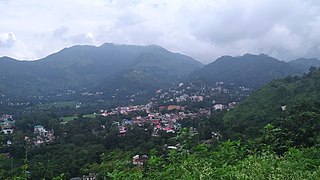
Sundar Nagar is a town and a municipal council in Mandi district in the Indian state of Himachal Pradesh. It was formerly a princely state, known as Suket.

Amla is a municipality located in Betul district in the Indian state of Madhya Pradesh. It is the administrative center and only municipality of the Amla Subdivision.

References

  1. 1 2 EB (1911).
  2. 1 2 3 EB (1878), p. 228.
  3. EB (1878), p. 229.
  4. "betul history". betul.nic.in. GOVERNMENT OF MADHAYA PRADESH. Retrieved 24 November 2019.
  5. Falling Rain Genomics, Inc - Betul
  6. "Station: Betul Climatological Table 1981–2010" (PDF). Climatological Normals 1981–2010. India Meteorological Department. January 2015. pp. 123–124. Archived from the original (PDF) on 5 February 2020. Retrieved 28 December 2020.
  7. "Extremes of Temperature & Rainfall for Indian Stations (Up to 2012)" (PDF). India Meteorological Department. December 2016. p. M115. Archived from the original (PDF) on 5 February 2020. Retrieved 28 December 2020.
  8. "Census of India 2011: Data from the 2001 Census, including cities, villages and towns (Provisional)". Census Commission of India. Archived from the original on 16 June 2004. Retrieved 1 November 2008.
  9. "District Administration Betul" (PDF). District Administration Betul.

Sources