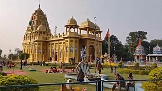
Betul is Municipal Council town in Madhya Pradesh, India. It is the administrative head-quarter of Betul district and forms the southernmost part of the Narmadapuram Division.

Malda, also known as English Bazar, is a city in the Indian state of West Bengal. It is the sixth largest city in West Bengal. It is the headquarters of the Malda district as well as of the Malda division of West Bengal. It consists of two municipalities, viz. English Bazar Municipality and Old Malda Municipality, under Malda Metropolitan Area. The city is located on the banks of the Mahananda River. Malda was an undeveloped city which was enlarging from 1925 to 1930. The city is growing rapidly nowadays with its population inching towards half a million.
Bandhgora is a census town in the Chas CD block in the Chas subdivision of the Bokaro district in the state of Jharkhand, India.
Banmankhi Bazar is a town and a notified area in Purnia district in the state of Bihar, India.
Bhatni Bazar is a town and a Nagar Panchayat in the Deoria district in the Indian state of Uttar Pradesh. It is the capital of the Development block Bhatni.

Dugda is a census town in the Chandrapura CD block in the Bermo subdivision of the Bokaro district in the state of Jharkhand, India. It is a small township, constructed during the 1970s, situated under the foot of several small hills. Residents of the township are primarily employees of Dugda Coal Washery under Bharat Coking Coal Limited (BCCL).
Gomoh (better known as Netaji Subhash Chandra Bose Junction Gomoh) is a census town in Topchanchi CD Block Dhanbad Sadar subdivision of Dhanbad district in the Indian state of Jharkhand. It has a major railway junction, which was renamed Netaji Subhas Chandra Bose Gomoh railway station on 23 January 2009, that is situated on the Grand Chord Line under the Dhanbad division of the East Central Railway. Gomoh is the meeting point for trains coming from Howrah, Ranchi/Bokaro and Puri/Bhubaneswar.
Isri is a census town in the Dumri CD block in Dumri sub-division of Giridih district in the Indian state of Jharkhand.
Jaleswar is a town located in the Balasore district of Odisha, in India. It consists of 144 villages, with four major areas: Bada Bazar, Nua Bazar, Station Bazar, and Purana Bazar. Jaleswar is considered one of the new municipalities in the state, and Jaleswar forms a state assembly constituency along with Balipal Block.
Jaridih Bazar is a census town in the Bermo CD block in the Bermo subdivision of the Bokaro district in the Jharkhand state, India.
Kalara is a census town in Domjur CD Block of Howrah Sadar subdivision in Howrah district in the Indian state of West Bengal. It is a part of Kolkata Urban Agglomeration.
Karjan is a city and a municipality in Vadodara district in the Indian state of Gujarat.It is a junction of Indian railway.Karjan is known for Shri Shankheshwar Parshwanath Jain Tirth at Anastu and Sumeru Navkar Jain Tirth - The Golden Temple. Karjan is Famous for it's Saree Market where many people comes for purchase from various places.Karjan is also famous for it's Snacks Like samosa, Khaman, Sev-Khamni, Gota, etc.Mainly Two markets in Karjan which are Nava bazar and Juna bazar in which Nava bazar is biggest market which has APMC MARKET.
Kurpania is a census town in the Bermo CD block in the Bermo subdivision of the Bokaro district in the Indian state of Jharkhand.

Mahiari is a census town in Domjur CD Block of Howrah Sadar subdivision in Howrah district in the Indian state of West Bengal. It is a part of Kolkata Urban Agglomeration.
Morshi is the second largest town in the Amravati district of Maharashtra, India. It is located 55 km north-east of Amravati, situated very close to the border with Madhya Pradesh, in the scenic southern foothills of the Satpura ranges. Morshi and the surrounding region is also known for the cultivation of Nagpur oranges and the prominent Nal Damayanti Dam. Salbardi is very near from morshi.
Parsadepur, also spelled Parshadepur, is a town and a nagar panchayat in Rae Bareli district in the Indian state of Uttar Pradesh. It is located on the north bank of the Sai river, at the crossroads between the road from Salon to Jais and the smaller road from Raebareli to Ateha. Historically noted for its large weaving industry, Parsadepur served as the headquarters of a pargana since the late 18th century. As of 2011, its population is 11,853 people, in 1,738 households.

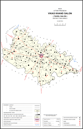
Salon is a town and nagar panchayat in Raebareli district in the Indian state of Uttar Pradesh. It serves as the headquarters of a tehsil as well as a community development block. Originally it was also the headquarters of the entire district, but they were moved after the Indian Rebellion of 1857. It is located a bit to the south of the Sai river, at the junction of the Raebareli-Pratapgarh and Jais-Khaga roads. Other roads lead to Dalmau, Manikpur, and Kunda. To the east is a large jhil.

Uppala is a town and Headquarters of Manjeshwaram Taluk in Kasaragod district, Kerala, India. It is geographically located midway from Kasaragod to Mangalore. Easy geographical access and lack of major towns nearby are the key reasons for the town to develop exponentially, especially in the past decade. The population of Manjeshwaram Taluk alone was over 268,642 as of 2011. Uppala is 22 km north of Kasaragod and one of the fastest growing urban settlements in Kasaragod district. It is well known as an important trade hub in the northernmost part of Kerala state.

Jahanabad is a town and a nagar panchayat in Pilibhit district in the Indian state of Uttar Pradesh. Community Health Center (CHC) is situated near bazar Jagdeeshpur road. CHC is providing health facilities to community. CHC is under department of medical, health & family welfare. CHC Jahanabad is under block Lalaurikhera.

English Bazar is a community development block that forms an administrative division in Malda Sadar subdivision of Malda district in the Indian state of West Bengal.


