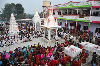
Akodia is a town and a Nagar Panchayat in Shajapur District in the state of Madhya Pradesh, India.
Amanganj is a town and a Nagar Panchayat and a tehsil in Panna district in the state of Madhya Pradesh, India.
Baihar is a town and a Nagar panchayat in Balaghat district in the state of Madhya Pradesh, India. Baihar is famous for various places like Joda Temple, Siyarpath Babamandi and Dhaba temple, also nearest City to Kanha Tiger reserve by Mukki Gate.
Bhikangaon is a village and a nagar parishad in Khargone district in the state of Madhya Pradesh, India.
Pharenda, or Anandnagar, is a city in the Maharajganj district of the province of Uttar Pradesh in northern India. It is located approximately 44 kilometres north of Gorakhpur near the border with Nepal. District of Pharenda is Maharajganj. This is situated on the Buddhist Circuit which is built from Sarnath to Lumbini. It lies on NH-24 and near NH 29. It is about 45 km from Gorakhpur, 40 km from Siddharthnagar, 30 km from Maharajganj and 55 km from Sonauli Indo-Nepal border. This place is named after Seth Anandram Jaypuriya. There is closed sugar Mill which was started in about 1935 and closed in 1995. Near Anand Nagar there is a temple is Durga devi mandir, popularly known as Lehara Devi mandir.
Khirkiya is a town and a nagar panchayat in Harda district in the Indian state of Madhya Pradesh. Khirkiya grain market is one of the biggest grain markets in madhya pradesh and also has record production and selling of grains. Navratri festival of Khirkiya is very famous in all over the country, so many beautiful pandals are created by samiti (community). In more than a dozen places, Durga statues are established. Even people from different cities come to celebrate the festival.
Lahar is a city and a Nagar Palika in Bhind district in the Indian state of Madhya Pradesh.
Mhowgaon is a Nagar Panchayat under Sub Division Dr. Ambedkar Nagar (Mhow) in Indore district in the Indian state of Madhya Pradesh. The total geographical area of Mhowgaon nagar panchayat is 13.5 km2 and it is the smallest city by area in the sub district. The population density of the city is 2309 persons per km2. Mhowgaon is divided into 15 wards for which elections are held every 5 years. Among them, Mhowgaon Ward No. 2 is the most populous ward with a population of 3440 and Mhowgaon Ward No. 15 is the least populous ward with a population of 957. Mhowgaon Nagar Panchayat has total administration over 6,373 houses to which it supplies basic amenities like water and sewerage. It is also authorized to build roads within Nagar Panchayat limits and impose taxes on properties coming under its jurisdiction.
Multai is a town and a Nagar Palika in Betul district in the Indian state of Madhya Pradesh. Multai is one of the southern cities of Madhya Pradesh, occupying almost half of the Satpura plateau. Considering the small villages around, it occupies a large area in width of the Satpura range between the valley of the Narmada on the north and the barer plains on the south. Forests lie to the west of the city between the districts of East Nimar and Amaraoti. It lies on the Northern bank of the Tapti and the place is also known for being the origin of the Tapti river.
Nasrullaganj, also known as Bherunda or Bhairunda, is a nagar panchayat in Sehore district in the Indian state of Madhya Pradesh. The nearest airport is in Bhopal.
Rehti is a city municipality in Sehore District in the Indian state of Madhya Pradesh. Rehti is divided into 15 wards for which elections are held every 5 years.
Satwas is a town and a Nagar Panchayat in Dewas district in the Indian state of Madhya Pradesh. Satwas is around 136.8 km (85.0 mi) from Dewas.
Sewalkhas is a town and a Nagar Panchayat in Meerut district in the Indian state of Uttar Pradesh.
Sohagpur is a town and a nagar panchayat in Narmadapuram district in the Indian state of Madhya Pradesh. It is one of the subdivisions and development blocks in Narmadapuram district. Sohagpur is also one of the legislative constituencies of Madhya Pradesh. Sohagpur is famour for its Betel culture, and an enormous quantity of betel is exported from here.
Unhel is a city in ujjain district in the Indian state of Madhya Pradesh.Unhel is a tehsil of Ujjain district. It is in the Malwa region of western Madhya Pradesh.
Tarana is a town and a nagar parishad in Ujjain district in the Indian state of Madhya Pradesh. Tarana is a tehsil in Ujjain and the distance to Ujjain is 34 km. Tarana was part of Holkar estate. The current M.L.A of Tarana constituency is Mahesh Parmar (INC).
Shahpur is a town and a Nagar panchayat in Burhanpur district in the Indian state of Madhya Pradesh.
Kotar is a town and a Nagar Parishad in Satna district in the Indian state of Madhya Pradesh.

The Malajpur Temple located in the Malajpur(region) near Chicholi in Betul, madhya pradesh, India. The only Ghost fair in the world. every year on the occasion of vashant panchami a fair is conducted on the Tombstone of Hindu Saint "Gurusahab Baba". Where people comes from across the india.

Bisauri is a village of the Jaunpur district, Uttar Pradesh, Northern India. Bisauri's Postal Index Number is 222129 and its post office is at Patrahi. The village is also a Gram Panchayat, comprising itself and the village of Tiwaripur.


