Related Research Articles

Thanjavur is a taluk of Thanjavur district of the Indian state of Tamil Nadu.
Kumbakonam taluk is a taluk of Thanjavur district of the Indian state of Tamil Nadu. The headquarters of the taluk is the town of Kumbakonam.
Papanasam taluk is a taluk of Thanjavur district of the Indian state of Tamil Nadu. The headquarters of the taluk is the town of Papanasam.
Pattukkottai taluk is a taluk of Thanjavur district of the Indian state of Tamil Nadu. The headquarters of the taluk is the town of Pattukkottai. It is the biggest taluk in the district.
Pallipattu taluk is a taluk of Tiruvallur district of the Indian state of Tamil Nadu. The headquarters of the taluk is the town of Pallipattu.
Chengalpattu taluk is a taluk of Chengalpattu district of the Indian state of Tamil Nadu. The headquarters of the taluk is the town of Chengalpattu.
Kancheepuram taluk is a taluk of Kancheepuram district of the Indian state of Tamil Nadu. The headquarters of the taluk is the town of Kanchipuram.
Madurantakam taluk is a taluk of Chengalpattu district of the Indian state of Tamil Nadu. The headquarters of the taluk is the town of Madurantakam. Madurantakam taluk is bounded by Chengalpattu taluk in north, Uthiramerur taluk of Kanchipuram district in West, Thirukklaukkundram Taluk in north east and Tindivanam lauk of Villupuram district in south.
Vanur taluk is a taluk of Viluppuram district of the Indian state of Tamil Nadu. The headquarters of the taluk is the town of Vanur.
Panruti taluk is a taluk of Cuddalore district of the Indian state of Tamil Nadu. The headquarters of the taluk is the town of Panruti.
Arakkonam Taluk is a taluk in Ranipettai district of the Indian state of Tamil Nadu. The headquarters of the taluk is the town of Arakkonam.
Walajapet taluk or Wallajah taluk is a taluk in Ranipet district of the Indian state of Tamil Nadu. The headquarters of the taluk is the town of Walajapet.
KUDAVAASAL Taluk is a taluka in Thiruvaroor District of the Indian state of Tamil Nadu. The headquarters of the taluk is the town of Kudavasal.
Nannilam taluk is a taluk in Thiruvarur district of the Indian state of Tamil Nadu. The headquarters of the taluk is the town of Nannilam.
Radhapuram taluk is a taluk of Tirunelveli district of the Indian state of Tamil Nadu. The headquarters is the town of Radhapuram. Radhapuram is also a legislative assembly constituency in Tirunelveli district. The constituency has been in existence since 1957 election. This taluk has the longest coastline. The Chettikulam beach is almost 3 km which lies in straight line. It has the KKNPCIL, Uvari.
Devakottai taluk is a taluk of Sivagangai district of the Indian state of Tamil Nadu. The headquarters of the taluk is the town of Devakottai
Dindigul taluk is a taluk of Dindigul district of the Indian state of Tamil Nadu. The headquarters of the taluk is the town of Dindigul.
Oddanchatram taluk is a taluk of Dindigul district of the Indian state of Tamil Nadu. The headquarters of the taluk is the town of Oddanchatram.
Vedaranyam taluk is a taluk of Nagapattinam district of the Indian state of Tamil Nadu. The headquarters of the taluk is the town of Vedaranyam
Uthiramerur Taluk is a taluk in Kanchipuram district of the Indian state of Tamil Nadu. The headquarters of the taluk is the town of Uthiramerur.
References
- ↑ "Provisional Population Totals - Tamil Nadu-Census 2011" (PDF). Census Tamil Nadu. Archived from the original (PDF) on 17 June 2013. Retrieved 4 July 2013.
| District Headquarters | 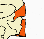 | |
|---|---|---|
| Country | ||
| State | ||
| Region | ||
| Divisions | ||
| Taluks | ||
| Revenue blocks | ||
| Municipalities | ||
| Rivers | ||
| History | ||
| Places of interest |
| |
| Religious and monastic institutions | ||
Coordinates: 10°46′N79°50′E / 10.77°N 79.83°E
| This article related to a location in Nagapattinam district, Tamil Nadu, India is a stub. You can help Wikipedia by expanding it. |