Thiruthuraipoondi is a municipality in Thiruvarur district in the Indian state of Tamil Nadu. Thiruthuraipoondi is 330 km south of Chennai, 40 km south of Nagapattinam and 65 km east of Thanjavur. As of 2011, the town had a population of 24,404.

Nagapattinam is a Lok Sabha constituency in Tamil Nadu. The seat is reserved for scheduled castes. Dalit agricultural workers form a large part of the electorate in the constituency. The constituency is noted for being an historically communist stronghold, having elected Communist Party of India parliamentary representative seven times.
Mayiladuturai is a legislative assembly constituency in Nagapattinam district in the Indian state of Tamil Nadu. Elections and Winners from this constituency are listed below.
Nagapattinam is a state assembly constituency in Tamil Nadu. Elections and Winners from this constituency are listed below.
Vedaranyam is a legislative assembly constituency in Nagapattinam district in the Indian state of Tamil Nadu. Elections and Winners from this constituency are listed below.
Mayiladuthurai taluk is a taluk of Nagapattinam district of the Indian state of Tamil Nadu. The headquarters of the taluk is the town of Mayiladuthurai. Mozhaiyur is 1 of 113 villages in the taluk of Mayiladuthurai.
Vedaranyam taluk is a taluk of Nagapattinam district of the Indian state of Tamil Nadu. The headquarters of the taluk is the town of Vedaranyam
Koothanallur is a town in Tiruvarur district in the South Indian state of Tamil Nadu. The town is located at a distance of 20 km (12 mi) from the district headquarters Tiruvarur and 350 km (220 mi) from the state capital Chennai. Koothanallur is known for the Big Mosque. Sri Ramanatha Swamy Thirukovil, an ancient temple at Tirurameshwaram, is located 7 km far to Koothanallur, southerly.
Kilvelur block is a revenue block in the Kilvelur taluk of Nagapattinam district, Tamil Nadu, India. There are a total of 38 panchayat villages in this block.
Kuthalam block is a revenue block in the Kuthalam taluk of Nagapattinam district, Tamil Nadu, India. There are a total of 51 panchayat villages in this block.
Mayiladuthurai block is a revenue block in the Mayiladuthurai taluk of Nagapattinam district, Tamil Nadu, India. There are a total of 54 panchayat villages in this block.
Vedaranyam block is a revenue block in Nagapattinam district, Tamil Nadu, India. There are a total of 36 panchayat villages in this block.
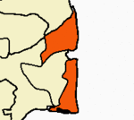
Nagapattinam division is a revenue division of Nagapattinam district in Tamil Nadu, India. It comprises the taluks of Kilvelur, Nagapattinam, Thirukkuvalai and Vedaranyam.
Kilvelur (SC) is a state assembly constituency in Tamil Nadu, India newly formed after constituency delimitations 2008. It is included in the Nagapattinam parliamentary constituency.
Vettar is a river flowing in Tiruvarur district, Thanjavur district and Nagapattinam district of the Indian state of Tamil Nadu.
Valivalam is a City in Nagapattinam district, Tamil Nadu, India.
Adhalaiyur is a village in Nagapattinam district in Tamil Nadu State of India.