Tanjore District (Madras Presidency)

Last updated

Thanjavur District
District of the Madras Presidency
1799–1950
British Raj Red Ensign.svg
Flag
Capital Nagapattinam (1799-1845)
Tarangambadi (1845-1860)
Thanjavur (1860-1950)
History 
 Establishment of the district
1799
 Modern Thanjavur District
1950
Preceded by
Succeeded by
Blank.png Thanjavur Maratha kingdom
Thanjavur District Flag of India.svg

Thanjavur District was one of the districts in the erstwhile Madras Presidency of British India. It covered the area of the present-day districts of Thanjavur, Tiruvarur, Nagapattinam, Mayiladuthurai and Aranthangi taluk, Karambakkudi taluk of Pudukkottai District in Tamil Nadu. Apart from being a bedrock of Hindu orthodoxy, Tanjore was a centre of Chola cultural heritage and one of the richest and most prosperous districts in Madras Presidency.

Contents

Tanjore district was constituted in 1799 when the Thanjavur Maratha ruler Serfoji II ceded most of his kingdom to the British East India Company in return for his restitution on the throne. Tanjore district, which is situated on the Cauvery Delta, is one of the richest rice-growing regions in South India. It was scarcely affected by famines such as the Great Famine of 1876–78.

Geography

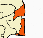
The Tanjore District was bounded by the districts of South Arcot in the north, Trichinopoly to the west and south and the Pudukkottai State and Madura and later, Ramnad districts to the south-east. The Kollidam River formed the long northern boundary with South Arcot. The Bay of Bengal bounded it on the east.

The district was made of four well-marked physical tracts - the fertile plains to the north between the Kollidam and the Kaveri known as the "Old Delta" which was naturally irrigated by the rivers through a system of anaicuts and comprising the whole of the taluks of Shiyali, Mayavaram and Kumbakonam, the northern part of Mannargudi and Nannilam and the eastern part of Tanjore taluk; the plains to the south of the Kaveri river covering the southern part of Nannilam and Mannargudi taluks known as the "New Delta" for the reason that these tracts were only recently brought under irrigation by numerous manmade canals from the Kaveri and Kollidam and its tributaries and which were less fertile than the Old Delta; the arid Vallam plateau which covered the western part of Tanjore and Pattukkottai taluks and the Vedaranyam salt pans the largest of its kind in the Madras Presidency that extended for about thirty miles in length and four or five miles in width from Point Calimere to Adiramapatnam covering the southern portion of Thiruthiraipoondi taluk and eastern half of Pattukkottai taluk. There were two inhabited islands situated within the confines of the district - those of Devicottah situated at the mouth of the Kollidam and Vinayagateru near Kumbakonam.

Most of the landholdings in Tanjore District were inam or mirasdari land, the district had the largest proportion of land under mirasdars. There were few large zamindaris, like Ukkadai estate, Poondi estate, Kunniyur estate, Poraiyar Nadar's estate, Kabisthalam estate and Vadapadimangalam estate in the Tanjore District. Gandharvakottai estate, Kallakottai estate and Konur estate situated near the Pudukkottai border. But the bulk of land was held by mirasdars who leased it on regular tenures to pannaiyals or tenants who in turn cultivated the land with the help of labourers.

History

The Brihadeeswarar Temple, Thanjavur c.2007 ThanjavurBigTemple.jpg
The Brihadeeswarar Temple, Thanjavur c.2007

Tanjore District was inhabited at least since the first millennium B. C. and was the traditional homeland of the Chola Dynasty. The Early Cholas ruled Tanjore from the 3rd century B. C. to the 3rd century A. D. The town of Poompuhar or Kaveripoompattinam served as an important port trading with Rome. Following the Kalabhra interregnum, Tanjore recovered its past glory under the Pallavas and reached the zenith of its prosperity under the Medieval Cholas and Later Cholas. In the 13th century, Tanjore was annexed by the Pandyas who were later defeated by Malik Kafur. Tanjore was ruled for brief periods by the Delhi Sultanate and the Madurai Sultanate, till the 15th century, when it was conquered by the Vijayanagar kings under whom it recovered much of its glory. Tanjore was a part of the Vijayanagar Empire and its successors, the Madurai Nayaks and the Thanjavur Nayaks, until 1674, when it was conquered by Venkoji a brother of Chattrapathi Shivaji, who founded the Thanjavur Maratha kingdom. The British East India Company began to play a major part in the affairs of the region from 1749 onwards. In the 1760s and 1770s, the Thanjavur Maratha ruler, the Nawab of Carnatic and other major powers of the region were brought under the British sphere of influence. In 1799, the British East India Company assisted the deposed Thanjavur Maratha king Serfoji II in regaining his throne. In return for British assistance, Serfoji II retained his hold over Tanjore city and ceded the rest of his kingdom to the British East India Company. Tanjore city was eventually annexed by the British as per the Doctrine of Lapse in 1855 on the death of his son Shivaji without a surviving male heir. Tanjore District was created in about 1800, its limits almost the same as that of the preceding Thanjavur Maratha kingdom. Maikondan was a chief of the caste of kallans lived in 17 th-century. He was a brave warrior who ruled areas around Nandavanapatti in Thanjavur. In the year of 1662, Bijapur sultans invaded Thanjavur. During this invasion maikondan fought against sultans and saved all the inhabitants of Thanjavur. [1]

Demographics

Vaishnavite Brahmin students at a Gurukulam in Tanjore, c.a. 1909 Iyengar Vedic students 1909.JPG
Vaishnavite Brahmin students at a Gurukulam in Tanjore, c.a. 1909
Historical population
YearPop.±%
1871 1,973,731    
1881 2,130,383+7.9%
1891 2,228,114+4.6%
1901 2,245,029+0.8%
1911 2,362,239+5.2%
Sources:
  • Imperial Gazetter of India, Volume 23. Clarendon Press. 1908.

Tanjore District covered a total area of 9,600 square kilometres (3,710 sq mi). It had a population of 2,245,029 in 1901. The population density was 234 inhabitants per square kilometre (605/sq mi). As per the 1901 census statistics, Tanjore was the fifth most populous district in the Madras Presidency and the second most densely populated after Madras city. It also had the third highest adult literacy rate (10%) in the Presidency after Madras and Nilgiris, second highest male literacy rate (21%) after Madras city and the seventh highest female literacy rate.

According to the 1901 census, 91 percent of the population was Hindu, 5 percent Muslim and 4 percent Christian. Among Hindus, Paraiyars (310,391), Vanniyars (235,406), Vellalars (212,168), Kallars (188,463), Pallars (159,855), Muthurajas (137,216), and Brahmins (118,882) were the most numerous. Kallars were mainly found in the western part of Tanjore and Pattukkottai taluks. Kallar served in the armies of the Chola kings. The Thanjavur kallar today largely engage in agriculture. [2] Tanjore had the third highest Brahmin population in the Madras Presidency (more than 6%) after South Canara and Ganjam and the highest among the Tamil-speaking districts. Most of the Muslims were Rowthers concentrated in Kumbakonam taluk where they formed the majority in the towns of Ayyampettai, Rajagiri and Pandaravadai apart from Koothanallur in Mannargudi taluk. They were also found in large numbers in the Negapatam and Pattukkottai taluks. More than a third of the total Christian population of the district lived in Tanjore taluk. There were a total of about 600 Jains chiefly concentrated in the Tanjore and Mannargudi taluks. The district was known for its Hindu orthodoxy and several historic Chola temples dedicated to Agamic gods and most of the Padal Petra Sthalams , shrines sung about in the devotional hymns of the Saivite Nayanmars were located here. There was an Advaitic Sankara mutt in Kumbakonam and Saivite mutts in Thiruvaduthurai, Thiruppanandal and Dharmapuram apart from many Veda pathashalas. The chief Muslim places of worship were located in Tanjore and Muttupet apart from the Nagore dargah.

Tamil was spoken as mother tongue by an overwhelming majority of the population while Telugu was spoken by about 3%. Other languages spoken include Marathi (13,651) and Saurashtra.

Taluks

A 1928 Map of the Thanjavur Maratha kingdom. The boundaries correlate almost exactly with that of the Thanjavur District of British India. Map of the Thanjavur Maratha kingdom.jpg
A 1928 Map of the Thanjavur Maratha kingdom. The boundaries correlate almost exactly with that of the Thanjavur District of British India.

As of 1901, Thanjavur District was made up of nine taluks.

Administration

The administration of the district was under a District Collector who was from the Indian Civil Service. The District Collector of Tanjore resided at Vallam. The district was sub-divided into six divisions, some of them administered by British civil servants and the rest by Indian Deputy-Collectors. The following were the sub-divisions of the district

As of 1901, there were five municipalities in the district: Kumbakonam, Tanjore, Mannargudi, Mayavaram and Negapatam. From 1800 to 1840, the District Collector of Tanjore was also the agent of Pudukkottai state. However, Pudukkottai was later transferred to the jurisdiction of Madura and then Trichinopoly.

Economy

During British times, Tanjore District was famous for its metal work. Brass, copper and silver utensils were manufactured in large quantities. The South Indian Railway Workshops were established at Negapatam in the 1860s. The chief centres of land trade were Tanjore, Kumbakonam, Mannargudi and Mayavaram, while the chief centres of sea trade were Nagapattinam and Adirampattinam. The town of Kumbakonam was known for its silk sarees and rice and flour mills. It was also one of the leading producers of betel leaves and nuts. Tanjore city was known for silk-weaving, lace, embroidery, jewellery, pithwork and manufacture of metal work and musical instruments.

List of Collectors

The list of district collectors of Tanjore from its formation in December 1799 till the abolition of Madras Province and its conversion to a state on 26 January 1950 is given below:

Related Research Articles

<span class="mw-page-title-main">Kumbakonam</span> City Municipal corporation in Tamil Nadu, India

Kumbakonam, or Kudanthai, is a city municipal corporation in the Thanjavur district in the Indian state of Tamil Nadu. It is located 40 km (25 mi) from Thanjavur and 282 km (175 mi) from Chennai and is the headquarters of the Kumbakonam taluk of Thanjavur district. It is the second largest city in the district after Thanjavur. The city is bounded by two rivers, the Kaveri River to the north and Arasalar River to the south. Kumbakonam is known as a "Temple town" due to the prevalence of a number of temples here and is noted for its Mahamaham festival, which happens once in 12 years, attracting people from all over the country.

<span class="mw-page-title-main">Thanjavur</span> Historical city in Tamil Nadu, India

Thanjavur, also known as Thanjai, previously known as Tanjore, is a city in the Indian state of Tamil Nadu. It is the 11th biggest city in Tamil Nadu. Thanjavur is an important center of southern Indian religion, art, and architecture. Most of the Great Living Chola Temples, which are UNESCO World Heritage Monuments, are located in and around Thanjavur. The foremost among these, the Brihadeeswara Temple, built by the Chola emperor Rajaraja I, is located in the centre of the city. This temple has one of the largest bull statue in India carved out of a single granite rock called Nandi. Thanjavur is also home to Tanjore painting, a painting style unique to the region. Thanjavur is the headquarters of the Thanjavur District. The city is an important agricultural centre located in the Kaveri Delta and is known as the Rice bowl of Tamil Nadu. Thanjavur is administered by a municipal corporation covering an area of 36.31 km2 (14.02 sq mi) and had a population of 222,943. Roadways are the major means of transportation, while the city also has rail connectivity. The nearest airport is Tiruchirapalli International Airport, located 59.6 km (37.0 mi) away from the city. The nearest seaport is Karaikal, which is 94 km (58 mi) away from Thanjavur. The city first rose to prominence during the reign of the Cholas when it served as the capital of the empire. After the fall of the Cholas, the city was ruled by various dynasties such as the Mutharaiyar dynasty, the Pandyas, the Vijayanagar Empire, the Madurai Nayaks, the Thanjavur Nayaks, the Thanjavur Marathas and the British Empire. It has been a part of independent India since 1947.

<span class="mw-page-title-main">Mayiladuthurai</span> Special Grade Municipality in Tamil Nadu, India

Mayiladuthurai is a town and district headquarter of Mayiladuthurai district in Tamil Nadu, India. The town is located at a distance of 256 km (159 mi) from the state capital, Chennai.

<span class="mw-page-title-main">Mannargudi</span> Town in Tamil Nadu, India

Mannargudi is a town in Thiruvarur district in the Indian state of Tamil Nadu. It is the headquarters of the Mannargudi taluk. The town is located at a distance of 28 km (17 mi) from the district headquarters Thiruvarur, 36 km from Kumbakonam, 40 km from Thanjavur and 310 km (190 mi) from the state capital Chennai. Mannargudi is known for the Rajagopalaswamy temple, a prominent Vaishnavite shrine.

<span class="mw-page-title-main">Ariyalur district</span> District in Tamil Nadu, India

Ariyalur district is an administrative district, one of the 38 districts in the state of Tamil Nadu in India. The district headquarters is located at Ariyalur. The district encompasses an area of 1,949.31 km².

<span class="mw-page-title-main">Bharathidasan University</span> Public university in Trichy, India

Bharathidasan University (BDU) is a university in the city of Tiruchirappalli, Tamil Nadu, India. It is located on Tiruchirappalli-Pudukkottai National Highway 336. It has affiliated colleges in the districts of Ariyalur district, Karur, Nagapattinam, Perambalur, Pudukkottai, Thanjavur, Tiruvarur and Tiruchirapalli. It is a recognised university, supported by the University Grants Commission of India. All major faculties of science and arts are represented. The university has totally 4 Faculties, 16 Schools, 37 Departments and 29 Specialized Research Centres.

<span class="mw-page-title-main">Thanjavur Nayak kingdom</span> 16th-17th century rulers of Thanjavur, Tamil Nadu

The Thanjavur Nayakdynasty were the rulers of Thanjavur in the 15th and 17th centuries. The Nayaks, who belonged to the Telugu-speaking Balija social group were originally appointed as provincial governors by the Vijayanagara Emperor in the 15th century, who divided the territory into Nayak kingdoms which were Madurai, Tanjore, Gingee and Kalahasthi. In the mid-15th century they became an independent kingdom, although they continued their alliance with the Vijayanagara Empire. The Thanjavur Nayaks were notable for their patronage of literature and the arts.

<span class="mw-page-title-main">Needamangalam</span> Town Panchayat in Tamil Nadu, India

Needamangalam (Nidamangalam) formerly Yamunambalpuram, is a town panchayat in Thiruvarur district in the Cauvery Delta of Indian state of Tamil Nadu. Needamangalam was originally part of the composite Tanjore Dist during British Raj until 1997 AD. In the 18th and 19th century, it was also called Yamunambalpuram. Needamangalam is the headquarters of the Needamangalam Taluk. The town is located 20 km east of Thanjavur, 80 km east of Tiruchirappalli and 318 km south of Chennai. Needamangalam is a junction for two busy highways, (i) National Highway 67 is a National Highway in Southern Indian states of Tamil Nadu and Karnataka that runs from Nagapattinam, a sea-side town in Tamil Nadu to Gundlupet, Karnataka (ii) State Highway SH-66 connecting Kumbakonam with Adirampattinam via Mannargudi in Cauvery Delta.

<span class="mw-page-title-main">Pattukkottai</span> City in Tamil Nadu, India

Pattukkottai is a major town in Thanjavur district in the Indian state of Tamil Nadu and also important town in Delta districts and Commercial town of Thanjavur, Thiruvarur and Pudukkottai district Coastal areas. The town came to prominence throughout Southern India after the construction of the fort by Vanaji Pandithar, a feudatory of the Thanjavur Maratha ruler Shahuji I in 1686–87. The recorded history of Pattukkottai is known from the 17th century and has been ruled, at different times, by the Thanjavur Marathas and the British. It is the headquarters of the Pattukkottai taluk of Thanjavur district and is one of the two municipalities in the district.

<span class="mw-page-title-main">Thiruthuraipoondi</span> Town in Tamil Nadu, India

Thiruthuraipoondi is a municipality in Tiruvarur district in the Indian state of Tamil Nadu. Thiruthuraipoondi is an agricultural town located south of Thiruvarur district. The town is located at a distance of 28 km from the district headquarters Thiruvarur.

<span class="mw-page-title-main">Thanjavur district</span> District in Tamil Nadu, India

Thanjavur district is one of the 38 districts of the state of Tamil Nadu, in southeastern India. Its headquarters is Thanjavur. The district is located in the delta of the Cauvery River and is mostly agrarian.

<span class="mw-page-title-main">Thanjavur Maratha kingdom</span> Principality of Tamil Nadu

The Thanjavur Maratha kingdom ruled by the Bhonsle dynasty was a principality of Tamil Nadu between the 17th and 19th centuries. Their native language was Thanjavur Marathi. Venkoji was the founder of the dynasty.

The Roman Catholic Diocese of Tanjore/Thanjavur is a diocese located in the city of Tanjore in the ecclesiastical province of Pondicherry and Cuddalore in India.

<span class="mw-page-title-main">Pudukkottai State</span> Monarchy in India (1680–1948)

Pudukkottai was a kingdom and later a princely state in British India, which existed from 1680 until 1948.

<span class="mw-page-title-main">S. A. Saminatha Iyer</span> Indian lawyer, landlord, politician and theosophist

Rao Bahadur S. A. Saminatha Iyer, also known as Thanjavur Saminatha Iyer, was an Indian lawyer, landlord, politician and theosophist who served as Chairman of the Tanjore municipality and a delegate to the 1885, 1886, 1887, 1889 and 1894 sessions of the Indian National Congress. He spoke against salt tax in the first session conducted in 1885 and in 1887, was a part of a 32-member team that wrote the constitution of the Congress. Christopher Baker and D. A. Washbrook describe him as the "most celebrated spokesman of the Tanjore gentry".

Adirampattinam is a newly established Municipality in the Pattukottai taluk of the Thanjavur district in the Indian state of Tamil Nadu. It is also short known by Adirai. It is the largest coastal town in the district and fourth largest town in the Thanjavur district.

Nemmeli is an agricultural village in Madukkur Panchayat Union, Pattukkottai taluk of Thanjavur district, Tamil Nadu, India, also known as 28.Nemmeli. Nemmeli village is division of Musugundha Nadu in Chola nadu. It comes under Pattukottai legislative constituency and Tanjore Parliament constituency. It is a small and well developing Village located in southern part of Tamil Nadu. It is 15 km from Pattukkottai and Mannargudi. It is surrounded with number of villages. Being in the Cauvery River Delta Area the inhabitants’ main occupation is agriculture. The younger generation is well educated and they working Various Location in India and also in foreign countries like Singapore, Malaysia, UAE, Saudi Arabia, UK and USA. Many people's working in foreign countries Like Saudi Arabia, Singapore, UK, USA, etc. The economy is booming in line with India’s rapid economic development. Nemmeli Seawater Desalination Plant located in the township is a major drinking water supply source for South Chennai since 2010.

The Trichinopoly district was a district of the erstwhile Madras Presidency of British India. It covered the present-day districts of Tiruchirappalli, Karur, Ariyalur and Perambalur in the Indian state of Tamil Nadu. The administrative headquarters was the town of Trichinopoly, Trichy or Tiruchi, now known as Tiruchirappalli. The district covered an area of 2,632 square miles (6,820 km2) in 1907. It was bound by the districts of South Arcot to the north, Salem to the west, Coimbatore to the west and north-west, Tanjore to the east and Madurai to the south. The princely state of Pudukkottai remained within the jurisdiction of Trichinopoly district from 1865 to 1947.

<span class="mw-page-title-main">Thanjavur Junction railway station</span> Railway station in Tamil Nadu, India

Thanjavur Junction is a junction railway station in Thanjavur district in the Indian state of Tamil Nadu and serves Thanjavur, earlier known as Tanjore.

References

  1. Tamilaham In The 17th Century (1956). p. 71.
  2. Historical Dictionary of the Tamils (2nd ed.). The Scarecrow Press. 2007. p. 105. ISBN   9780810864450.

Sources