| Addapar River | |
|---|---|
| Physical characteristics | |
| Mouth | |
• coordinates | 10°29′40″N79°50′34″E / 10.494542°N 79.842904°E |
Addapar is a river flowing in the Nagapattinam district of the Indian state of Tamil Nadu. [1]
| Addapar River | |
|---|---|
| Physical characteristics | |
| Mouth | |
• coordinates | 10°29′40″N79°50′34″E / 10.494542°N 79.842904°E |
Addapar is a river flowing in the Nagapattinam district of the Indian state of Tamil Nadu. [1]

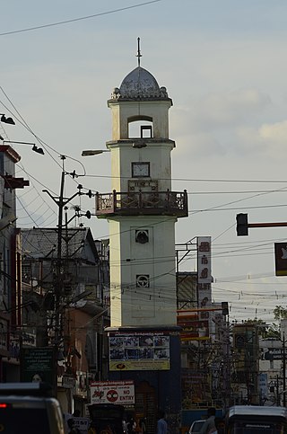
Mayiladuthurai is a town and district headquarter of Mayiladuthurai district in Tamil Nadu, India. The town is located at a distance of 281 km (175 mi) from the state capital, Chennai.

Nagapattinam is a town in the Indian state of Tamil Nadu and the administrative headquarters of Nagapattinam District. The town came to prominence during the period of Medieval Cholas and served as their important port for commerce and east-bound naval expeditions. The Chudamani Vihara in Nagapattinam constructed by the Srivijayan king Sri Mara Vijayattungavarman of the Sailendra dynasty with the help of Rajaraja Chola I was an important Buddhist structure in those times. Nagapattinam was settled by the Portuguese and, later, the Dutch under whom it served as the capital of Dutch Coromandel from 1660 to 1781. In November 1781, the town was conquered by the British East India Company. It served as the capital of Tanjore district from 1799 to 1845 under Madras Presidency of the British. It continued to be a part of Thanjavur district in Independent India. In 1991, it was made the headquarters of the newly created Nagapattinam District. Nagapattinam is administered by a Special grade municipality covering an area of 17.92 km2 (6.92 sq mi) and had a population of 102,905 as of 2011.

Chola Nadu is a cultural region of the Tamil Nadu state in southern India. It encompasses the lower reaches of the Kaveri River and its delta, and formed the cultural homeland and political base of the Chola Dynasty which ruled large parts of South India and parts of Sri Lanka between the 9th and 13th centuries CE. Uraiyur served as the early Chola capital, then medieval Cholas shifted to Thanjavur and later cholas king Rajendra Chola I moved the capital to Gangaikonda Cholapuram in Ariyalur in the 11th century CE.

Thiruvarur also spelt as Tiruvarur is a town and municipality in the Indian state of Tamil Nadu. It is the administrative headquarters of Thiruvarur district and Thiruvarur taluk. The temple chariot of the Thyagaraja temple, weighing 360 tonnes (790,000 lb) and measuring 96 feet (29 m) tall is the largest temple chariot in India. Thiruvarur is the birthplace of Tyagaraja, Muthuswami Dikshitar and Syama Sastri, popularly known as the Trinity of Carnatic music of the 18th century CE. Thiruvarur Thiyagarajaa Swaamy temple is older than Tanjore big temple.

Nagapattinam district is one of the 38 districts of Tamil Nadu state in southern India. Nagapattinam district was carved out by bifurcating the erstwhile composite Thanjavur district on 19 October 1991. The town of Nagapattinam is the district headquarters. As of 2011, the district had a population of 697,069 with a sex-ratio of 1,025 females for every 1,000 males. Until Mayiladuthurai district was created out of it on 24 March 2020, Nagapattinam was the only discontiguous district in Tamil Nadu.

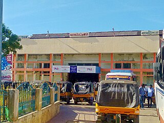
Thiruthuraipoondi is a municipality in Tiruvarur district in the Indian state of Tamil Nadu. Thiruthuraipoondi is an agricultural town located south of Thiruvarur district. The town is located at a distance of 28 km from the district headquarters Thiruvarur.

Vedaranyam is a town in Nagapattinam district in the Indian state of Tamil Nadu. The town is named after the presiding deity of the Vedaranyeswarar Temple. The recorded history of Vedaranyam is known from medieval Chola period of the 9th century and has been ruled, at different times, by the Medieval Cholas, Later Cholas, Later Pandyas, Vijayanagar Empire and the British. During India's independence struggle, C. Rajagopalachari, who would later become independent India's first Governor-General, launched a salt march in Vedaranyam parallel to the Dandi March launched by Gandhi in 1930 to protest against the sales tax levied on salt extraction.

East Coast Road (ECR), combination of SH-49, NH-332A, NH-32, officially known as Mutthamizh Arignar Kalaignar Road, is a two-lane highway in Tamil Nadu, India, built along the coast of the Bay of Bengal connecting Tamil Nadu's state capital city Chennai with Kanyakumari via Puducherry, Cuddalore, Chidambaram, Sirkali, Thirukkadaiyur, Tharangambadi, Karaikal, Nagore, Nagapattinam, Thiruthuraipoondi, Muthupet, Adirampattinam, Manora, Manamelkudi, Mimisal, Ramanathapuram, Thoothukudi, Tiruchendur, Uvari, Kudankulam. The total length of the road is about 777 km between Chennai and Kanyakumari.

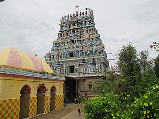
Sirkazhi, also spelled as Sirkali and Siyali, is a major municipal town in Mayiladuthurai district in Tamil Nadu, India. It is located 13 km (8.1 mi) from the coast of the Bay of Bengal, and 250 km (160 mi) from the state capital Chennai. Sirkazhi was a part of Thanjavur district until 1991 and has later been part of Nagapattinam district. The town covers an area of 13.21 km2 (5.10 sq mi) and in 2011 had a population of 34,927. It is administered by a second grade municipality. Sirkazhi is part of the Cauvery delta region and agriculture is the major occupation. Roads are the main means of transportation; the town has 51.47 km (31.98 mi) of district roads, including a national highway.

The Vennar River or Vennaaru is a river and distributary of the Kaveri River in the Kaveri delta. It flows through the Thanjavur, Tiruvarur, and Nagapattinam districts of Tamil Nadu, India.
Nagapattinam taluk is a taluk of Nagapattinam district of the Indian state of Tamil Nadu. The headquarters of the taluk is the town of Nagapattinam
Nagapattinam block is a revenue block in the Nagapattinam taluk of Nagapattinam district, Tamil Nadu, India. There are a total of 27 panchayat villages in this block.
Thirumalairajan is a river flowing in the Thanjavur, Tiruvarur and Nagapattinam districts of the Indian state of Tamil Nadu and Karaikal district of Puducherry. The river splits from Kudamurutti, a tributary of Kaveri river at Rajagiri near Papanasam, Thanjavur district. The river enters Bay of Bengal at Tirumalarajanpattinam near Karaikal.The river has a 150 years old bridge built by a king, who ruled the nearby places of the river.The bridge is also named after the river, the thirumalairajan river bridge.
Veera Chozhan is a river flowing in the Nagapattinam district of the Indian state of Tamil Nadu.
The Vettar River is a river in the Kaveri delta that flows through the Thanjavur, Tiruvarur, and Nagapattinam districts of the Indian state of Tamil Nadu.

Tamil Nadu Dr. J. Jayalalithaa Fisheries University (TNJFU), formerly and commonly known as Tamil Nadu Fisheries University (TNFU), is a government fisheries university situated in Vettar River View Campus in the southern part of the city of Nagapattinam, Tamil Nadu, India. It is about 10 km (6.2 mi) from the Nagapattinam Junction Railway Station and about 8 km (5.0 mi) from the Nagapattinam Bus Stand. It is one of the premier fisheries universities named after the former Chief Minister of Tamil Nadu J. Jayalalithaa.

Nagapattinam Port is a port in the South Indian town of Nagapattinam in the Indian state of Tamil Nadu. It is a natural port located in the shores of Bay of Bengal. The port came to prominence during the period of Medieval Cholas and served as their important port for commerce and east bound naval expeditions. Nagapattinam was settled by the Portuguese and, later, the Dutch under whom it served as the capital of Dutch Coromandel from 1660 to 1781 CE. In November 1781, the town was conquered by the British East India Company. The port was an important port for the colonial empires until Thoothukudi port became the primary port in the Coromandel Coast.

Velankanni railway station is a terminal station in Velankanni town in the Indian state of Tamil Nadu.

Nagapattinam Junction is a junction railway station serving the town of Nagapattinam in Tamil Nadu, India.

Mayiladuthurai district is one of the 38 districts of the state of Tamil Nadu in India. The district headquarters is located at Mayiladuthurai.