This article needs additional citations for verification .(September 2019) |
| Arichandranathi River |
|---|
Arichandranathi River is a river flowing in the Tiruvarur district of the Indian state of Tamil Nadu. [1]
This article needs additional citations for verification .(September 2019) |
| Arichandranathi River |
|---|
Arichandranathi River is a river flowing in the Tiruvarur district of the Indian state of Tamil Nadu. [1]
Mayiladuthurai is a town and district headquarter of Mayiladuthurai district in Tamil Nadu, India. The town is located at a distance of 281 km (175 mi) from the state capital, Chennai.

Nagapattinam is a town in the Indian state of Tamil Nadu and the administrative headquarters of Nagapattinam District. The town came to prominence during the period of Medieval Cholas and served as their important port for commerce and east-bound naval expeditions. The Chudamani Vihara in Nagapattinam constructed by the Srivijayan king Sri Mara Vijayattungavarman of the Sailendra dynasty with the help of Rajaraja Chola I was an important Buddhist structure in those times. Nagapattinam was settled by the Portuguese and, later, the Dutch under whom it served as the capital of Dutch Coromandel from 1660 to 1781. In November 1781, the town was conquered by the British East India Company. It served as the capital of Tanjore district from 1799 to 1845 under Madras Presidency of the British. It continued to be a part of Thanjavur district in Independent India. In 1991, it was made the headquarters of the newly created Nagapattinam District. Nagapattinam is administered by a Special grade municipality covering an area of 17.92 km2 (6.92 sq mi) and had a population of 102,905 as of 2011.

Erode is a city in the Indian state of Tamil Nadu. Erode is the seventh largest urban agglomeration in the state, after Chennai, Coimbatore, Madurai, Tiruchirapalli, Tiruppur and Salem. It is also the administrative headquarters of the Erode district. Administered by a city municipal corporation since 2008, Erode is a part of Erode Lok Sabha constituency that elects its member of parliament. Located on the banks of River Kaveri, it is situated centrally on South Indian Peninsula, about 400 kilometres (249 mi) southwest of its state capital Chennai, 250 kilometres (155 mi) south of Bengaluru, 100 kilometres (62 mi) east of Coimbatore and 275 kilometres (171 mi) east of Kochi. Erode is an agricultural, textile and a BPO hub and among the largest producers of turmeric, hand-loom and knitwear, and food products.
The South Pennar River is a river in India. Bangalore, Hosur, Tiruvannamalai, and Cuddalore are the important cities on the banks of South Pennar river. This is the second longest river in Tamil Nadu, with a length of 497 km, after the Kaveri. Chandapura, Anekal, Hosur, Bagalur and Chengam are the major industrial settlements on its banks. The river is severely polluted by industrial waste as it flows through major industrial areas in the eastern suburbs of Bangalore, Industrial parks of Hosur and Chengam.

Palar is a river of southern India. It rises in the Nandi Hills in Chikkaballapura district of Karnataka state, and flows 93 kilometres (58 mi) in Karnataka, 33 kilometres (21 mi) in Andhra Pradesh and 222 kilometres (138 mi) in Tamil Nadu before reaching its confluence into the Bay of Bengal at Vayalur about 75 kilometres (47 mi) south of Chennai. It flows as an underground river for a long distance only to emerge near Bethamangala town, from where, gathering water and speed, it flows eastward down the Deccan Plateau. The Towns of Bethamangala, Santhipuram, Kuppam, Ramanaickenpet, Vaniyambadi, Ambur, Melpatti, Gudiyatham, Pallikonda, Anpoondi, Melmonavoor, Vellore, Katpadi, Melvisharam, Arcot, Ranipet, Walajapet, Kanchipuram, Walajabad, Chengalpattu, Kalpakkam, and Lattur are located on the banks of the Palar River. Of the seven tributaries, the chief tributary is the Cheyyar River.

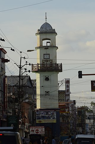
Thiruvarur also spelt as Tiruvarur is a town and municipality in the Indian state of Tamil Nadu. It is the administrative headquarters of Thiruvarur district and Thiruvarur taluk. The temple chariot of the Thyagaraja temple, weighing 360 tonnes (790,000 lb) and measuring 96 feet (29 m) tall is the largest temple chariot in India. Thiruvarur is the birthplace of Tyagaraja, Muthuswami Dikshitar and Syama Sastri, popularly known as the Trinity of Carnatic music of the 18th century CE. Thiruvarur Thiyagarajaa Swaamy temple is older than Tanjore big temple.
Thoothukudi District is one of the 38 districts of Tamil Nadu state in southern India. The district was formed by bifurcation of Tirunelveli district on 20 October 1986. Thoothukudi is the district headquarters and largest city of the district. The district is known for fishing as well as pearl cultivation, with an abundance of pearls being found in the seas offshore. Thoothukudi district has many historical sites such as Adichanallur and the ancient trade port of Korkai.

Dharmapuri is one of the 38 districts in the state of Tamil-Nadu, India. It is the first district created in Tamil Nadu after the independence of India by splitting it from then-Salem district on 2 October 1965. Dharmapuri District is one of the major producers of mango in the state, fine quality granite is found in the district. It is also one of the main sericulture belts in the state. Around 30 percent of the district's area is under forest cover. Kaveri enters Tamil Nadu through this district. Dharmapuri district had the lowest literacy rate of 74.23% in Tamilnadu during the 2011 census.
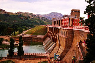
Mullaperiyar DamIPA: [mulːɐpːeɾijɐːr], is a masonry gravity dam on the Periyar River in the Indian state of Kerala It is located 881 m (2,890 ft) above the sea level, on the Cardamom Hills of the Western Ghats in Thekkady, Idukki District of Kerala, India. It was constructed between 1887 and 1895 by John Pennycuick and also reached in an agreement to divert water eastwards to the Madras Presidency area. It has a height of 53.6 m (176 ft) from the foundation, and a length of 365.7 m (1,200 ft). The Periyar National Park in Thekkady is located around the dam's reservoir. The dam is built at the confluence of Mullayar and Periyar rivers. The dam is located in Kerala on the river Periyar, but is operated and maintained by the neighbouring state of Tamil Nadu. Although the Periyar River has a total catchment area of 5398 km2 with 114 km2 downstream from the dam in Tamil Nadu, the catchment area of the Mullaperiyar Dam itself lies entirely in Kerala and thus not an inter-State river. On 21 November 2014, the water level hit 142 feet for first time in 35 years. The reservoir again hit the maximum limit of 142 feet on 15 August 2018, following incessant rains in the state of Kerala. In a UN report published in 2021, the dam was identified as one among the world's big dams which needs to be decommissioned for being 'situated in a seismically active area with significant structural flaws and poses risk to 3.5 million people if the 100+ years old dam were to fail'.

Thanjavur district is one of the 38 districts of the state of Tamil Nadu, in southeastern India. Its headquarters is Thanjavur. The district is located in the delta of the Cauvery River and is mostly agrarian. As of 2011, Thanjavur district had a population of 2,405,890 with a sex-ratio of 1,035 females for every 1,000 males.
Madurantakam taluk is a taluk of Chengalpattu district of the Indian state of Tamil Nadu. The headquarters of the taluk is the town of Madurantakam. Madurantakam taluk is bounded by Chengalpattu taluk in north, Uthiramerur taluk of Kanchipuram district in West, Thirukklaukkundram Taluk in north east and Tindivanam lauk of Villupuram district in south.
The Thirumanimutharu River originates form Manjavadi village in the Shevaroy Mountain Range and flows through the Salem and Namakkal districts of the Indian state of Tamil Nadu. It rises in the Yercaud hills. Thirumanimutharu River joins the Cauvery at the Nanjai Edayar village in Namakkal.
Addapar is a river flowing in the Nagapattinam district of the Indian state of Tamil Nadu.
Upparu River is a river flowing in the Tirupur district of the Indian state of Tamil Nadu.
The Koraiyar River is a river in the Ambasamudram taluk of the Tirunelveli district of the Indian state of Tamil Nadu. It is a right-bank tributary of the Thamirabarani River, which flows through Tirunelveli and Thoothukudi districts. It is formed by the confluence of the minor Vadakkur Koraiyar and Therkku Koraiyar rivers, which are its headwater streams, on the eastern slopes of the Western Ghats. It flows for a total length of 13.2 kilometres (8.2 mi) before flowing into the Kannadian channel near the village of Vellankuli upstream of the Kannadian anicut. The channel bypasses the anicut before joining the Thamirabarani downstream and to the east of the dam. Along its course it is joined by three tributaries, the Vandal Odai, Elumichaiyar, and Koppuraiyar rivers. The Koraiyar's drainage basin covers an area of 75.75 square kilometres (29.25 sq mi) and has a recorded maximum flood discharge of 12000 cusecs.

Odampokki is a distributary of Vettar River flowing in the Tiruvarur district of the Indian state of Tamil Nadu. This river originates near the Engan village and passes through Thiruvarur town. Valavaikal canal branches off from Odampokki river near Ammaiyappan village.
The Vettar River is a river in the Kaveri delta that flows through the Thanjavur, Tiruvarur, and Nagapattinam districts of the Indian state of Tamil Nadu.
Nattar is a river flowing in the Tiruvarur district of the Indian state of Tamil Nadu.
Valavaikkal is a river flowing in the Tiruvarur district of the Indian state of Tamil Nadu.
Silaiman is a panchayat village in Tirupparankunram Mandal (Thiruparankundram) of Madurai District in the Tamil-Nadu state of India. Silaiman is located on the right (south) bank of the Vaigai River, on Route 85 about eight kilometers by road southeast of the city of Madurai, the district headquarters. It is very near to the Keeladi excavation site. Dice made of elephant trunk, ear rings, and thongattan made of gold are examples of the important materials excavated and collected from this site and deposited in Mysore museum. The Tamil Nadu government is taking steps to establish archaeological museums in and around Keeladi village to preserve this kind of material within Tamil Nadu. In the 2011 census the population was 6,436.
| District Headquarters |  | |
|---|---|---|
| Country | ||
| State | ||
| Region | ||
| Divisions | ||
| Taluks | ||
| Revenue blocks | ||
| Municipalities | ||
| Rivers | ||
| History | ||
| Places of interest |
| |
| Universities | ||
| | This article related to a location in Tiruvarur district, Tamil Nadu, India is a stub. You can help Wikipedia by expanding it. |