Krishnagiri district

Last updated

Krishnagiri District
Denkanikottai Temple .png
Krishnagiri Tomb 3.jpg
nettungkl uuril ullll nettungkl.jpg
Adhiyamaan College of Engineering 4-19-2014 8-48-23 AM.JPG
Pamba Dam @ Gavi - panoramio (6).jpg
Krishnagiri in Tamil Nadu (India).svg
Location in Tamil Nadu
Krishnagiri district
Coordinates: 12°31′4.8″N78°12′46.8″E / 12.518000°N 78.213000°E / 12.518000; 78.213000
CountryFlag of India.svg  India
State TamilNadu Logo.svg Tamil Nadu
Established9 February 2004
Founded by J. Jayalalithaa
Headquarters Krishnagiri
Talukas Krishnagiri, Hosur, Denkanikottai, Shoolagiri, Pochampalli, Uthangarai, Bargur, Anchetty
Government
  District CollectorK. M. Sarayu IAS
Population
 (2011)
  Total1,879,809
Languages
  Official Tamil
Time zone UTC+5:30 (IST)
PIN
635001
Telephone code 04343
ISO 3166 code ISO 3166-2:IN
Vehicle registration TN 24, TN 70 [1]
Website krishnagiri.nic.in

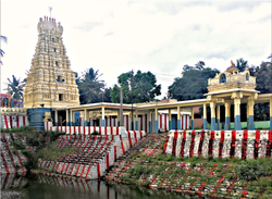
Krishnagiri district is one of the 38 districts (a district in the north western part) of the state of Tamil Nadu, in India. This district is carved out from Dharmapuri District by 2004. The municipal town of Krishnagiri is the district headquarters. In Tamil Nadu, e-Governance was first introduced at Krishnagiri district under the National e-Governance Project (NEGP) in revenue and social welfare departments on a pilot basis. [2] [3] The district is one of the largest producers of mangoes in India. [4] As of 2011, the district had a population of 1,879,809 with a sex-ratio of 958 females for every 1,000 males. Hosur is the most populous town in the district.

Contents

History

Krishnagiri Fort Krishnagiri fort.jpg
Krishnagiri Fort

Krishnagiri district was formed as the 30th district of Tamil Nadu on 9 February 2004. It was formed by carving out five taluks and ten blocks of the erstwhile Dharmapuri district. The first collector of Krishnagiri was Mangat Ram Sharma.

Dolmens

Moral Pari near Mallachandram has more than 100 dolmens. [5] The site is located 19 km (12 mi) from Krishnagiri.

Politics

Source: [6] [7]
DistrictNo.ConstituencyNamePartyAllianceRemarks
Krishnagiri 51 Uthangarai (SC) T. M. Tamilselvam All India Anna Dravida Munnetra Kazhagam None
52 Bargur D. Mathiazhagan Dravida Munnetra Kazhagam SPA
53 Krishnagiri K. Ashok Kumar All India Anna Dravida Munnetra Kazhagam None
54 Veppanahalli K. P. Munusamy All India Anna Dravida Munnetra Kazhagam None
55 Hosur Y. Prakaash Dravida Munnetra Kazhagam SPA
56 Thalli T. Ramachandran Communist Party of India SPA

District administration

A district collector heads the district administration. Krishnagiri district is divided into two divisions and seven taluks for the purpose of revenue administration. A Revenue Divisional Officer heads each division and a Tahsildars are in charge of taluk level administration. Development administration in this district is coordinated by panchayats (or blocks) in rural areas. There are about ten panchayat unions, seven town panchayats, 352 village Panchayats and 874 revenue villages in this district. The two revenue divisions are Krishnagiri and Hosur. The eight taluks are Krishnagiri, Hosur, Pochampalli, Uthangarai, Shoolagiri, Bargur and Anchetti Denkanikottai. There are 12 panchayat unions: Kelamangalam, Thalli, , Krishnagiri, Shoolagiri, Veppanapalli, Hosur, Kaveripattinam, Pochampalli, Mathur, and Uthangarai. [8]

Villages

Geography and climate

Krishnagiri district covers an area of 5143 km2. Krishnagiri district is bound by Tirupattur to the southeast, Thiruvannamalai districts to the east, Dharmapuri district to the south and Kolar, Bangalore Rural, Bangalore Urban, Ramanagara and Chamarajanagar districts of the state of Karnataka to the northwest and west and Chittoor district of the state Andhra Pradesh to the north. This district is elevated from 300 m to 1400 m above the mean sea level. It is located between 11° 12' N and 12° 49' N latitude, 77° 27' E to 78° 38' E longitude.

Taluk HQLatitude (N)Longitude (E)
Krishnagiri Taluk12o32’44"78o13’36"
Pochampalli Taluk12o20’78o22’
Uthangarai Taluk12o15’78o33’
Hosur Taluk12o48’77o50’23"
Denkanikottai Taluk12o02’77o47’
Bargur Taluk12o55’78o37’

It basically has a mountainous terrain. The flatlands are irrigated by the South Pennar River. The eastern part of the district experiences a hot climate and the western part contrastingly has a pleasant climate. The average rainfall is 830 mm per year. March - June is the summer season. July - November is the rainy season and during December - February winter prevails.

YearRainfall (in mm)
2001–2002825.700
2002–2003521.600
2003–20041075.600
2004–2005230.620
2005–20061262.800

Net cultivated, irrigated, double, multiple cropped, cultivable wasteland, water land and forest

ClassificationGeo.Extent (ha)
Forest20240939%
Banner and uncultivable waste241945%
Land put to non-agricultural uses214664%
Cultivable waste63411%
Permanent pastures and other grassing lands73781%

Transportation

Aerial view of Hosur Hosur.JPG
Aerial view of Hosur

The following major national highway roads pass through Krishnagiri district:--

There are state highways passing through the district.

Also, several MDRs (Major District Roads) pass through this district. They are as follows:

1. MD-53 Bagalur - Berigai Road

2. MD-91 Denkanikottai - Kelamangalam Road

3. MD-124 Hosur Town to Hosur Railway Station Road

4. MD-157 Kaveripattinam - Kakkangarai Road

5. MD-192 Krishnagiri - Rayakottai Road

6. MD-193 KRP Dam approach Road

7. MD-366 Pondy - Krishnagiri Road

8. MD-422 Shoolagiri - Berigai Road

9. MD-424 Singarapet - Thirupathur Road

10. MD-456 Theertham - Berigai Road

11. MD-517 Uthangarai bypass road

12. MD-588 Denkanikottai - Anchetty - Natrampalayam Road

13. MD-660 Pondy Krishnagiri Road to Hill Round Road

14. MD-703 Thally - Jawalagiri - Karnataka State Border Road

15. MD-754 Kundarapalli - Veppanapalli Road

16. MD-861 Kaveripattinam - Palacode Road

17. MD-862 Kaveripattinam - Pochampalli Road

18. MD-863 Jandamedu - Puliyur Road

19. MD-1000 Veppanapalli - Theertham Road

20. MD-1001 Kurubarapalli - Kothakrishnapalli Road

21. MD 1186 - Perandapalli - Athimugam

Railways

Salem-Dharmapuri-Bengaluru broad gauge line runs through Hosur. Kovai-Erode-Jolarpettai broad gauge line runs through kallavi and Samalpatti.

Public amenities

Irrigation

Krishnagiri Reservoir Project Dam KRP Dam.jpg
Krishnagiri Reservoir Project Dam

The Public Works Department and Panchayat union tanks, ponds and supply channels play an important role in the irrigation of Krishnagiri district. However, they have to be desilted and strengthened. New check dams and flood protection walls have to be constructed for water conservation.

Electricity

Street lighting in rural areas is vested with the Panchayat Administration. The panchayats look after the erection of new streetlights in the hamlets, payment of current consumption charges from the panchayat funds. The procurement of tube lights, sodium vapor lights and other electrical appliances is done by the connected panchayat itself. Overall, 95% of the hamlets are covered under rural electrification. Generally the power supply position in Krishnagiri District is normal. However, in some areas the low voltage problem is felt, especially in the hamlets in the ghat section. To minimize the current consumption charges in the panchayats, efforts were taken to utilize solar power lights as an alternate and renewable source in Krishnagiri district.

Education

There is a Community Polytechnic run by the Government in Krishnagiri district. Also, the TAHDCO (Tamil Nadu Adi Dravidar Housing Development Corporation) offers nursing and catering training under vocational training courses through private training institutions to people belonging to SC/ST communities. To uplift the education of women, St. James Tailoring Institute is striving for the welfare of women in Krishnagiri town. This dress making technology gives self earning at home and makes women to get jobs in ready made garment companies in Krishnagiri itself.

Education centersNo.
Primary schools988
Middle schools107
High schools113
Hr. sec. schools72
Industrial training institutions5
Music schools1
Teachers training schools2
Polytechnics8
Engineering colleges5
Arts and science colleges8
Computer Training Institutes5

Demographics

Historical population
YearPop.±% p.a.
1901389,745    
1911407,883+0.46%
1921389,723−0.45%
1931454,928+1.56%
1941526,107+1.46%
1951592,009+1.19%
1961716,442+1.93%
1971881,371+2.09%
19811,056,885+1.83%
19911,305,013+2.13%
20011,561,118+1.81%
20111,879,809+1.88%
source: [9]

According to the 2011 census, Krishnagiri district had a population of 1,879,809 with a sex-ratio of 963 females for every 1,000 males, much above the national average of 929. [10] A total of 217,323 were under the age of six, constituting 112,832 males and 104,491 females. Scheduled Castes and Scheduled Tribes accounted for 14.22% and 1.19% of the population respectively. The average literacy of the district was 63.2%, compared to the national average of 72.99%. [11] The district had a total of 448,053 households. There were a total of 877,779 workers, comprising 218,600 cultivators, 197,369 main agricultural labourers, 15,237 in house hold industries, 310,795 other workers, 135,778 marginal workers, 17,438 marginal cultivators, 6 45,700 other marginal workers. 22.79% of the population lived in urban areas. [10]

Religions in Krishnagiri district (2011) [12]
ReligionPercent
Hinduism
91.70%
Islam
6.13%
Christianity
1.91%
Other or not stated
0.26%

Hinduism is the major religion and is practiced by 91.7% of the population, followed by Muslim and Christian minorities which are 6.13% and 1.91%. [12]

Languages of Krishnagiri district (2011) [13]

   Tamil (58.23%)
   Telugu (21.56%)
   Kannada (12.70%)
   Urdu (5.87%)
  Others (1.64%)

At the time of the 2011 census, 58.23% of the population spoke Tamil, 21.56% Telugu, 12.70% Kannada and 5.87% Urdu as their first language. [13]

The taluks of Krishnagiri individually too has a clear Tamil majority followed by a large minority of telugus and kannadigas. [14]

Economy

Agriculture

ProductionArea (hectares)
Paddy20,687
Ragii48,944
Other minor crops11,937
Pulses48,749
Sugarcane50,000
Mango30,017
Coconut13,192
Tamarind1,362
Other crops43,199

Mining and forestry based activities

Animal husbandry and fisheries

(Details about the revenue in fisheries up to 15 July 2007)

ReservoirTarget (MT)AchievementRevenue collection (Rs)Fishermen benefited / amount
Krishnagiri Dam51.06.810484423/4844
Pambaru Dam302.0181357016/13570
Kelavarppalli Dam29.015.1109538730/95387
Barur Lake284.017.60012460037/124600
Chinnaru Dam6.80.931104105/10410
Mayil Ravanan Lake3.00.1648201/820
Ramanayakan Lake4.00.27323051/2305
Paraiyur Lake2.00.21618691/1260

In Krishnagiri District the annual income in the animal husbandry sector was as follows for 2006-07.

ClassificationIncome received
Milk 24,94,926
Egg 3,88,192
Pork 1,54,496
Sale of livestock4,21,578
Miscellaneous 13,55,244
Artificial insemination 5,79,898
LN 2 (liquid nitrogen)1,27,819
Total income55,22,153

See also

Related Research Articles

Kandhili or Kandili block is a small township in the Tirupathur district of Tamil Nadu, India.

<span class="mw-page-title-main">Dharmapuri</span> City in Tamil Nadu, India

Dharmapuri is a city in the north western part of Tamil Nadu, India. It serves as the administrative headquarters of Dharmapuri district which is the first district created in Tamil Nadu after the independence of India by splitting it from then Salem district on 2 October 1965. The city is located 50 km from Krishnagiri, 69 km from Salem, 60 km from Tirupattur, 90 km from Hosur, 117 km from Thiruvannamalai, 126 km from Bangalore and Erode, 181 km from Tiruppur, 200 km from Coimbatore and Tiruchirappalli, 300 km from Madurai and the state capital Chennai. It is located between latitudes N 11 47’ and 12 33’ and longitudes E 77 02’ and 78 40’. It is one of the major leading cultivators and producers of mangoes in the state along with Krishnagiri, and is often referred as Mango Capital of India.

<span class="mw-page-title-main">Vellore district</span> District of Tamil Nadu in India

Vellore district is one of the 38 districts in the Tamil Nadu state of India. It is one of the eleven districts that form the north region of Tamil Nadu. Vellore city is the headquarters of this district. As of 2011, the district had a population of 1,614,242 with a sex ratio of 1,007 females for every 1,000 males. In 2017 Vellore district ranked eleventh in list of districts in Tamil Nadu by Human Development Index.

<span class="mw-page-title-main">Dharmapuri district</span> Place in India

Dharmapuri is one of the 38 districts in the state of Tamil-Nadu, India. It is the first district created in Tamil Nadu after the independence of India by splitting it from then-Salem district on 2 October 1965. Dharmapuri District is one of the major producers of mango in the state, fine quality granite is found in the district. It is also one of the main sericulture belts in the state. Around 30 percent of the district's area is under forest cover. Kaveri enters Tamil Nadu through this district. Dharmapuri district had the lowest literacy rate of 74.23% in Tamilnadu during the 2011 census.

Bargur is a selection-grade town panchayat in the Krishnagiri district of the Indian state of Tamil Nadu, that serves as the headquarters of Bargur taluk, one of the seven taluks in Krishnagiri district.

<span class="mw-page-title-main">Jolarpettai</span> Town in Tirupattur District, India

Jolarpettai is a railway town in Tirupattur district, Tamil Nadu, India. It is a commuter rail hub in Southern Railway, which is one of the largest Railway Junction in Tamil nadu. It is 7 km from district headquarter Tirupattur and 18 km from Vaniyambadi.

Kambainallur is a panchayat town in karimangalam taluk of Dharmapuri district in the Indian state of Tamil Nadu. It also serves as a main source of transport, food, health and education for many villages situated around the Kambainallur.

Kaveripattinam is a town in Krishnagiri district in the northern part of Tamil Nadu.It is a revenue block in the Krishnagiri district of Tamil Nadu, India. It has a total of 36 panchayat villages.

<span class="mw-page-title-main">Krishnagiri</span> City in Tamil Nadu, India

Krishnagiri is a city in the state of Tamil Nadu, India, and it serves as the administrative headquarters of Krishnagiri District formed in 2004. It is located at the bottom of Krishnadevaraya Hills, and the town is fully surrounded by hill rocks. It is located 250 km from Chennai, 45 km from Dharmapuri, and 90 km from Bengaluru. Krishnagiri is known as "Mango Capital of India" as mangoes are cultivated as the main crop, and the land here is extremely fertile with rich access to fresh water making it amenable to growing crops. Krishnagiri is the site of significant business and residential development. The Krishnagiri Dam was built in 1967.

Singarapettai is a town in Krishnagiri district in Tamil Nadu. In the 2011 census it had a population of 2253 in 537 households.

Pochampalli taluk is one of the seven taluks of Krishnagiri district in the Indian state of Tamil Nadu. The majority of the population speak Tamil. The headquarters of the district is at Pochampalli.

<span class="mw-page-title-main">K. E. Krishnamoorthi</span> Indian politician

K. E. Krishnamoorthi is an Indian politician. He served as Member of the Tamil Nadu Legislative Assembly serving the Bargur constituency (2011–2016). He represents the Anna Dravida Munnetra Kazhagam party.


The Kandili is a revenue block in the Tirupattur district of Tamil Nadu, India. It has a total of 39 panchayat villages.

Aandiyur Uthangarai is a village in Uthangarai taluk, Krishnagiri district, Tamil Nadu, India.

Mathur is a town in the Pochampalli Taluk in Krishnagiri District in Tamil Nadu, India.It is located on National Highway NH 77.It is Krishnagiri – Pondicherry Highway.It is located 30 km from Krishnagiri, 24 km from Tirupathur, and 20 km from Uthangarai. Mathur is surrounded by Kandhili Taluk towards North, Uthangarai Taluk towards South, Bargur Taluk towards North, Tirupattur taluk towards East. Mathur is one of the 10 revenue blocks in Krishnagiri District and consists of 24 panchaya.

Kandikuppam is a panchayat in Bargur Block, Krishnagiri district in the state of Tamil Nadu, India. The economy is dependent on mango cultivation. Chennai is the state capital for Kandikuppam village. It is located around 223.5 kilometer away from Kandikuppam.. The other nearest state capital from Kandikuppam is Bangalore and its distance is 93.7 km. The other surrounding state capitals are Bangalore 93.7 km., Pondicherry 178.4 km., Thiruvananthapuram 463.4 km. Kandikuppam is located along Chennai – Krishnagiri National Highway. Banks and ATM: Indian Bank with ATM, 1 India ATM. Central Government own India Post Branch post office. The surrounding nearby villages and its distance from Kandikuppam are Achamangalam 2.6 km, Kurumber Theru 1.9 km, Thandavanpallam 1.5 km, Varattanapalli 4.3 km, Karakuppam 5.4 km, Bargur 6.6 km, Thogarapalli 6.7 km, Jagadevi 6.9 km, Mallapadi 8.0 km, Oppathavadi 10.1 km, Valasagoundanoor 21.9 km, Jingalkathirampatti 27.1 km, Parandapalli 28.5 km, Kottagaram.

Kelamangalam railway station is one of the intermittent railway stations between Hosur railway station and Dharmapuri railway station.

<span class="mw-page-title-main">Tirupattur</span> Town in Tamil Nadu, India

Tirupathur or Tirupattur is the headquarters of Tirupathur district in the state of Tamil Nadu in India and is one of the oldest inhabited places in the state, with a history of over 1,600 years. The town is known for an abundance of sandalwood in the surrounding hills. It is located about 89 km (55 mi) from Vellore, 85 km (53 mi) from Hosur, 60 km (37 mi) from Dharmapuri, 50 km (31 mi) from Krishnagiri, 50 km (31 mi) from Thiruvannamalai, 279 km (173 mi) from coimbatore, 210 km (130 mi) from Chennai, and 125 km (78 mi) from Bangalore.

Pochampalli is a small town in the Krishnagiri District of Tamil Nadu State, India. It also acts as the headquarters of Pochampalli taluk. Pochampalli is located 27 kilometers south from the district headquarters Krishnagiri, 30 kilometers from Dharmapuri, 30 kilometers from Tirupattur, and 256 kilometers from the state capital Chennai. It is located on SH-60.

References

  1. "www.tn.gov.in" (PDF). tn.gov.in. Retrieved 23 March 2018.
  2. "e-Governance in Pilot Basis". TNeGA.
  3. "CM to inaugurate e-Governance scheme in Krishnagiri". The Hindu . 23 September 2010. Archived from the original on 27 September 2010.
  4. "Arab political world's uncertainty shakes Mango export of India". BBC. 13 November 2011. Retrieved 14 November 2011.
  5. "Krishnagiri District Website". Krishnagiri.tn.nic.in. Archived from the original on 11 March 2008. Retrieved 15 March 2013.
  6. "Tamil Nadu Election Results 2021: Here's full list of winners". CNBCTV18. 3 May 2021. Retrieved 22 December 2023.
  7. "Tamil Nadu Election Results 2021: Full list of winners". www.indiatvnews.com. 2 May 2021. Retrieved 22 December 2023.
  8. "Krishnagiri District Map". krishnagiri.nic.in. 21 January 2021. Retrieved 28 January 2021.
  9. Decadal Variation In Population Since 1901
  10. 1 2 "District Census Handbook 2011 - Krishnagiri" (PDF). Census of India . Registrar General and Census Commissioner of India.
  11. "Census Info 2011 Final population totals". Office of The Registrar General and Census Commissioner, Ministry of Home Affairs, Government of India. 2013. Retrieved 26 January 2014.
  12. 1 2 "Table C-01 Population by Religion: Tamil Nadu". censusindia.gov.in. Registrar General and Census Commissioner of India. 2011.
  13. 1 2 "Table C-16 Population by Mother Tongue: Tamil Nadu". Census of India . Registrar General and Census Commissioner of India.
  14. "census of 2011".
  15. "Agriculture" (PDF). Statistical Hand Book 2018. Government of Tamil Nadu Department of Economics and Statistics. Retrieved 12 July 2020.